Kepler Track
Every December, runners line up at the shore of Lake Te Anau and sprint into the mountains. The fastest cover 60 kilometers in about five hours, racing along ridgelines where the wind can knock a standing person flat, through forests where the canopy blocks out the sky, and past rivers that swell to impassable torrents after a single afternoon of rain. The rest of the year, trampers take three or four days to walk what those runners cover before lunch. Both groups are following the Kepler Track, one of New Zealand's Great Walks, a circular route through Fiordland National Park that climbs from lakeside beech forest to exposed alpine tussock at 1,472 meters before dropping back to the water's edge. The track is named for the Kepler Mountains, which take their name from Johannes Kepler, the 17th-century astronomer. He never saw this place, but the night skies above the ridgeline would have stopped him in his tracks.
From Lakeshore to Treeline
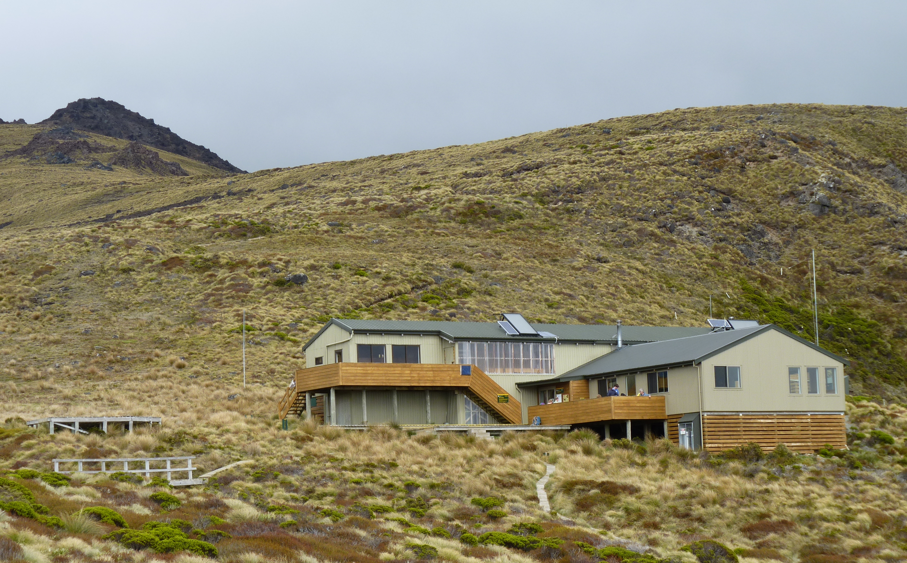
The track begins gently, following the eastern shore of Lake Te Anau through stands of tall beech forest. Mosses coat every surface, ferns crowd the understory, and bellbirds call from somewhere overhead. At Brod Bay, many trampers arrive by water taxi, shaving a couple of hours off the walk before the track turns inland and begins to climb in earnest. The ascent to Luxmore Hut is a hard slog through dense bush, the kind of sustained uphill that makes you question your fitness and your life choices in roughly equal measure. But the forest is the reward: silver beech gives way to mountain beech as altitude increases, the trunks increasingly gnarled and draped with hanging lichens. Near the hut, a side trail leads to Luxmore Cave, a limestone cavern on the mountainside that hints at the geological forces still shaping this landscape.
Walking the Ridgeline
Above the bushline, the Kepler Track becomes a different experience entirely. For roughly 15 kilometers, the path traverses exposed alpine ridges where the views stretch across the entirety of Fiordland on a clear day, from the silver surface of Lake Te Anau to the east to the dark fingers of the fiords cutting into the western coast. The highest point sits at 1,472 meters, and on those rare clear days, the 360-degree panorama is among the finest in New Zealand. But Fiordland's weather is notoriously fickle. Snow can fall in summer. Gale-force winds rake the ridgeline without warning, and cloud can drop visibility to a few meters within minutes. Two emergency shelters along the alpine section exist for good reason. The Department of Conservation does not recommend this section from May to late October, when avalanche risks and ice make the exposed terrain genuinely dangerous without alpine skills and equipment.
The Kea Problem
Somewhere above the treeline, you will meet the kea. New Zealand's alpine parrot is brilliant, curious, and spectacularly destructive. These birds have been known to unzip backpacks, shred boots left outside huts, tear apart rain jackets, and disassemble anything held together with rubber or Velcro. They work in teams, one bird distracting a tramper while another raids their gear. The intelligence that makes kea fascinating also makes them endangered; human food is harmful to them, and the same curiosity that drives them to investigate everything brings them into conflict with people. Feeding them accelerates the problem. Trampers are urged to keep all gear inside the huts and resist the temptation to share their lunch, no matter how charming the audience. Watching a kea systematically dismantle a hiking pole is entertaining right up until you realize it is your hiking pole.
Descent to the Iris Burn
From the alpine section, the track drops through a hanging valley to Iris Burn Hut, following the river as it cascades down toward Lake Manapouri. The descent passes through some of the most pristine forest on the track, thick podocarp and beech woodland where the only sounds are birdsong and running water. The Iris Burn itself is a beautiful river, though it can rise dramatically after rain, transforming from a gentle stream to a brown torrent in hours. The final section of the track follows the shores of Lake Manapouri before turning east to Moturau Hut, then tracing the Waiau River back to the control gates near Te Anau. These gates regulate the flow of water from Lake Te Anau and mark the end of the circuit, returning trampers to the same spot where they started three or four days earlier, considerably more tired and significantly more impressed with Fiordland than when they set out.
From the Air
The Kepler Track circuit lies at approximately 45.42S, 167.51E in Fiordland National Park, visible as a thin line traversing the ridgeline of the Kepler Mountains between Lake Te Anau and Lake Manapouri. The alpine section along the ridgeline is best viewed from 3,000-5,000 feet AGL, with the track tracing a distinctive line above the bushline. The nearest airport is Te Anau/Manapouri (NZMO), approximately 5 nautical miles east. Queenstown Airport (NZQN) is roughly 90 nautical miles northeast. Fiordland weather is highly changeable; cloud often obscures the ridgeline even when lower elevations are clear. Morning flights offer the best chance of visibility.