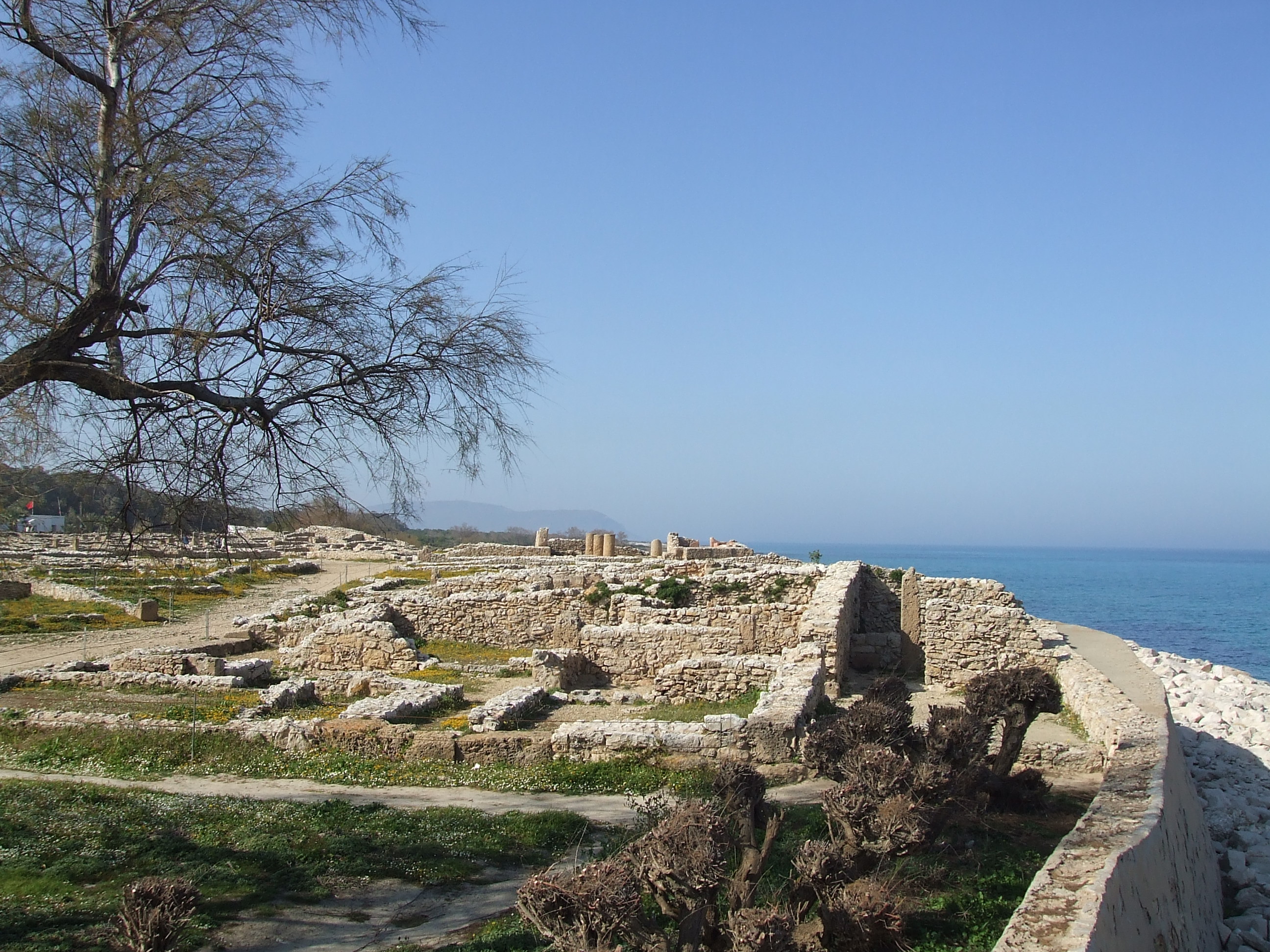
Kerkouane
Nobody knows what the people of Kerkouane called their city. The name used today was assigned by archaeologists; the ancient name appears in no surviving document from any civilization. This small Punic settlement on the Cape Bon peninsula of Tunisia existed for roughly 400 years before being abandoned during the First Punic War, and because the Romans never rebuilt on top of it, the ruins present something unique in the entire Mediterranean: an unaltered Phoenicio-Punic city, the only one to survive. UNESCO recognized this in 1985, inscribing Kerkouane and its necropolis as a World Heritage Site.
A City of Purple and Salt
Kerkouane was never large. Archaeologists estimate its population at no more than 1,200 people, most of them fishermen and craftsmen. But the site's excavations reveal a community punching above its weight. Heaps of murex shells indicate that the town produced Tyrian purple dye, the luxury pigment extracted from sea snails that was so valuable in the ancient world that it became synonymous with royalty. The town also produced salt and garum, the fermented fish sauce that served as a condiment across the ancient Mediterranean. Streets followed a grid pattern, houses had private bathrooms with sophisticated drainage, and the floors were decorated with mosaics -- signs of a prosperous, well-organized settlement.
Gods of the Punic World
At the heart of the city stood a temple complex with an area for ritual banquets and a sacrificial altar. Archaeologists remain uncertain which deities were worshipped there, but the evidence points toward Melqart, Sid, and Tanit -- the major figures of the Punic religious pantheon. Terracotta heads found at the site depict two male figures wearing conical hats that resemble Sid and Melqart iconography known from the Temple of Antas in Sardinia, suggesting religious connections across the Punic world. Tanit, the chief goddess of Carthage and protector of the city, likely received devotion here as well. Her symbol, the sign of Tanit, appears throughout the site.
Frozen in Time
What makes Kerkouane invaluable to historians is an accident of war. The city was probably destroyed or abandoned during the First Punic War between Rome and Carthage, which raged from 264 to 241 BC. Unlike Carthage, Utica, and other Punic cities that Rome conquered and rebuilt according to its own urban plan, Kerkouane was simply left. No Roman temples were constructed over Punic shrines, no Roman streets replaced Punic lanes, no Latin inscriptions covered Phoenician ones. The result is an archaeological time capsule: the street plan, domestic architecture, drainage systems, and religious spaces of a Punic community preserved without the overwriting that makes interpreting other sites so difficult.
A Name from the Land
If the ancient name is lost, the modern one at least has roots. Kerkouane is a Libyco-Berber toponym derived from the Berber word kkerker, meaning "to wall up" -- an apt description for a fortified settlement. The same linguistic root appears in place names across Algeria and the Sahel, a reminder that the indigenous Berber population of North Africa had their own names for places long before Phoenicians, Romans, or Arabs arrived. The site sits on the northeastern coast of the Cape Bon peninsula, facing the open Mediterranean, exposed to winds and rising seas that now threaten its preservation. Scientists have noted that even under moderate climate scenarios, sea level rise will eventually reach the ruins unless protective measures are taken, adding a new chapter of urgency to a city that has survived unaltered for more than two millennia.
From the Air
Located at 36.95N, 11.10E on the northeastern coast of the Cape Bon peninsula in Tunisia. The archaeological site sits on low ground near the shoreline, visible as cleared ruins against the surrounding landscape. Nearest airports include Tunis-Carthage International (DTTA) about 90 km to the west and Enfidha-Hammamet International (DTNH) to the south. Cape Bon's distinctive peninsular shape is a clear landmark from altitude.