Kham
The name itself means frontier. In Tibetan, "Do Kham" describes the convergence of rivers and valleys at the edge of the known world -- the place where the Tibetan Plateau's high grasslands break apart into the deepest gorges on Earth. Four of Asia's great rivers -- the Mekong, the Yangtze, the Yalong, and the Salween -- carve parallel trenches through the Hengduan Mountains here, separated by ridges that can rise 3,000 meters from river to summit. Kham is one of Tibet's three traditional provinces, but it has never been an easy place to govern. The Khampas -- its original inhabitants -- were warriors, horse riders, and traders who answered to local chieftains and monasteries rather than distant capitals. James Hilton is said to have drawn on accounts of this region when he imagined Shangri-La.
Land of Gorges and Grass
Kham's geography dictates everything. The Hengduan Mountains run northwest to southeast in a corrugated wall of ridges and canyons, their rivers flowing in parallel like strings on an instrument. The Mekong and the Yangtze pass within 20 kilometers of each other at one point, separated by a mountain wall thousands of meters high. Forests of spruce and fir cloak the lower slopes; above the treeline, alpine meadows give way to glaciers. The valleys between the ranges -- fertile, sheltered, and irrigated -- produced enough barley, wheat, and rice to sustain populations that the mountains kept isolated from one another. Under modern Chinese administration, Kham's 50 counties are divided among the Tibet Autonomous Region, Sichuan, Qinghai, and Yunnan. But the landscape resists bureaucratic tidiness. Communities separated by a single ridge may speak different languages and follow different customs.
Warrior Horsemen of the Plateau
The Khampas earned a reputation across Central Asia. Renowned for their marksmanship and horsemanship, they were the people other Tibetans described with a mix of admiration and wariness. Many Khampas in the northern Hor States claimed Mongolian heritage; one-third of Kham's residents speak Qiangic languages rather than Khams Tibetan, evidence of a frontier that absorbed and "Tibetanized" diverse populations over centuries. Physical appearance, dress, and customs varied significantly from those of Lhasa. When the 7th-century Pugyal Dynasty sent troops east from central Tibet to establish control over the plateau's eastern reaches, they encountered cultures already deeply rooted. The name they gave the region -- Do Kham, the convergence frontier -- acknowledged that this was a place where multiple worlds met. A dual system of secular kingdoms and Buddhist monasteries governed the region, but no single authority held it together.
Contested Ground
Kham's history reads as a catalog of competing ambitions. In 1837, the chieftain Gompo Namgyal of Nyarong launched wars of expansion against the Hor States, Litang, Dege, and Batang, briefly unifying eastern Kham under his rule. After the British invasion of Tibet in 1904 alarmed the Qing court, Beijing sent Zhao Erfeng to reassert control. His methods were brutal: monasteries destroyed, monks executed, sacred texts torn up to line boot soles, Tibetan leaders replaced with Chinese magistrates, and schemes drawn up to resettle Han peasants from Sichuan. Zhao's program, historians have noted, uncannily prefigured the Communist policies that would follow half a century later. The fall of the Qing brought no relief. Warlord Liu Wenhui drove Tibetan forces back to the Yangtze in 1932. The Kuomintang enlisted Khampa fighters against the Communists during the Chinese Civil War. In 1950, the People's Liberation Army invaded western Kham, and by 1965 the region had been divided between the Tibet Autonomous Region and Sichuan.
Tea, Horses, and Gold Dust
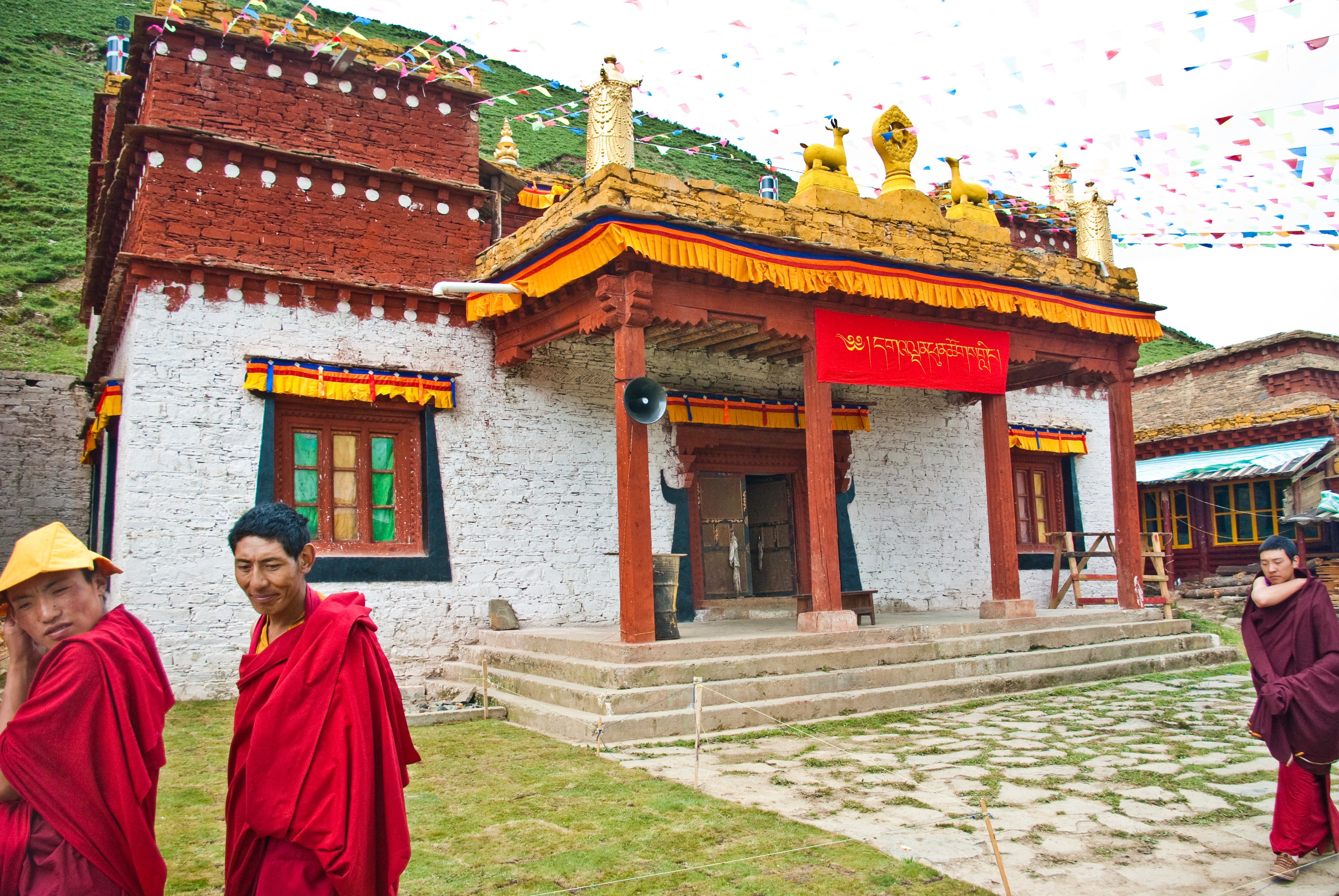
Before the borders hardened, Kham lived by trade. The ancient Tea Horse Road -- the network of mule trails connecting Ya'an in Sichuan to Lhasa -- passed directly through the region, and Batang served as one of its most important caravan stops. Compressed bricks of tea moved west; Tibetan horses, medicinal herbs, and musk moved east. French missionary Auguste Desgodins, stationed in the borderlands from 1855 to 1870, reported that "gold dust is found in all the rivers and even the streams of eastern Tibet," with locals panning despite severe prohibitions. The British consul A. Hosie, visiting Batang in 1904, found an economy built on black leather and barley beer. Kham's isolation preserved traditions that the lowlands lost to modernization. Colourful cham dances still mark the Tibetan calendar at monasteries like Chode Gaden Pendeling in Batang, where 500 monks maintain a practice that dates back centuries.
From the Air
Located at 30.60N, 96.84E in eastern Tibet. Kham occupies the Hengduan Mountain region where the Mekong, Yangtze, Yalong, and Salween rivers carve deep parallel gorges. Terrain is extremely rugged with peaks exceeding 6,000 meters and valleys dropping below 2,000 meters. Chamdo Bangda Airport (ZUBD) is the nearest major airport, one of the world's highest at 4,334 meters. The region spans portions of the Tibet Autonomous Region, Sichuan, Yunnan, and Qinghai. From altitude, the parallel river gorges are the defining visual feature -- four deep trenches running northwest to southeast, separated by knife-edge ridges.