Khunjerab Pass
In the Wakhi language, "Khunjerab" means "waterfall house," a name that evokes tumbling water and shelter. The reality at 4,693 meters is rather different: a long, wind-scoured saddle between the Karakoram peaks, often buried under snow for months at a time, where the world's highest paved international border crossing connects Pakistan's Gilgit-Baltistan with China's Xinjiang. Somewhere along this stretch of tarmac, traffic switches from driving on the left to driving on the right, and the Karakoram Highway, one of the great engineering feats of the 20th century, reaches its highest point.
The Road That Chose the Steeper Path
When Pakistan and China decided to build a highway across the Karakoram in the 1960s, the obvious route led over the Mintaka Pass, a lower and gentler crossing that caravans had used for centuries. China vetoed it. Mintaka's open approaches, the Chinese military argued, would make the road vulnerable to air strikes. The steeper, more sheltered Khunjerab Pass was chosen instead. Construction took nearly two decades. Workers blasted through gorges, bridged rivers, and paved switchbacks at altitudes where the air holds barely half the oxygen of sea level. The road was completed in 1982, and the old Mintaka and Kilik passes, once the principal routes across the range, were quietly retired. The Karakoram Highway now runs 1,300 kilometers from Islamabad to Kashgar, with the Khunjerab Pass as its literal and metaphorical summit.
Life at the Top
The pass is not a sharp ridge but a broad, relatively flat expanse, which makes it feel less like a mountain crossing and more like a windswept plateau that happens to have a border on it. Snow closes it to heavy vehicles from late November through the end of April, and to all traffic from late December through March. Climate change has made these schedules less predictable; some recent winters have seen the road remain passable for days or weeks longer than expected. When the pass is open, a daily bus runs between Gilgit and Kashgar. On the Pakistani side, it takes about five hours to reach the customs post at Sost, 75 kilometers away. On the Chinese side, the port of entry lies just 3.5 kilometers from the border in Tashkurgan County, and Kashgar is 420 kilometers further northeast.
Snow Leopards and ATMs
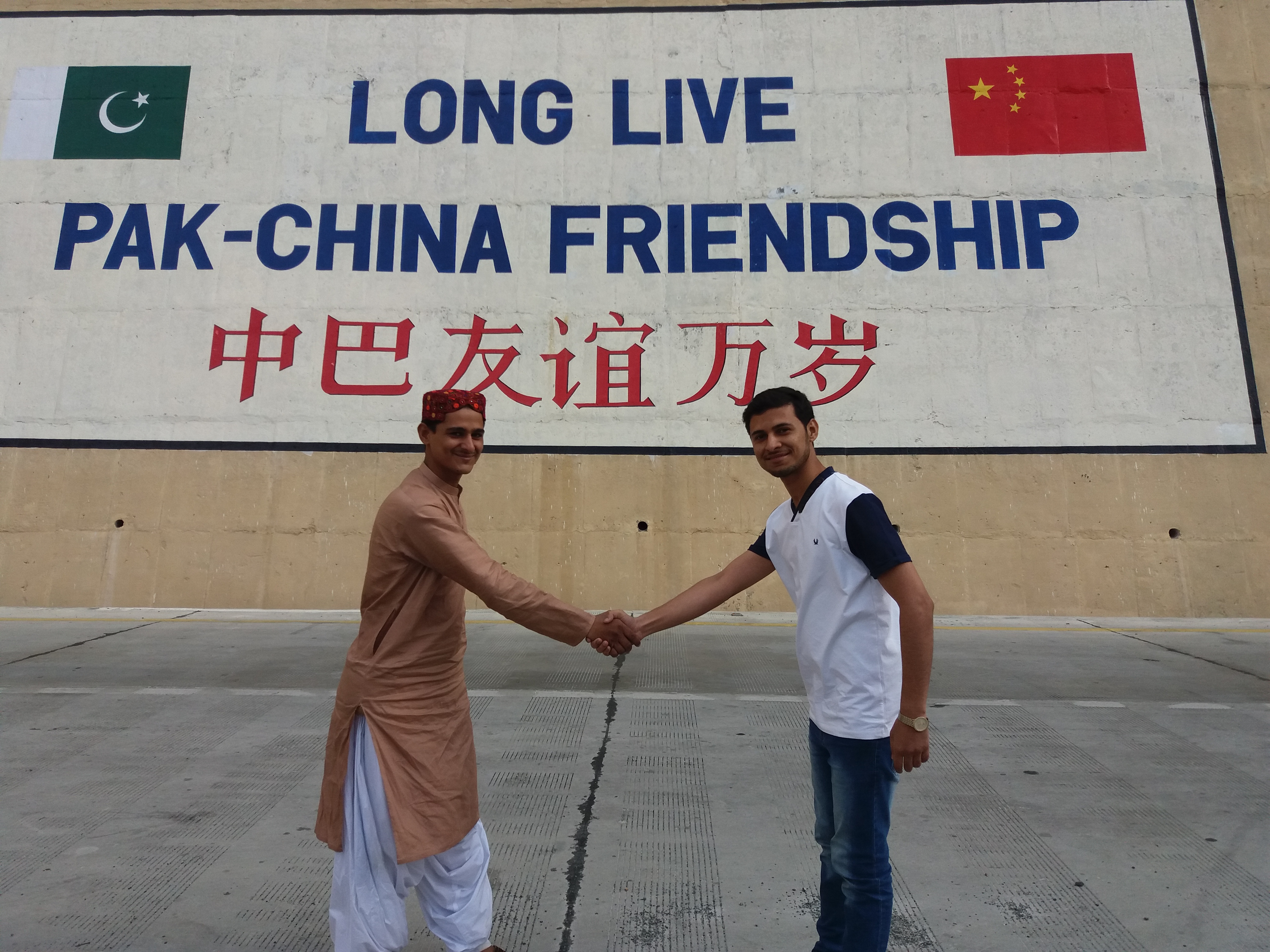
The Khunjerab National Park flanks the Pakistani approach to the pass, and its high meadows and rocky slopes are home to snow leopards, one of the world's most elusive predators. Marco polo sheep, ibex, and brown bears also inhabit these elevations. At the border itself, the scenery takes a more unexpected turn: the National Bank of Pakistan operates the highest ATM in the world here, linked to China UnionPay and the domestic 1LINK network. The juxtaposition is pure Karakoram Highway: ancient trade route meets modern infrastructure, endangered wildlife meets electronic banking, and soldiers from two nuclear powers stand side by side posing for photographs at the friendship monument.
A Dream of Rails
The highway was always meant to be a beginning, not an end. In 2007, Pakistan and China hired consultants to study the feasibility of a railway through the pass, part of a grand vision to connect the Chinese rail network to the ports of the Arabian Sea. A formal study launched in November 2009 envisioned a line from Havelian in Khyber Pakhtunkhwa to Kashgar in Xinjiang, spanning 1,100 kilometers of some of the most challenging terrain on the planet. The project has not advanced beyond the study phase. It is not included in the current China-Pakistan Economic Corridor plan, and the engineering challenges of threading a railway through the Karakoram at nearly 5,000 meters remain formidable. The highway, for now, remains the only thread.
Where Left Becomes Right
Few borders make their geopolitical differences so physically tangible. Approaching from Pakistan, drivers keep to the left; the moment they cross into China, they must switch to the right. It is one of a handful of international crossings in the world where this handedness flip occurs. The pass is 870 kilometers from Islamabad and 1,890 kilometers from Urumqi, which gives some sense of just how far from the centers of power this frontier sits. And yet it matters enormously. The Karakoram Highway is the physical backbone of the China-Pakistan economic relationship, and the Khunjerab Pass is its keystone. Everything that moves between the two countries by road, every container truck, every bus, every traveler, passes through this cold, high, improbable crossing.
From the Air
Khunjerab Pass is located at approximately 36.85N, 75.43E, at an elevation of 4,693 meters (15,397 feet) in the Karakoram Range. Fly at or above FL200 for terrain clearance; surrounding peaks exceed 7,000 meters. The Karakoram Highway is visible as a thin ribbon winding through the valleys below. Nearest airports: Gilgit (OPGL) approximately 270 km south in Pakistan, Kashgar (ZWSH) approximately 420 km northeast in China. Expect severe mountain turbulence, high winds, and icing. The broad, flat character of the pass itself is distinguishable from the sharper ridgelines to either side.