Kinsale
Alexander Selkirk made a fateful decision in Kinsale. In 1703, the Scottish privateer joined a raiding expedition departing from this small County Cork harbour, bound for Spanish shipping lanes in the Pacific. After a year of storms and skirmishes left his vessel rotting beneath him, Selkirk demanded to be put ashore rather than risk drowning. The captain obliged, marooning him on a remote island off the Chilean coast for four years and four months. Daniel Defoe would later borrow the bones of his story for Robinson Crusoe, but Selkirk's actual life was wilder than any novel. And it all began in this unassuming harbour at the mouth of the River Bandon, whose name in Irish -- Cionn tSaile, "head of the brine" -- hints at the salt air and sea currents that have shaped its fortunes for centuries.
Where Empires Stumbled
Kinsale's harbour was ideally sized for the small wooden vessels of the medieval era, close enough to Cork's port for trade yet remote enough to dodge English warships patrolling the western Channel. That geography made it a magnet for continental interference. In 1601, Spanish troops landed here to support the O'Neills of Ulster, the last major Irish opposition to English control. The problem was strategic: the Spanish arrived at the wrong end of the country. Bottled up in Kinsale, they waited while Irish forces marched south to break the English siege. The result was catastrophe. On Christmas Eve 1601, the combined Irish and Spanish forces were routed. The Spanish surrendered after three months, sailed home, and Irish independence effectively died for three centuries.
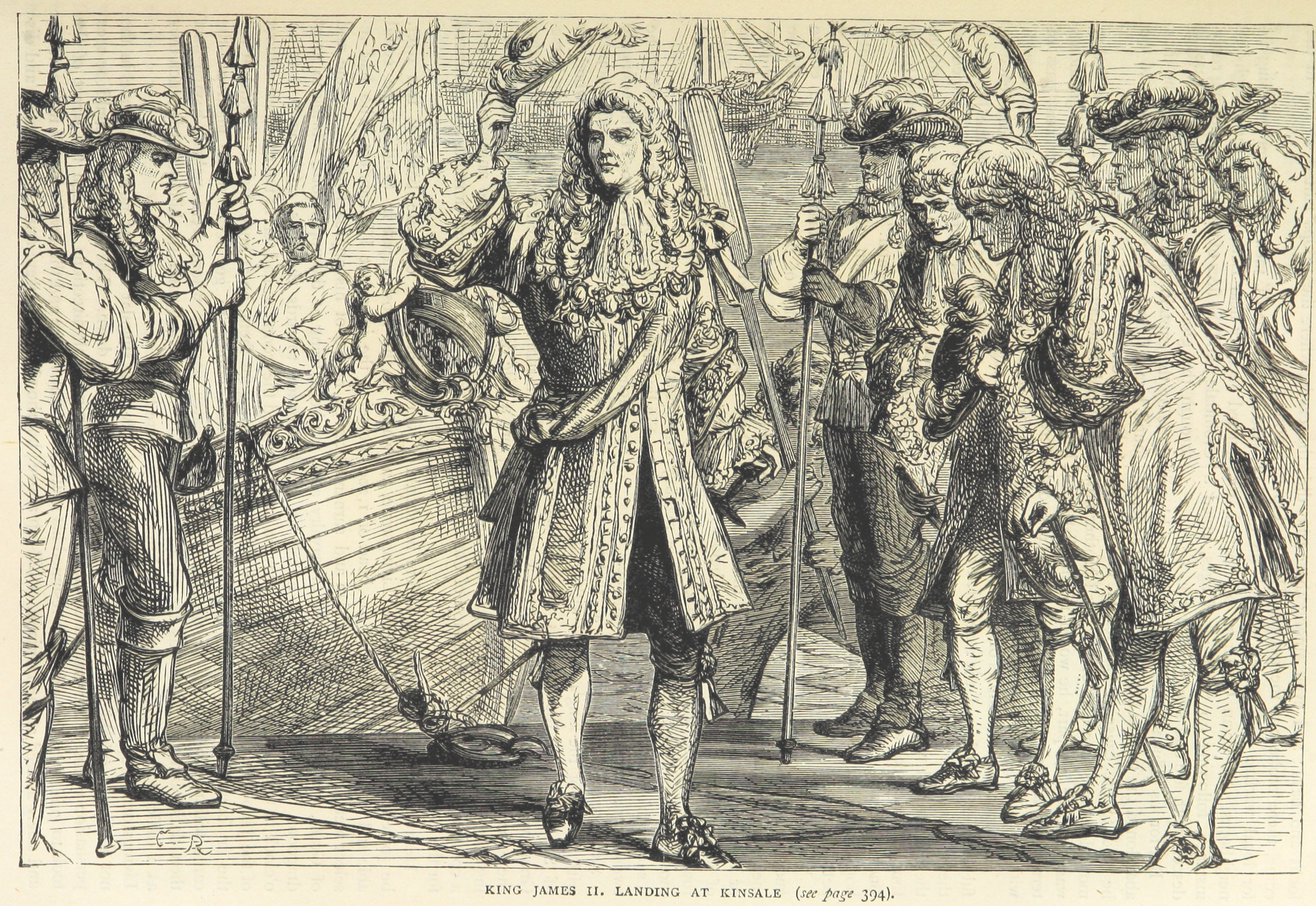
James the Unfortunate
Kinsale hosted another continental visitor in 1689, when the deposed King James II landed with French troops, hoping to reclaim his throne through Ireland. He marched north and was beaten at the Battle of the Boyne. What followed was less retreat than rout: James fled south to Wexford, then to Kinsale, and from there escaped to France, abandoning the Irish supporters who had risked everything for his cause. The Irish were not generous in their assessment. They gave him the nickname Seamus an Chaca -- a phrase that translates, without euphemism, to "James the Shit." His supporters fought and died for a cause their champion had already abandoned.
Too Small for Greatness
Paradoxically, what saved Kinsale was its limitations. The English built navy facilities here, but the harbour proved too shallow for the larger warships of the late eighteenth century, let alone the iron steamers of the Victorian age. A sandbar at the entrance and rocks known locally as "The Sovereign's Bollocks" kept the big ships out. The navy base moved to Cork. Industry never arrived. Emigration ships sailed from elsewhere. The result is that Kinsale's narrow, crooked medieval streets survived intact, their colourful houses tumbling down toward the waterfront in the kind of higgledy-piggledy arrangement that urban planners cannot reproduce and tourists cannot resist. What was once a disadvantage became, eventually, the town's greatest asset.
The Gourmet Harbour
For a town of just 6,000 people, Kinsale has an improbable concentration of fine restaurants. The gourmet tradition runs deep enough that an annual food festival each October draws visitors from across Ireland and beyond. Sailing remains central to the town's identity, with a visitor marina at Castlepark -- the old navy dockyard where wooden vessels were once careened on the beach, though nothing of that era survives. Out at the Old Head of Kinsale, a spade-shaped headland 15 kilometres southwest of town, a signal tower built during the Napoleonic era now serves as a small museum. Its grounds hold a memorial to the 1,198 people who died when the Lusitania was torpedoed 12 miles offshore in 1915, one of the defining tragedies of the First World War.
Fortress and Shore
Charles Fort, a star-shaped military fortification south of town, stands as one of the best-preserved examples of its kind in Europe. The Sovereign Islands, a pair of sea stacks visible from the headland beyond the fort, are a nature reserve where boats cannot land -- not that any boat could manage the approach. Garretstown and Garrylucas offer exposed beaches with surf, while the Wild Atlantic Way begins its 2,400-kilometre journey north at the Old Head. From the air, Kinsale resolves into a tight cluster of rooftops around a sheltered inlet, the River Bandon curving through green fields to meet the sea. It looks peaceful. It has not always been so.
From the Air
Kinsale is located at 51.71N, 8.53W on the south coast of Ireland, at the mouth of the River Bandon. From the air, look for the sheltered harbour inlet and the distinctive star-shaped Charles Fort on the headland south of town. The Old Head of Kinsale, a prominent spade-shaped peninsula, is visible 15 km to the southwest. Cork Airport (EICK) is approximately 20 km to the north. Best viewed at 2,000-4,000 feet for harbour detail.