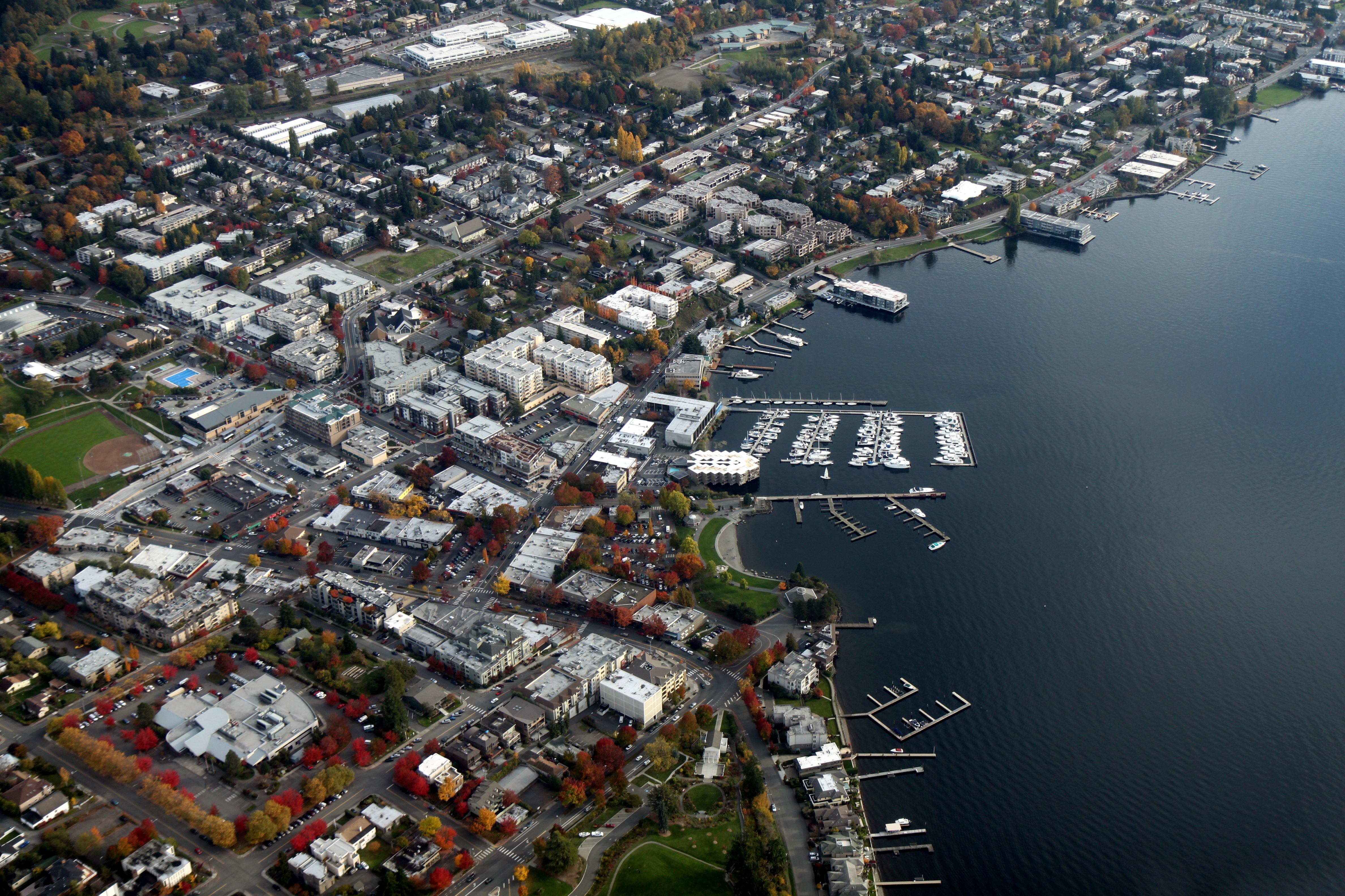
Kirkland
Peter Kirk had steel in his blood. In 1888, this English industrialist looked at the forested shores of Lake Washington and saw chimneys, foundries, the great roaring heart of a Western Pittsburgh. He laid out a city bearing his name, built a mill, and waited for the iron age to come to the Pacific Northwest. It never did. The steel dreams rusted and faded, but something unexpected grew in their place. Today, nearly 93,000 people call Kirkland home, drawn not by smokestacks but by waterfront parks where the Olympic Mountains float above Puget Sound and the Seattle skyline sparkles across the lake like a promise. The city that failed as an industrial powerhouse succeeded as something gentler: a place where art galleries cluster along tree-lined streets and the biggest daily decision might be which lakeside cafe deserves your afternoon.
Steel Dreams to Silicon Reality
The story of Kirkland's reinvention mirrors the broader transformation of the Pacific Northwest. When Peter Kirk's steel ambitions collapsed in the financial panic of 1893, the small city might have faded into obscurity. Instead, it evolved. Shipyards flourished during the World Wars, building vessels in the same waters where pleasure boats now bob at anchor. By the late twentieth century, a different kind of industry had arrived: Costco made Kirkland its headquarters, eventually lending the city's name to its house brand that now appears on products from olive oil to golf balls in warehouses around the world. Northwest University spreads across wooded grounds. Technology workers commute across the Evergreen Point Floating Bridge, the longest floating bridge on Earth, which links Kirkland's quiet neighborhoods to the bustle of Seattle.
The Waterfront Life
Kirkland's downtown hugs the lake in a way few Eastside communities manage. Waterfront parks line the shore, offering unobstructed views that explain why residents accept the toll booth charges to live here. On clear days, you can trace the jagged line of the Olympic Mountains rising beyond the Space Needle, the snowfields catching afternoon light like crumpled white paper. The downtown area clusters along Lake Street and Central Way, compact enough to explore on foot, diverse enough to reward wandering. Art galleries showcase local painters and sculptors; their work often featuring the very landscapes visible through the gallery windows. Cafes spill onto sidewalks when weather permits, which in the Pacific Northwest means learning to love drizzle.
Getting There and Getting Around
Two major arteries feed Kirkland's neighborhoods. Interstate 405 forms the eastern spine, connecting the city to Lynnwood in the north and Bellevue to the south, though rush hour traffic can transform a fifteen-minute drive into an hour of crawling frustration. State Route 520 runs along Kirkland's southern border, crossing Lake Washington on that famous floating bridge to reach Seattle. Both routes now feature congestion-priced toll lanes where the rates fluctuate with traffic conditions. Most drivers use Good to Go transponders linked to prepaid accounts; those without find photographs of their license plates arriving with bills in the mail. Once downtown, the scale turns human again. Walking works well along the waterfront, and the transit center on 3rd Street connects riders to Seattle, Bellevue, Redmond, and points beyond.
Where Art Meets Water
The creative spirit that grew in the shadow of Peter Kirk's failed steel mill has become Kirkland's defining characteristic. Galleries cluster near the waterfront, displaying paintings, sculptures, and crafts that often draw inspiration from the dramatic landscape surrounding the lake. Bronze sculptures dot public spaces, surprising pedestrians on ordinary sidewalks. The community has cultivated this identity deliberately, recognizing that quality of life, not industrial output, drives its modern economy. Residents accept higher costs and toll-road commutes for access to these streets where the Olympic peaks frame every western view and the only smoke rising comes from restaurant kitchens preparing Northwest cuisine.
From the Air
Located at 47.69N, 122.19W on the eastern shore of Lake Washington. The city appears as developed waterfront stretching north from the SR-520 corridor. The Evergreen Point Floating Bridge is clearly visible crossing the lake to Seattle. No commercial airport; nearest is Boeing Field/King County International (KBFI) 10nm south or Seattle-Tacoma International (KSEA) 18nm south. Kenmore Air Harbor (S60) for seaplanes is 6nm north.