Kiso River
They call a 13-kilometer stretch of it the Japan Rhine, and from a boat drifting between the steep forested banks near Inuyama, the comparison holds. The Kiso River begins high in the mountains of Nagano Prefecture and runs 229 kilometers through four prefectures before spilling into Ise Bay just south of Nagoya. It is the principal river among the Kiso Three Rivers, joined in its final reach across the Nobi Plain by the Nagara and Ibi rivers. Together these waterways have shaped the geography, politics, and human drama of central Japan for centuries. The Kiso is not merely a scenic waterway. It is a river that has been fought over, engineered, planted with cherry trees, and soaked in the blood of samurai ordered to tame it. Its valley forms one of Japan's most important historic corridors, and its floodplain remains a monument to both nature's power and the lengths to which people will go to control it.
A Valley Between Ranges
The Kiso's upper reaches carve through the Kiso Valley, a deep corridor flanked by the Central Alps on one side and the peaks of the Kiso Mountains on the other. This is old Nakasendo territory, the inland highway that once connected Edo to Kyoto through mountain passes rather than along the coast. Post towns like Narai and Tsumago still preserve their wooden facades along the valley floor, their existence owed entirely to the river and the route it carved. As the Kiso descends from the highlands and enters Gifu Prefecture, it widens and slows, the mountain torrent becoming a broad river flowing across increasingly flat terrain. Between the cities of Minokamo and Inuyama, the valley narrows again into the gorge that earned the river its European nickname. Here the water pushes between rocky bluffs crowned with forest, a landscape that reminded early Western visitors of the Rhine Valley between Mainz and Koblenz.
Blossoms on the Levee
The Kiso River's 47-kilometer embankment, built during the Edo period between the cities of Inuyama and Yatomi, tells its own story of reinvention. After record floods in May 1884 collapsed a section of the levee, volunteers replanted the rebuilt embankment with 1,800 cherry tree saplings at the request of the governor of Aichi Prefecture, replacing the Japanese red pines that had lined it before. The choice of varieties was deliberate and unusual. The planters specifically excluded the Somei Yoshino cherry that had become wildly popular across Japan, instead selecting rare and wild species to create something distinct. A seven-kilometer section of this flowering embankment between Ichinomiya and Konan has been designated both a National Place of Scenic Beauty and a Natural Monument since 1927. By 2001 the original trees had dwindled through natural attrition to fewer than 400, but the city of Ichinomiya launched a major replanting campaign to restore the embankment's former glory. In spring, the surviving and newly planted trees still paint the riverbank in shades of pink and white.
Three Rivers, One Catastrophe
The Kiso, Nagara, and Ibi rivers converge on the Nobi Plain in a tangle of channels and floodplain that for centuries made life precarious for everyone downstream. During the Edo period, a strict rule required levees on rivers flowing through other domains to be built lower than those protecting Owari Domain, the Tokugawa heartland around Nagoya. This meant neighboring areas absorbed the worst flooding while Owari stayed dry. The most infamous consequence of this arrangement was the 1754 Horeki River Incident, in which the shogunate forced Satsuma Domain to carry out flood control works on all three rivers. The project was deliberately sabotaged by shogunal authorities, dikes were ordered destroyed and rebuilt three times, and 84 Satsuma samurai died through seppuku, disease, or despair. The rivers were not properly separated until the Meiji era, when Dutch engineer Johannis de Rijke redesigned the lower delta beginning in 1889. His plan, finalized around 1912, gave the three rivers the distinct parallel courses visible from the air today.
The River Today
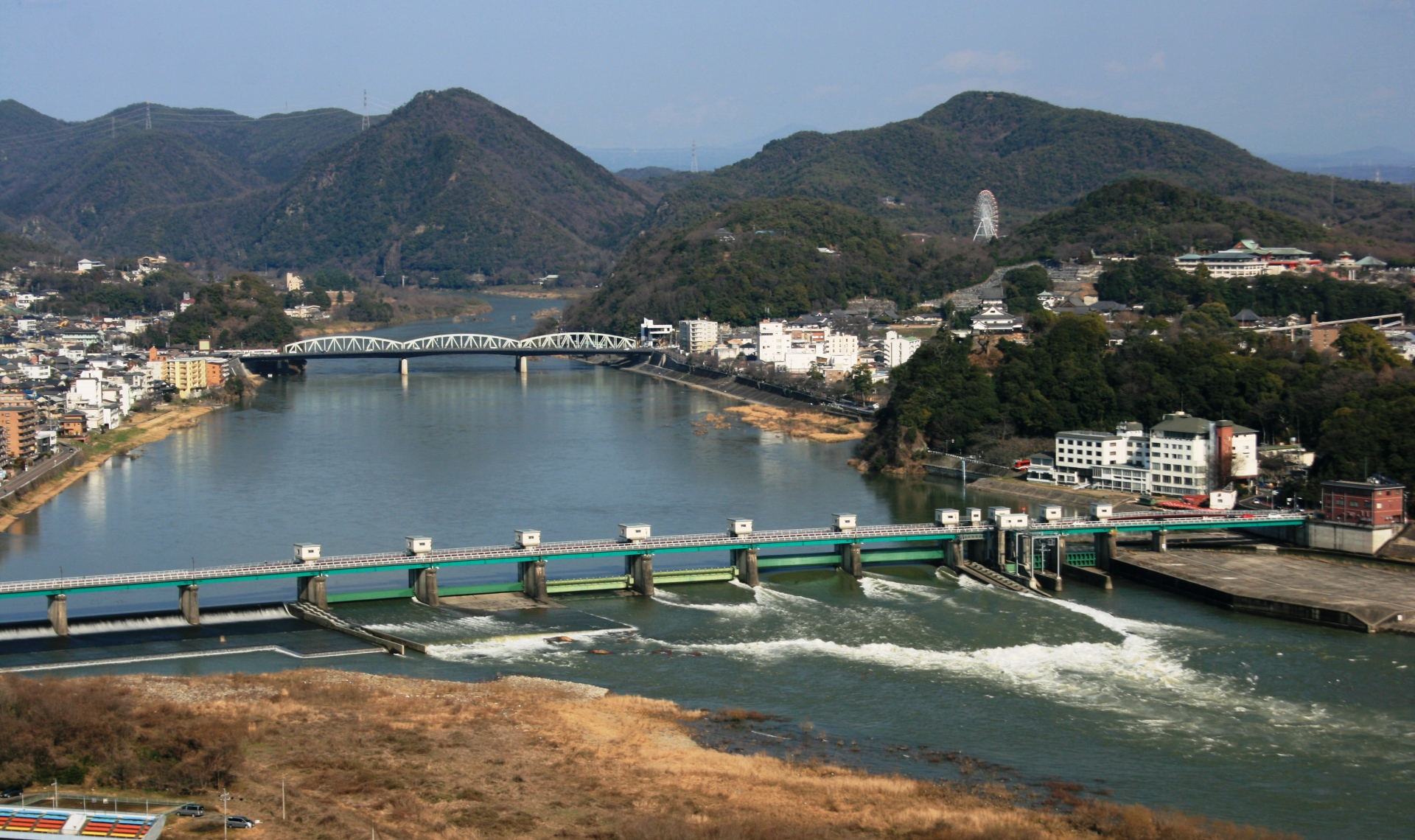
Additional stretches of the Kiso River near Inuyama and through the Gifu Prefecture towns of Kakamigahara, Kani, and Sakahogi were collectively designated a National Place of Scenic Beauty in 1934. Inuyama Castle, one of Japan's twelve original surviving castles, perches on a bluff directly above the river, offering views down into the gorge that has drawn visitors for centuries. The lower Kiso crosses the Nobi Plain as a broad, levee-lined channel, its waters reflecting the urban and agricultural landscape of one of Japan's most densely populated regions before reaching Ise Bay. From the air, the final stretch is unmistakable: three silver ribbons running parallel across a flat green plain, separated by the engineered embankments that took 150 years and countless lives to build. The Kiso's journey from mountain torrent to tidal estuary spans the full spectrum of Japan's relationship with its rivers, from reverence to engineering to remembrance.
From the Air
The Kiso River runs 229 km from Nagano Prefecture highlands to Ise Bay at approximately 35.03N, 136.75E. The Japan Rhine gorge section between Minokamo and Inuyama (around 35.38N, 136.95E) is best viewed at 2,000-4,000 feet for gorge detail. The dramatic three-river parallel courses across the Nobi Plain are clearly visible from 5,000-8,000 feet. The cherry tree embankment between Ichinomiya and Konan is striking in spring. Nearest airports: RJGG (Chubu Centrair International Airport) at the bay mouth, RJNA (Nagoya Airfield/Komaki) near the plain. Inuyama Castle is a prominent visual landmark on the river bluff. Watch for restricted airspace around Nagoya.