Kitakami River
Most rivers have one mouth. The Kitakami has two. Japan's fourth-largest river and the mightiest in the Tohoku region flows 249 kilometers from Mount Nanashigure in northern Iwate Prefecture to Ishinomaki City in Miyagi, where it performs an unusual trick: one branch -- the Kyukitakami River -- turns south into Ishinomaki Bay, while the main channel pushes east into the open Pacific. Between those twin endings and the mountain source lies a valley that has shaped northeastern Japan for centuries, serving as a highway for rice barges in the Edo period, a corridor for salmon returning upstream each autumn, and every April, the backdrop for one of the country's most breathtaking displays of cherry blossoms.
Between Two Mountain Walls
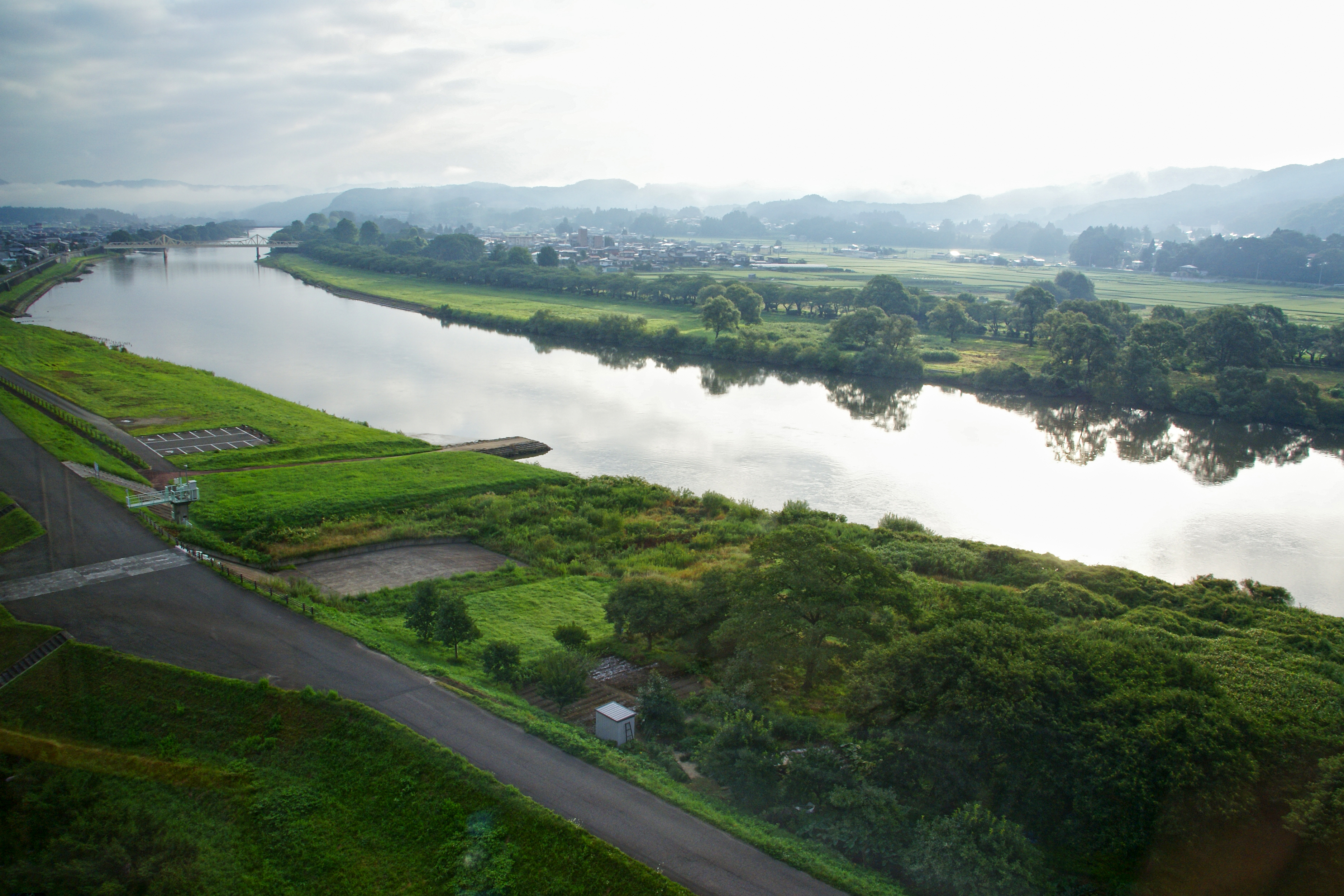
The Kitakami carves its path through a landscape defined by parallel mountain ranges. To the east rise the Kitakami Mountains, an ancient granite and sedimentary chain running the length of Iwate Prefecture. To the west stand the Ou Mountains, the volcanic backbone of northern Honshu. The river threads the wide valley between them, flowing generally southward through rural countryside that remains some of the least urbanized in Japan. Over twenty tributaries feed the Kitakami from both flanks as it passes through cities and towns including Morioka, Hanamaki, Kitakami, Oshu, and Ichinoseki. Its total drainage basin covers roughly 10,150 square kilometers, gathering water from across Iwate and Miyagi Prefectures. From the air, the river reads as a bright silver thread stitching together the green patchwork of rice paddies and forested hills.
The Undammed Reach
Dams are common throughout the Kitakami watershed. From the Taisho and Showa periods onward, numerous structures were built on the river and its tributaries for hydroelectric power, flood control, and irrigation. But the Kitakami holds a remarkable exception: from its mouth all the way upstream to the Shijushida Dam north of Morioka, the main channel runs free. No concrete barriers interrupt the current across this long stretch. The result is one of Japan's great salmon runs. Every autumn, chum salmon push upstream through the lower Kitakami, returning to spawn in the same gravelly riverbeds where they hatched. The unbroken flow also supports a rich freshwater ecosystem, with ayu (sweetfish) in the summer months drawing anglers to the riverbanks. This unimpeded stretch is increasingly rare in Japan's heavily engineered river systems.
A River Road Through History
Before railways stitched Japan together in the Meiji period, the Kitakami River was the Tohoku region's most important transportation artery. Flat-bottomed boats carried rice, timber, and goods downstream to the coastal ports of Ishinomaki, and poled back upriver with supplies for inland towns. The river connected the feudal domains of the Sendai region to the broader economy, making it a vital commercial lifeline during the Edo period. Towns along its banks grew around river landings and trade posts. Even after rail lines arrived in the late 19th century, the Kitakami remained central to the region's identity -- not as a trade route, but as a source of irrigation water that sustains the rice paddies stretching across its floodplain, making Iwate and Miyagi important rice-producing prefectures.
Ten Thousand Trees in Bloom
Each April, the city of Kitakami hosts one of Japan's most celebrated cherry blossom festivals at Tenshochi Park, which lines the riverbank for two kilometers. Roughly 10,000 cherry trees create an unbroken canopy of pink and white blossoms that tunnel over walking paths along the water. The park is regularly ranked among the top 100 sakura viewing sites in Japan and the three greatest in the Tohoku region. During the festival, over 300 colorful koinobori -- carp-shaped streamers -- are strung across the river, fluttering in the spring breeze above the water. Horse-drawn carriages carry visitors beneath the blossoms, and cruise boats glide along the river offering views of the flowering banks from below. Traditional Onikenbai dance performances, with origins stretching back 1,300 years, add a layer of cultural pageantry to the natural spectacle.
From the Air
Located at 38.58°N, 141.46°E. The Kitakami River is one of the most prominent visual features in northeastern Honshu, clearly visible from cruising altitude as it flows south through the broad valley between the Kitakami Mountains (east) and Ou Mountains (west). The dual river mouths at Ishinomaki are a distinctive landmark. The nearest airports are JASDF Matsushima Air Base (RJST) near Ishinomaki and Sendai Airport (RJSS) about 80 km to the southwest. Hanamaki Airport (RJSI) sits closer to the river's mid-section near Hanamaki. In spring, the cherry blossom canopy at Tenshochi Park near Kitakami City is visible as a pink band along the riverbank. The river's many tributaries branching east and west create a distinctive dendritic pattern visible from altitude.