Koganeyama Shrine
In 749 AD, a discovery in the hills of Tohoku made Emperor Shomu so overjoyed that he renamed his entire era. Gold dust had been found in Toda District -- the first native gold ever recorded in Japan -- and the emperor rechristened his reign Tenpyo Kanpo, roughly meaning "Heavenly Peace and Gratitude for Treasure." Today, the small Shinto shrine that marks the spot sits quietly in the town of Wakuya, Miyagi Prefecture, a modest torii gate leading uphill toward a mountain that was once worshipped as the seat of the gods themselves. There is no honden -- no inner sanctum housing the deity -- because the mountain behind the shrine is the deity.
Gold for the Great Buddha
The gold's purpose was anything but modest. Emperor Shomu was in the middle of constructing the Nara Daibutsu, the enormous bronze Buddha at Todai-ji Temple, and he needed gold to gild its surface. He sent a call to every province in the realm. The ruler of Mutsu Province, Kudara-no-konikishi Kyofuku -- a descendant of King Uija of the Korean kingdom of Baekje -- answered with 900 ryo of gold, approximately 13 kilograms, from the mines of Toda District. Two years later, he sent another 900 ryo of gold sand. The Daibutsu was completed in 752, its golden surface shining with metal pulled from these northern hills. That a descendant of Korean royalty, governing a frontier province in Japan's far north, supplied the gold for the nation's most sacred Buddhist icon speaks to the tangled, cosmopolitan reality of eighth-century East Asia.
A Shrine Without Walls
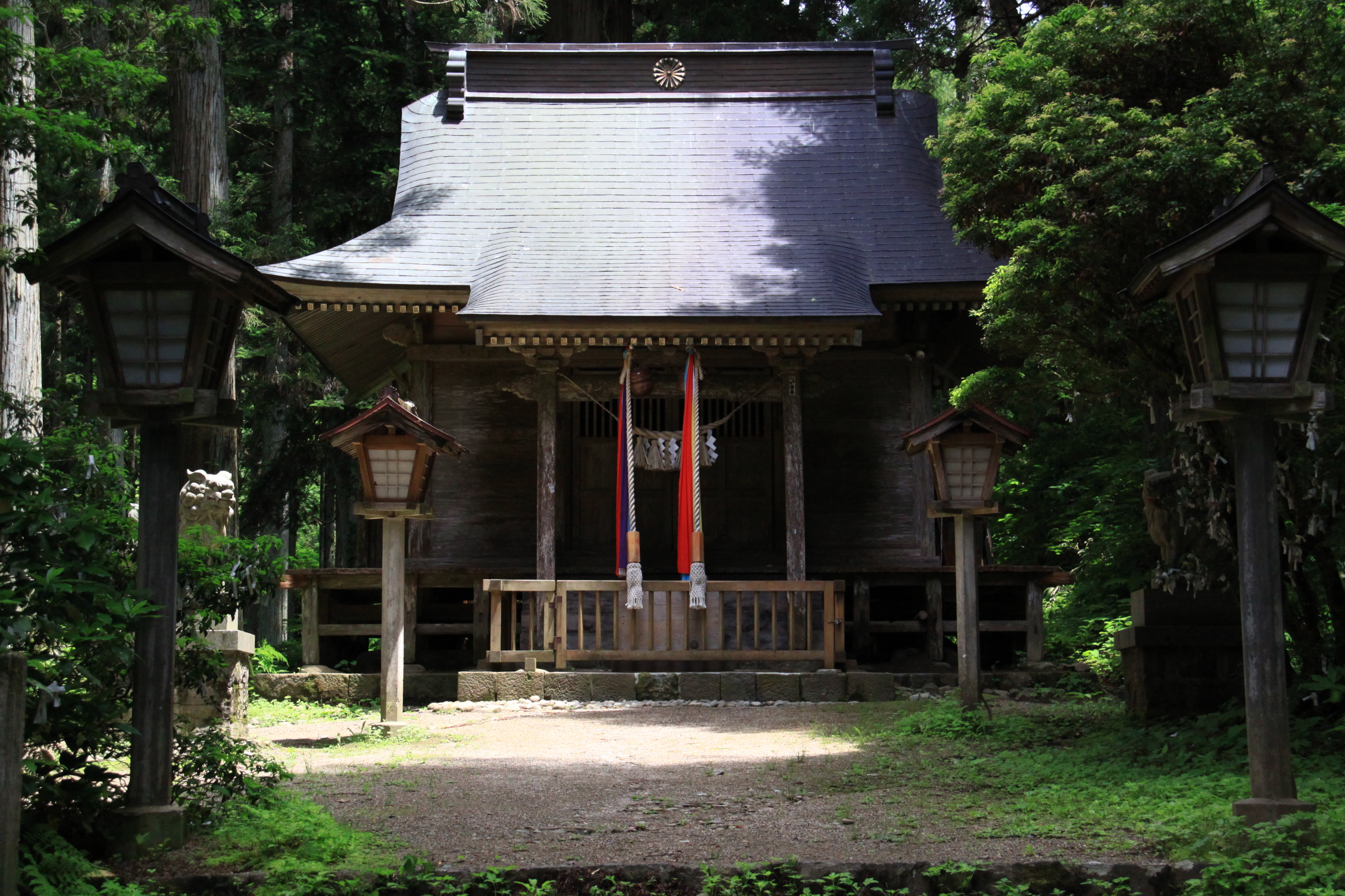
Koganeyama Shrine follows an older Shinto tradition where the natural landscape itself serves as the sacred object. The shrine has a haiden -- a hall of worship where visitors pray -- but deliberately no honden, the enclosed chamber that normally houses the enshrined deity. Instead, the forested mountain rising behind the shrine is regarded as the body of the kami. Worshippers face the mountain and pray directly to it. The current haiden, built in the Shinmei-zukuri style with its clean, unadorned lines of cypress wood, dates from 1909. Under the modern ranking system for Shinto shrines, Koganeyama held the status of Prefectural Shrine. The shrine's annual festival falls on September 15, drawing visitors to a site that has been continuously venerated for well over a millennium.
Buried Evidence
The shrine's claims to antiquity moved from legend to archaeology in 1957, when researchers from Tohoku University began excavating the grounds. They unearthed the foundations of Nara-period structures and roof tiles dating to the eighth century -- physical proof that a significant building complex stood here during the exact decades when Toda District was shipping gold south to Nara. The Engishiki, a tenth-century compendium of government regulations, lists a shrine at this location as early as 767 AD, further anchoring the site in documented history. Miyagi Prefecture designated it a Prefectural Historic Site in 1959. Eight years later, in 1967, the Japanese central government elevated it to a National Historic Site, recognizing Koganeyama as one of the country's most important archaeological landmarks tied to early gold production.
The Michinoku Gold Road
Koganeyama Shrine is part of a broader landscape of gold heritage across Miyagi Prefecture and the Tohoku region. Nearby Kinkasan Island, visible from the coast, hosts its own Koganeyama Shrine and is considered one of the three sacred places of Tohoku. The connection between these sites traces back to the same eighth-century gold rush that supplied Nara. Today, the Tohoku Golden Route links these locations for visitors interested in following the path of Japan's earliest known gold from mine to monument. The shrine sits a 45-minute walk from Wakuya Station on the JR East Ishinomaki Line, in a landscape of rice paddies and low hills that gives little outward sign of the precious metal that once flowed from its earth.
From the Air
Located at 38.56N, 141.14E in the Toda District of Miyagi Prefecture, in the low hills north of the Ishinomaki coastal plain. The shrine grounds are nestled against a forested hillside and may be difficult to spot from altitude, but the town of Wakuya is identifiable by its grid of rice paddies and the Ishinomaki rail line running east-west. Nearest airports: Sendai Airport (RJSS) approximately 40nm south-southwest, JASDF Matsushima Air Base (RJST) approximately 15nm southeast. The Tohoku region has variable weather with clear conditions common in autumn; winter brings snow and reduced visibility.