
Koh Tang
Koh means island in Khmer. Tang translates loosely as legend. The name is far older than anything that happened here, and it has turned out to be uncomfortably apt for a rock in the Gulf of Thailand, fifty-two kilometres off Cambodia's southwest coast, that carries more history than a place with no civilian population has any business carrying. Frigatebirds nest on it. The Cambodian military keeps a garrison. Under the jungle and the coral sand are the reasons American recovery teams kept coming back for thirty years.
The Shape of It
The island is a jungle ridge fringed with rock, highest at its northern extremity, and that geography has decided everything that ever happened on it. Two shallow coves press into the neck of the northern plateau, one on the east and one on the west; the eastern cove holds a long, shallow beach of coral sand. Nearly everywhere else the shore is rock and the interior is dense enough to stop a person walking through it.
Around Koh Tang lie the smaller islands of its archipelago — Koh Mul about 1.3 kilometres east, Koh Domloung, the potato island, a little over two kilometres south, and Koh Tee Mui and Koh Tee Bpi further out. BirdLife International has designated the group an Important Bird Area for its Christmas Island frigatebirds and Nicobar pigeons.
What the Boats Brought
In May 1975, weeks after taking Phnom Penh, Khmer Rouge troops landed on Thổ Chu, a Vietnamese island to the southeast, and removed 513 civilians — very nearly everyone who lived there. They were brought to Koh Tang and put to forced labour. All of them were killed. It is by a wide margin the largest death toll this island has ever held, and the one least often mentioned; the people were fishermen and their families, and Vietnamese investigators were still documenting the site decades later.
Three years on, in August 1978, a junk called the Foxy Lady was blown off course between Singapore and Bangkok and took shelter on Koh Tang's western side. Khmer Rouge gunboats fired on her, killing the Canadian crewman Stuart Glass. The two survivors, John Dewhirst of England and Kerry Hamill of New Zealand, were pulled from the water and taken to the S-21 prison in Phnom Penh, where they were tortured into confessions and executed.
Two Beaches
Between those two events, the island became the objective of an American assault. The crew of the seized container ship SS Mayaguez were believed to be held on Koh Tang; they were not, and had already been moved toward the mainland. US planners estimated twenty to thirty defenders. There were more than a hundred, under the local commander Em Son, dug in on both coves behind heavy machine guns, recoilless rifles and mortars that had been sited to stop a Vietnamese landing.
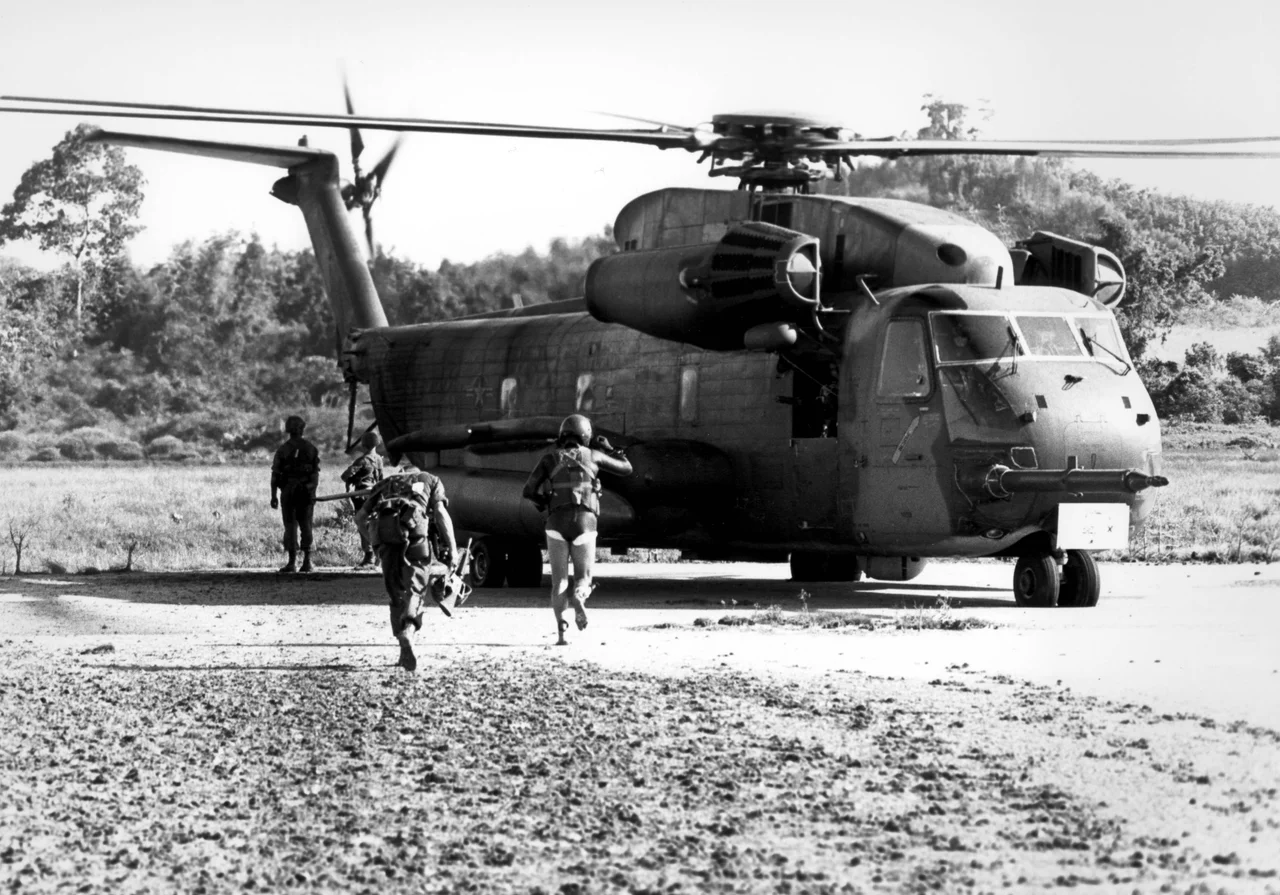
Because the jungle left only those two beaches usable, and because the defenders knew it, the Marines came ashore on the morning of 15 May 1975 exactly where they were expected. Three helicopters were destroyed within minutes. A platoon on the east beach was cut off for twelve hours. The rest fought all day in two isolated pockets on the west, and were lifted out after dark under fire, the last aircraft leaving around 20:10.
Three Men on the Right Flank
As the west beach perimeter shrank through the evening, a three-man machine-gun team — Lance Corporal Joseph Hargrove, Private First Class Gary Hall and Private Danny Marshall — was covering its right flank from behind a rocky outcrop, outside the line. Their company commander believed all his men were inside it. Two hours after the evacuation ended, with the force scattered across three ships, someone counted again.
Just after 20:20 an American voice had come up on a radio, given the correct authentication, and asked when the next helicopter was coming. Told to swim out to sea, he answered that only one of the three could swim. He was warned that airstrikes were about to hit the area, acknowledged, and was not heard again. The following morning the destroyer Henry B. Wilson worked back and forth off the beaches for three hours, broadcasting in English, French and Khmer that it meant no harm and would send an unarmed boat if anyone signalled. Half the ship's company stood on deck watching the treeline. Nothing came.
Thirty Years of Digging
What happened to them was assembled slowly and long afterwards. In 1999 Em Son came forward to American investigators and described his men capturing a wounded American on the west beach the morning after the battle, and his own order to shoot him; the description matched Hargrove. About a week later his men noticed food going missing, set a night ambush, and took two more. Those two were carried to the mainland, held at a pagoda above Sihanoukville, and beaten to death on instructions from Phnom Penh.
Seven joint US–Cambodian investigations ran between 1991 and 1999, including an underwater excavation of a helicopter crash site offshore. Bone fragments recovered in 1999 that may have belonged to Hall and Marshall were too small for conclusive DNA testing. In 2016 an American recovery agency found Hall's identity card in an empty grave. By 2021 the Defense Department counted thirteen of the eighteen Americans missing from the incident as recovered and identified.
The island has gone quiet. There is no permanent civilian population and never was — only the garrison, the birds, and a great deal of sand.
From the Air
Koh Tang lies at 10.300°N, 103.133°E, roughly 52 km southwest of Sihanoukville in the Gulf of Thailand. From altitude it reads as an elongated, densely forested island running north–south, highest at the northern end, with two small pale-sand coves notching the neck of the northern plateau — the east and west landing beaches of the 1975 battle, and the clearest identifying feature. Recommended viewing altitude 5,000–10,000 ft; the surrounding shallows and the satellite islets of Koh Mul and Koh Domloung help fix the position. Nearest airports: Sihanouk International (VDSV) about 60 km northeast, Phu Quoc International (VVPQ), Vietnam, about 85 km southeast, and Phnom Penh International (VDPP) about 220 km northeast. Note the island hosts an active Cambodian military base. Visibility is best in the November–April dry season; the southwest monsoon brings low cloud and heavy haze.
Nearby Stories
- Koh Rong Sanloem 13 km away
- Koh Seh 18 km away
- Koh Poulo Wai 33 km away
- An Thoi Naval Base 34 km away
- Bokor Hill Station 35 km away
- Battle of Pailin 257 km away
- U-Tapao: The Airfield Built on a Shipyard 322 km away
- Krue Se Mosque 380 km away