Kolguyev Island
Two origin stories compete for the name Kolguyev. In one, the Pomor seafarers named the island after Ivan Kalgov, a fisherman who vanished without trace in the surrounding waters. In the other, the word descends from an ancient Finnic term, "kollague," meaning triangle -- a reasonable description of an island that is, in fact, roughly circular. Neither story is confirmed. Both feel appropriate for a place defined by disappearance and imprecision: a low, boggy disc of tundra sitting in the southeastern Barents Sea, 80 kilometers across, home to a single village and a great deal of wind.
Nenets Country
Kolguyev Island lies within the Nenets Autonomous Okrug of Russia, northeast of the Kanin Peninsula and west of the Pechora Sea. The Nenets people have used the island for centuries as a base for seal hunting, reindeer herding, and fishing. Today, the only inhabited settlement is Bugrino, on the southeast coast, where Nenets families form the majority of the population. Reindeer herding has been the island's economic backbone for generations, but the relationship between people, animals, and landscape is precarious. In 2013-2014, a food shortage on the island caused a catastrophic die-off: the reindeer herd plummeted from 12,000 to as few as 50 animals. Four workers remained on the state reindeer farm. Supply interruptions from the mainland are not uncommon.
Explorers and Expeditions
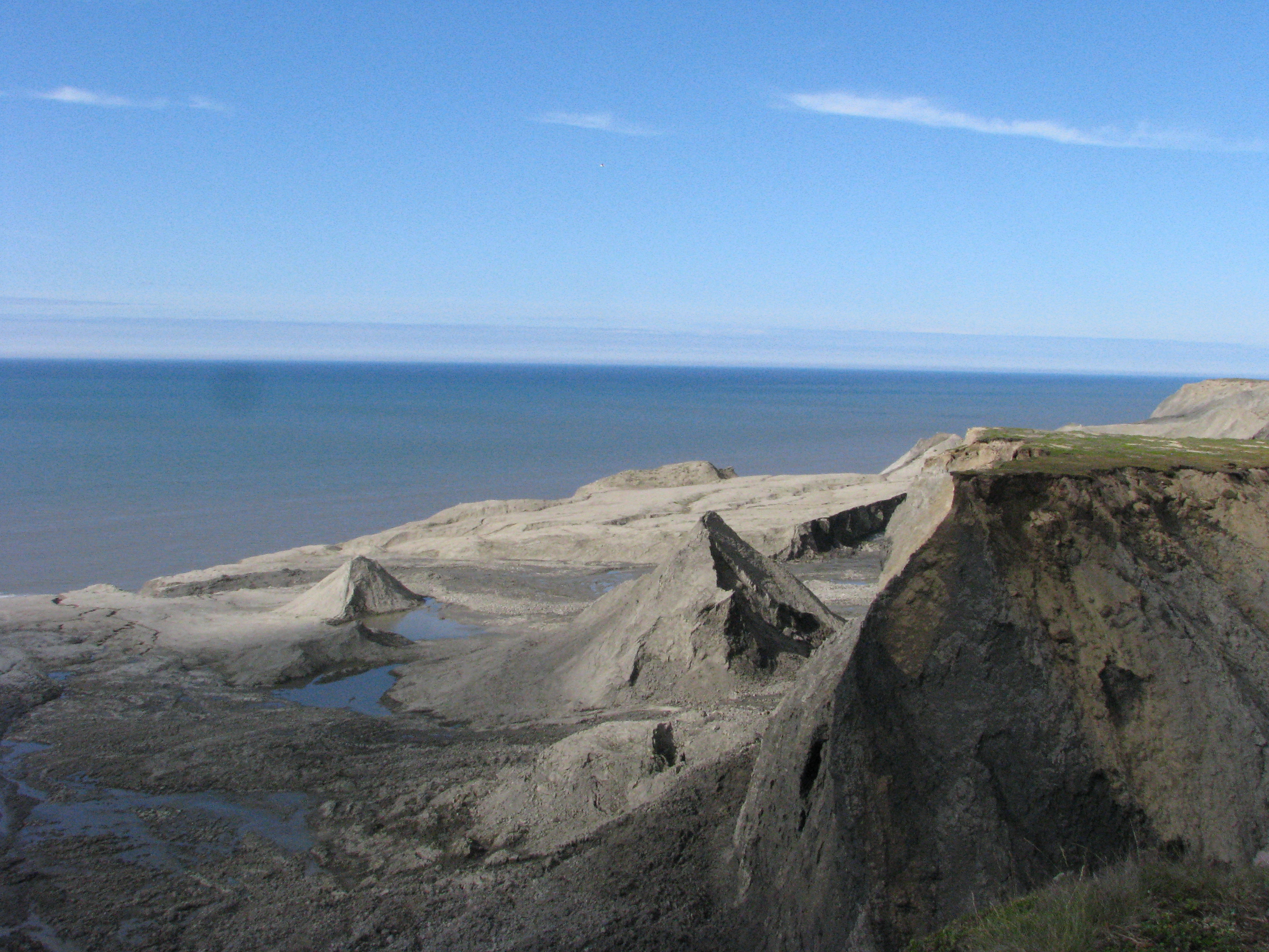
Willem Barentsz, the Dutch navigator whose name would eventually attach to the sea itself, briefly explored the waters around Kolguyev in August 1594 during his search for a Northeast Passage to Asia. Nearly 250 years later, in 1841, the Russian Academy of Sciences sent an expedition under the botanist Franz Josef Ruprecht and Professor Saweljaw to survey the island's natural history during the short Arctic summer. What they found was a flat, waterlogged landscape of bogs and morainic hills -- the debris of glaciers long retreated -- covered in tundra vegetation. The island's highest point reaches only 166 meters. Beneath the surface, however, the geology holds deeper time: fossils of the temnospondyl amphibian Wetlugasaurus malachovi, dating to the Lower Triassic some 250 million years ago, have been found near borehole Peschanoozerskaya 35.
Oil From the Tundra
Exploration for oil began on Kolguyev in 1980, and the Peschanoozerskoye field was discovered in 1983. ArktikNeft operates the extraction, running 52 wells that produce roughly 100,000 tonnes of crude oil per year. The deposits are of notably high quality with very low sulfur content. All oil is exported to Rotterdam, loaded onto 30,000-tonne tankers five kilometers offshore via a floating siphon pipeline -- a procedure possible only during the summer and autumn shipping season. The workforce operates in shifts of 150 people rotating every 52 days. Until 2002, winter access required a helicopter connection from Arkhangelsk, Murmansk, or Naryan-Mar, while summer transport relied on a steamer from Murmansk. Since late 2002, ArktikNeft has maintained a runway capable of receiving medium-sized aircraft like the Yak-40, An-24, and An-26, serving both the oil operation and the residents of Bugrino.
An Island of Wings and Wind
Kolguyev's climate is classified as tundra (Koppen ET), with an August average temperature of just 8.3 degrees Celsius and February as the coldest month. The island receives 331 millimeters of precipitation annually, most of it falling in summer and autumn. Maritime conditions create a seasonal lag -- the warmest days trail the solstice by weeks. Despite these harsh conditions, Kolguyev supports significant populations of barnacle geese and greater white-fronted geese, earning recognition from BirdLife International as an Important Bird Area. A proposed subspecies of candle larkspur, Delphinium elatum ssp. cryophilum, may be unique to the island, though its distinctness from mainland populations remains disputed. Between the migratory birds overhead, the reindeer herds on the surface, the oil beneath, and the Triassic fossils deeper still, Kolguyev is an island layered in time -- each stratum a different kind of life clinging to the same windswept ground.
From the Air
Located at approximately 69.0N, 49.0E in the southeastern Barents Sea, within Russia's Nenets Autonomous Okrug. The island is roughly circular, 80 km in diameter, and appears as a low, flat landmass from altitude -- easily distinguishable from the surrounding sea. Maximum elevation is only 166 meters. The ArktikNeft airstrip near Bugrino on the southeast coast can receive An-24/An-26 class aircraft. Nearest mainland airports include Naryan-Mar (ULAM) to the southeast and Murmansk (ULMM) far to the west. Weather is frequently overcast with limited visibility; tundra climate with strong maritime influence.