Komsomolsk-on-Amur
The name tells you the story the city's founders wanted told: Komsomolsk, city of the Komsomol — the Communist Youth League whose members arrived on the Amur's banks in 1932 to build a socialist dream from the taiga. Wide tree-lined avenues, modern trams, great factories pressing the Soviet future east across the continent. The monuments are still there, the murals still vivid, the pioneer statues still gesturing toward a hopeful horizon. What the monuments don't mention is that nearly three-quarters of the city's builders were not enthusiastic youth at all. They were prisoners — convicts, Japanese POWs, political dissidents — and nearly a million people passed through the gulag camps here during Stalin's purges. The city of Komsomolsk-on-Amur rests, as it turns out, on top of thousands of unmarked graves.
The City the Party Built
The Amur River here runs broad and cold, a continent-scale waterway that connects the Russian interior to the Sea of Japan. Indigenous peoples had fished and hunted these banks for generations. Settlers from the Perm region followed. But the city as it exists today dates from 1932, when Soviet planners designated this remote stretch of taiga as the site for a model industrial center. The Komsomol volunteers who came were real — their enthusiasm genuine, their sacrifice significant. They worked in brutal conditions and some of them died doing it. But the scale of what was needed quickly overwhelmed what volunteers could provide. The gulag supplied the rest.
Sukhoi Jets from the Taiga
Despite — or because of — its origins, Komsomolsk became one of the Soviet Union's most important industrial cities. Today it is the third-largest city in the Russian Far East, with around 250,000 residents. The Sukhoi Superjet 100 regional jet is manufactured here, at the Komsomolsk-on-Amur Aircraft Plant, which has been building military and civilian aircraft since World War II. The city's strategic significance earned it two airports: civilian Khurba airbase and a separate military facility. This industrial legacy is part of why the city has survived the post-Soviet economic contraction that hollowed out many other Far Eastern settlements. The factories kept running.
Stalin's City on the River
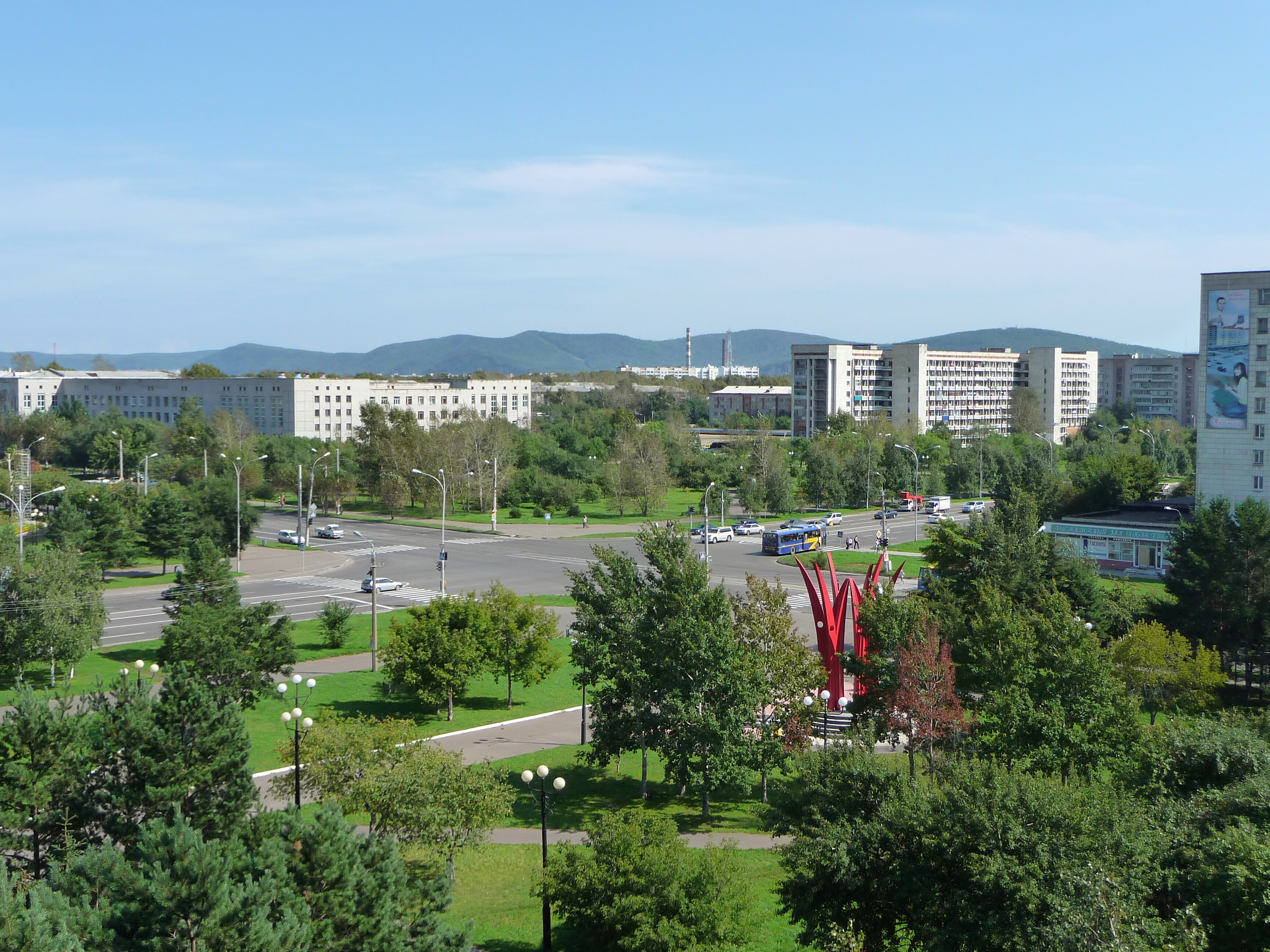
Walking the city's center today, the architectural inheritance of Stalinism is impossible to miss. Buildings in the Stalinist Neo-Renaissance style line the central avenues. Housing blocks carry sculptured and painted murals with Soviet themes — workers, soldiers, cosmonaut-like figures straining upward. On a marble plaza above the river boat terminal stands a War Memorial with seven giant granite heads gazing toward an eternal flame. The River Terminal itself is designed to look like a ship. A monument nearby depicts the original Komsomol pioneers. These are extraordinary objects — earnest, colossal, strange. Whether they commemorate glory or obscure atrocity depends on what you know when you look at them.
The Amur Route
Komsomolsk sits on the Baikal-Amur Mainline, the BAM railway that was itself built largely by gulag labor and completed as a functioning rail link only in the 1990s. The city is a hub in a sparse transportation network: trains run west toward Tynda (about 40 hours) and east toward the Pacific port of Vanino, where ferries cross to Sakhalin. A branch line heads south to Khabarovsk and Vladivostok. In summer, Meteor hydrofoils skim up the Amur from Khabarovsk in six hours — faster than the train. In winter, the river freezes and the boat option disappears. The landscape outside the city is taiga pines in every direction, broken by the vast, slow-moving Amur. It is, in its way, spectacular — provided you have somewhere warm to be.
From the Air
Komsomolsk-on-Amur is located at approximately 50.55°N, 137.00°E in Khabarovsk Krai, Russian Far East, on the left bank of the Amur River. Khurba Airport (UHKK) serves the city. From the air, the city's layout is immediately distinctive: long, wide Soviet-era boulevards extend in a grid from the river front, with the Amur itself curving around the northern edge of the urban area. The surrounding taiga stretches south toward Khabarovsk (roughly 400 kilometers) and east toward Vanino and the Pacific coast. The river is one of the longest in Asia and clearly visible as a geographic anchor from altitude.