Konar Sandal
In 2001, floodwaters along the Halil River near Jiroft exposed something that had been buried for nearly five thousand years. Locals began finding carved chlorite vessels and lapis lazuli objects in the mud, and within months the antiquities market was flooded with artifacts of startling sophistication -- animals entwined with serpents, figures wrestling beasts, geometric patterns of a style no dealer could confidently place. By the time archaeologist Yousef Majidzadeh arrived to lead professional excavations in 2002, looters had already torn through the site. What remained was still extraordinary: two massive mounds, a mudbrick citadel, clay sealings that matched those found at Ur and Jemdet Nasr, and an inscribed brick fragment bearing symbols that nobody has been able to read.
Twin Mounds on the Halil
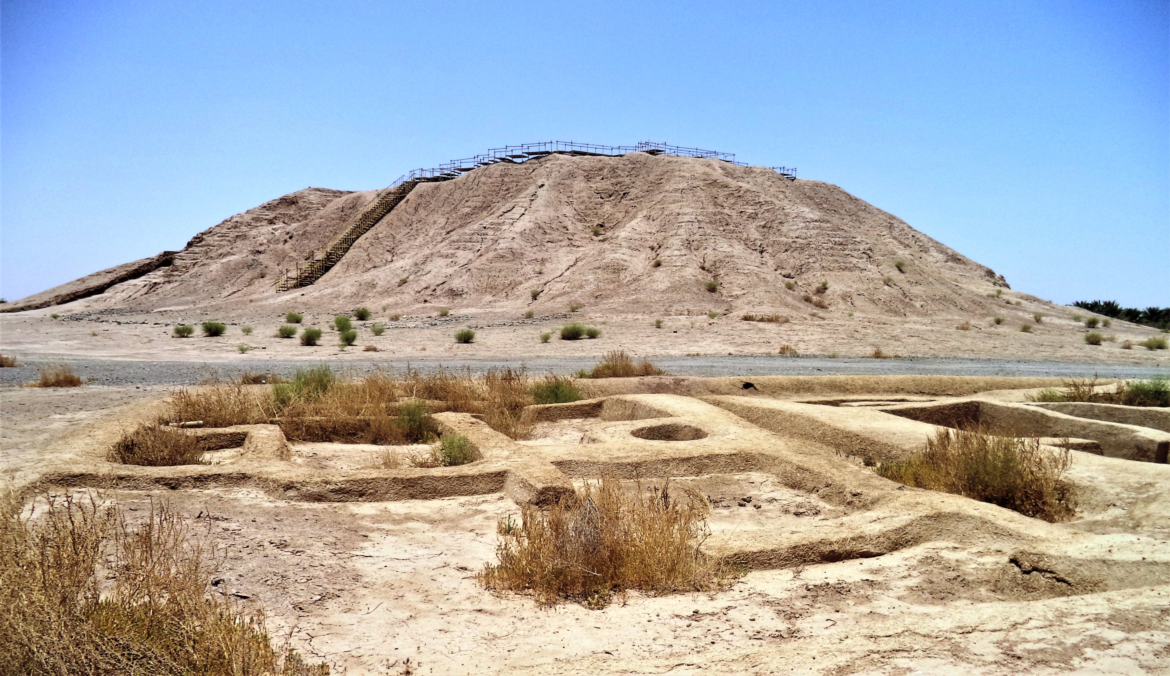
Konar Sandal consists of two mounds a few kilometers apart in the valley of the Halil River, just south of the modern city of Jiroft in Kerman Province. The northern mound stands 13 meters high and covers an area of roughly 300 by 300 meters. The southern mound rises higher, to 21 meters, and contains the more dramatic finds. The British-Hungarian explorer Aurel Stein first visited the site in 1936, and a survey in the 1980s documented numerous smaller mounds in the surrounding area. By the time modern excavations began, palm agriculture had destroyed many of those satellite mounds, and looting had left visible scars across the landscape.
The Citadel and Its Secrets
At Konar Sandal South, excavators uncovered an upper town dominated by what they called a Citadel -- a medium-sized mudbrick structure encircled by a brick wall or platform ten meters wide, punctuated by niches. Radiocarbon dates place its occupation between approximately 2880 and 2200 BC, aligning it with the Early Dynastic through Akkadian Empire periods in Mesopotamia. Sixteen excavation trenches revealed four occupation levels on the upper mound. In the oldest, an administrative building was constructed and later deliberately demolished and infilled before the Citadel rose in its place. A lower town spread around the base, given over to residential and industrial use, though modern agriculture now covers most of it. In Trench XIV, a 'city seal' used to secure a door was recovered -- matching seals found at Jemdet Nasr and Ur, lending weight to the theory that a league of interconnected cities operated across the ancient Near East during the Early Dynastic I period.
Symbols No One Can Read
Near the gateway to the Citadel, a small inscribed brick fragment -- just seven centimeters across -- was found in a secondary context. It may contain five characters of Linear Elamite script, though this remains uncertain. The excavator, Majidzadeh, called other undeciphered symbols found at the site 'geometric script,' and the debate over what they represent has been fierce. Proposals range from decorative patterns to musical notation to a genuinely unknown writing system. The controversy deepened when questions arose about whether some of the inscribed tablets might be modern forgeries -- a suspicion fueled by the massive wave of looting that preceded professional excavation. The journal Science covered the dispute in 2007 under the headline 'Ancient Writing or Modern Fakery?' The question remains unresolved, which only deepens Konar Sandal's allure for scholars and skeptics alike.
A Wider World of Bronze Age Neighbors
Konar Sandal does not stand alone. About 1.4 kilometers to the southeast lies Mahtoutabad, where the 2001 flood exposed a graveyard that was quickly looted before excavations from 2006 to 2009 documented four occupation levels stretching back to around 4100 BC. Uruk-period ceramics, including the distinctive beveled rim bowls, made up 13 percent of the pottery found there. Five kilometers to the southwest, Hajjiabad-Varamin served as an industrial production site from the late fifth to the late third millennium BC. Together with Shahr-e Sukhteh, Shahdad, Tal-i-Iblis, and Tepe Yahya, these sites form the constellation that some scholars call the Jiroft culture -- a proposed Bronze Age civilization positioned between Elam to the west and the Indus Valley to the east. Whether these sites truly represent a unified culture or simply shared trade goods remains debated.
Lost Kingdom or Scholarly Dream
Majidzadeh went further than most, proposing that Konar Sandal might be the remains of Aratta -- a legendary kingdom mentioned in Sumerian literature as a land of fabulous wealth lying beyond the mountains. Other scholars, including Daniel T. Potts and Piotr Steinkeller, have suggested a connection to Marhashi, an obscure city-state that Mesopotamian texts place east of Elam. Oscar Muscarella of the Metropolitan Museum of Art, while acknowledging the site's importance, criticized the excavators for sensationalist announcements and slow publication of scholarly reports. What is not in dispute is the scale of what lies here: French geophysical surveys have identified at least ten distinct archaeological periods in the region, with evidence buried as deep as eleven meters underground. Konar Sandal is not simply a ruin. It is a palimpsest of civilizations, each written over the last, with chapters still waiting to be uncovered.
From the Air
Located at 28.46N, 57.78E in the Halil River valley, Kerman Province, southeastern Iran. The twin mounds are visible as raised formations amid agricultural land south of the city of Jiroft. Nearest airport is Jiroft Airport (OIKJ), approximately 10 km north. Kerman Airport (OIKK) is about 200 km to the north. Best viewed at 2,000-4,000 feet AGL to distinguish the two mound formations. The Halil River runs between the mounds, and the surrounding valley is green with date palm agriculture contrasting sharply with the arid hills beyond.