Kouchibouguac National Park
In Mi'kmaq, the word means "river of the long tides." It is a fitting name for a place where the past never quite recedes. Kouchibouguac National Park stretches across 238 square kilometres of New Brunswick's eastern coast, a tapestry of barrier islands, lagoons, salt marshes, and boreal forest that shelters one of North America's richest coastal ecosystems. But the beauty here carries weight. To create this park in 1969, the Canadian government evicted roughly 1,200 people from seven communities, bulldozing homes and scattering families whose roots ran generations deep. It was the single largest forced removal in the history of the Canadian national park system, and the resistance it provoked changed Parks Canada's rules permanently.
The Dispossession
The seven communities that once stood here bore names like Claire-Fontaine, Guimond Village, and Cap St-Louis. Their residents were mostly Mi'kmaq and Acadian descendants whose ancestors had already survived one great upheaval, the Expulsion of the Acadians in the eighteenth century. They made their living from fishing, hunting, agriculture, and forestry. Government officials looked at their modest circumstances and concluded, with breathtaking paternalism, that these people would benefit from starting their lives over elsewhere. Courses were created to help them lead what bureaucrats called "more productive lives." The residents saw it differently. They shut down the park on several occasions. The most defiant among them was Jackie Vautour, whose home was bulldozed in 1976. Two years later, he returned and squatted on the land until his death on February 7, 2021, becoming a folk hero in the process. His decades-long stand forced a reckoning: Parks Canada ultimately changed its rules so that no one would ever again be forcibly removed to create a national park.
Barrier Islands and Long Dunes
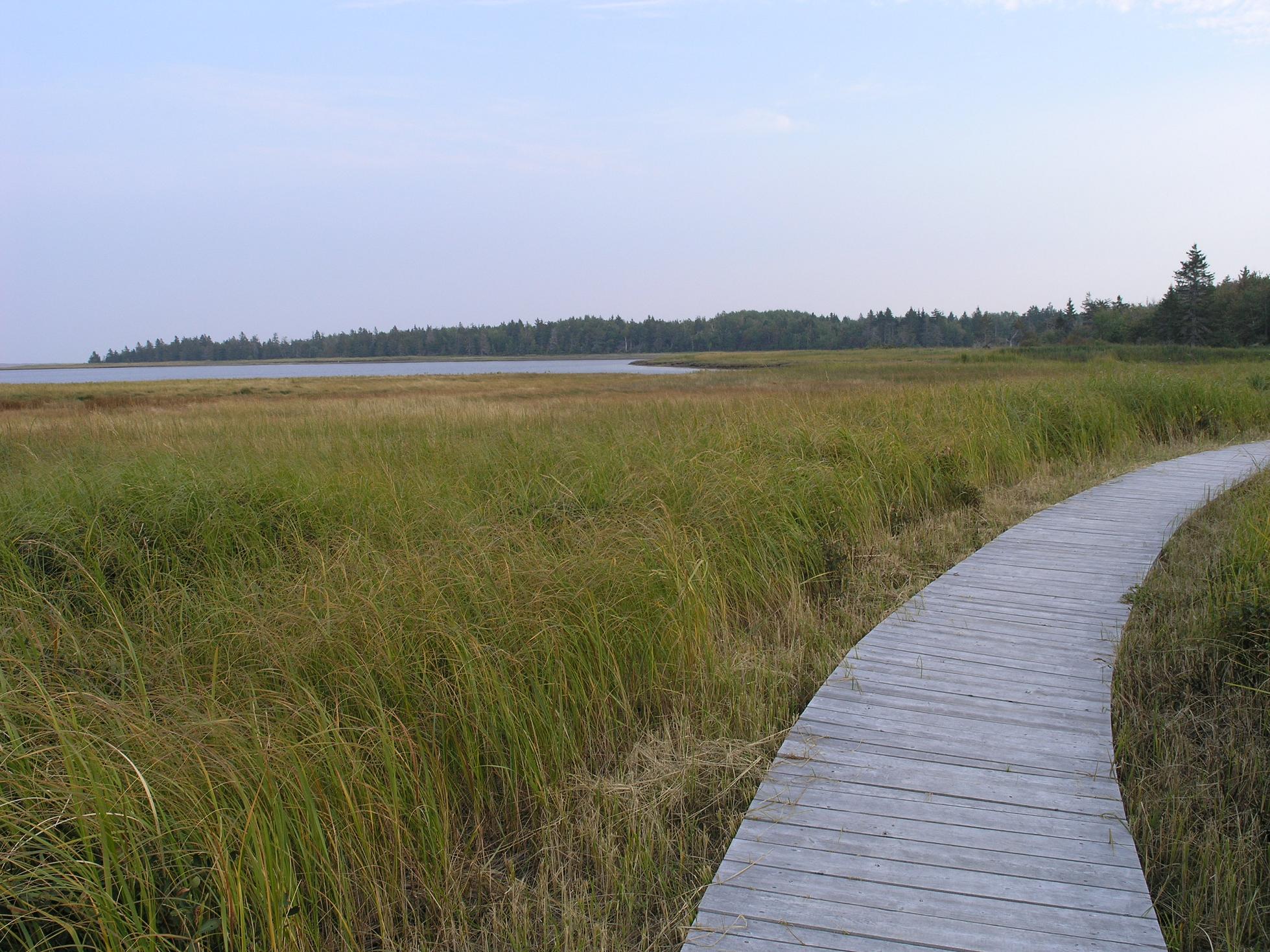
The landscape that provoked such human conflict is genuinely extraordinary. Twenty-five kilometres of sand dunes arc along the coast, forming barrier islands that shelter warm lagoons from the open Northumberland Strait. Kelly's Beach, a long ribbon of sand accessible by boardwalk, is the park's most popular destination, but the quieter stretches are where the ecosystem reveals itself. Harbour seals and grey seals haul out on the barrier islands in colonies visible from shore. The park hosts the second-largest tern colony in North America, and its beaches provide critical nesting habitat for the endangered piping plover. Inland, bogs and boreal forest harbor moose, black bear, bobcat, and seven species of bats. The extremely rare Gulf of St. Lawrence aster once flourished here, though storms in 2006 devastated most of its colonies.
Rivers Through the Dark
Six rivers and creeks thread through the park, including the Kouchibouguac, the Kouchibouguacis, and the Black River, each carrying fresh water through forest corridors to the coast. River otters, beavers, and muskrats work these waterways. Brook trout draw anglers to the deeper pools. In 2009, the park earned designation as a Dark-sky Preserve, an acknowledgment that its remoteness from urban light pollution makes it one of the finest places in eastern Canada for stargazing. The designation also protects nocturnal habitats for the park's wildlife, from the bats that hunt above the rivers to the owls that patrol the forest edge. On clear nights, the Milky Way arches over the dunes with a brilliance that most of the continent has lost to artificial light.
Reckoning and Reconciliation
The pain of the expropriation has not faded with time. A permanent exhibit at the park's Visitor Centre tells the story of the displaced communities, and a website hosts twenty-six video portraits of people who were removed from their land. Many Acadian residents wanted the park named Claire-Fontaine, after one of their destroyed communities, rather than the Mi'kmaq name that was chosen instead. The tension in that naming dispute captures something essential about this place: it sits at the intersection of Indigenous, Acadian, and English histories, each with legitimate claims and grievances. The park's current management plan, updated in 2021, commits to co-management with Mi'kmaq partners and ongoing engagement with descendants of the expropriated residents. Over thirty Indigenous and four non-Indigenous archaeological sites within the park are now under active cultural resource management, an effort to honor what was here long before the boundaries were drawn.
A Coast Under Pressure
Climate change presses on Kouchibouguac with particular urgency. Sea level rise and intensifying storms erode the barrier islands and dunes that define the park's character. The very features that made this coastline worth protecting are the ones most vulnerable to a warming world. Invasive species, both terrestrial and marine, add biological pressure. The park's management plan looks ahead to 2071 with strategies organized around resilience, community engagement, and year-round visitor experience. Winter programming is expanding, turning what was once a seasonal destination into something that draws people through the cold months too. But the fundamental tension remains: how to welcome visitors while safeguarding an ecosystem that is both fragile and irreplaceable, on land that was taken from people who never stopped remembering what they lost.
From the Air
Located at 46.85N, 64.97W on New Brunswick's eastern coast along the Northumberland Strait. From the air, the long barrier islands and lagoons are clearly visible, with Kelly's Beach forming a distinctive sand ribbon. Nearest airport is Greater Moncton Romeo LeBlanc International (CYQM), approximately 100 km southwest. Chatham Airport (CYCH) is about 60 km north. Best viewed at 3,000-5,000 feet to appreciate the barrier island system and the contrast between coastal dunes and inland forest.