Kozmodemyansk
The Mari people called it Tsikma -- the Palisade. Long before any Russian fortress stood here, a wooden Mari stronghold controlled the strategic confluence where the Vetluga River empties into the Volga, a point that mattered enormously to traders moving goods between the northern forests and the markets of Volga Bulgaria. Then came the Mongols, then centuries of shifting power, and finally, in 1583, Ivan the Terrible planted a frontier fortress on the spot and named it after Saints Cosmas and Damian. The Russian name stuck. But the Mari never entirely left.
A Fortress Named for Healers
Ivan founded Kozmodemyansk in the aftermath of his conquest of Kazan in 1552 and the grueling Cheremis Wars that followed in 1553-1557, 1582, and 1592. The fortress was an instrument of control -- a garrison of streltsy soldiers marking the new eastern boundary of the Grand Duchy of Moscow. For years, the fortress was essentially the only building in the area. Saints Cosmas and Damian, the patron healers from whom the town takes its name, offered an oddly gentle dedication for what was fundamentally a military outpost imposed on indigenous territory. Commerce along the Volga gradually drew a town into existence around the walls, but the surrounding region remained overwhelmingly populated by the Mari people, whose culture persisted in the forests and villages beyond the Russian settlement.
The Overnight Stop
By the 19th century, Kozmodemyansk had evolved from garrison to trading hub, eclipsing its Volga neighbors Vasilsursk and Cheboksary in commercial importance. Its great asset was geography: the town sat almost precisely halfway between Nizhny Novgorod and Kazan, making it the natural overnight stop for Volga River steamers. Summer brought the town to life. A fair specializing in wooden and wicker goods produced by local Mari craftsmen drew traders from across the region. The river was the town's lifeblood, and when winter froze the Volga solid, Kozmodemyansk effectively hibernated. The 1913 imperial census counted 5,500 inhabitants, of whom 97.5 percent were classified as Russians -- a statistic that obscured the deep Mari presence in the surrounding countryside.
The Question of Belonging
In 1918, as the old empire collapsed, a genuinely difficult question arose: to whom did Kozmodemyansk belong? The Idel-Ural Movement, which sought self-determination for the Volga-Ural peoples, triggered a dispute between Mari and Chuvash representatives over whether the town should join a proposed Mariland or Chuvashia. Surviving documents from a May 15, 1917 meeting of minority peoples suggest the Volga itself was to serve as the border, with cultural autonomy granted to the Hill Mari minority on the Chuvash side. The dispute was never cleanly resolved -- Soviet administrative structures overtook ethnic self-determination. Today Kozmodemyansk sits in the Mari El Republic, serving as the administrative center of Gornomariysky District while technically remaining separate from it.
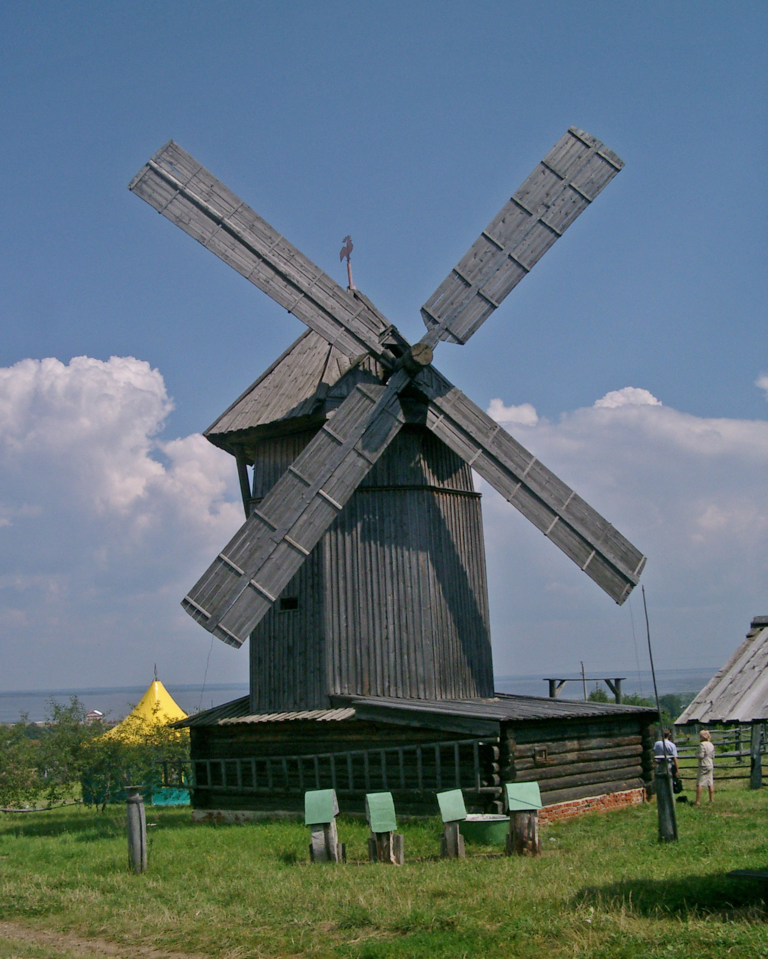
Museums Where Windmills Stand
Modern Kozmodemyansk has turned its layered identity into a cultural asset. An art museum opened in 1919, founded by the Mari artist Alexander Grigoriev, now holds works by prominent Russian and Mari painters. A regional museum dedicated to preserving Mari cultural artifacts followed in 1979. Most striking is the open-air ethnographic museum established in 1983, where more than 60 buildings typical of Mari and Russian vernacular architecture are arrayed across the grounds. Over 2,000 exhibits of artisan craft and tools fill the structures, and even the fences display characteristic Mari designs. It is a town that spent centuries as a Russian fortress on Mari land, and has found a way to honor both halves of that inheritance.
From the Air
Located at 56.34N, 46.56E at the confluence of the Vetluga and Volga rivers in the Mari El Republic. The town occupies high ground on the right bank of the Volga, with the Vetluga joining from the north. The river confluence is the key visual landmark -- two major waterways meeting at the town's doorstep. Nearest airports: Yoshkar-Ola (UWKJ) approximately 100 km east, Cheboksary (UWKS) approximately 70 km southeast. Best viewed at 3,000-5,000 feet AGL, where the river junction and compact town layout are clearly visible. The open-air ethnographic museum with its windmill and traditional buildings may be visible on the town's outskirts.