Krishna River
Five rivers emerge from the ancient temple at Old Mahabaleshwar, but only one of them crosses an entire subcontinent. The Krishna begins its 1,400-kilometer journey from a spout in the Mahadeo temple, at 1,300 meters elevation in the Western Ghats, then drops through forested gorges and spills eastward across the vast Deccan Plateau. By the time it reaches the Bay of Bengal, it has watered the fields of four Indian states, powered some of the country's largest hydroelectric dams, and flowed past temples so sacred that Hindus believe bathing in its waters washes away a lifetime of sins.
A River That Feeds a Nation
The Krishna is India's third-longest river after the Ganga and Godavari, and the scale of its basin is staggering. Covering nearly eight percent of India's total land area, the Krishna Basin sprawls across Maharashtra, Karnataka, Telangana, and Andhra Pradesh. Its delta with the Godavari has earned the name "Rice Granary of India" for good reason: the cultivable land within the basin accounts for more than ten percent of all farmland in the country. Thirteen major tributaries feed into the Krishna along its course, including the Tungabhadra, the Bhima, and the Koyna. The river's waters are so intensively used for agriculture and power generation that in most years, little or no water actually reaches the sea -- a fact that has pushed its estuary ecosystem to the brink.
Sacred Waters, Ancient Stones
At Wai, the first holy town on the Krishna's course, seven stone ghats step down to the water. The Mahaganpati Mandir and Kashivishweshwar temple draw pilgrims who come to pray where the river is still young and clear. Farther downstream, at Kudala Sangama in Karnataka, the Krishna meets the Malaprabha at the site where Basavanna, the twelfth-century founder of the Lingayat tradition, is believed to have reached spiritual liberation. The Mallikarjuna Jyotirlinga at Srisailam, one of Hinduism's twelve most sacred Shiva shrines, sits on a hilltop above the river's gorge. Every twelve years, the Krishna Pushkaram fair draws millions to the riverbanks, and at Bhilawadi in Maharashtra, a stone ghat and temple built in 1779 stand partly submerged in the current -- architecture designed to coexist with the river's moods.
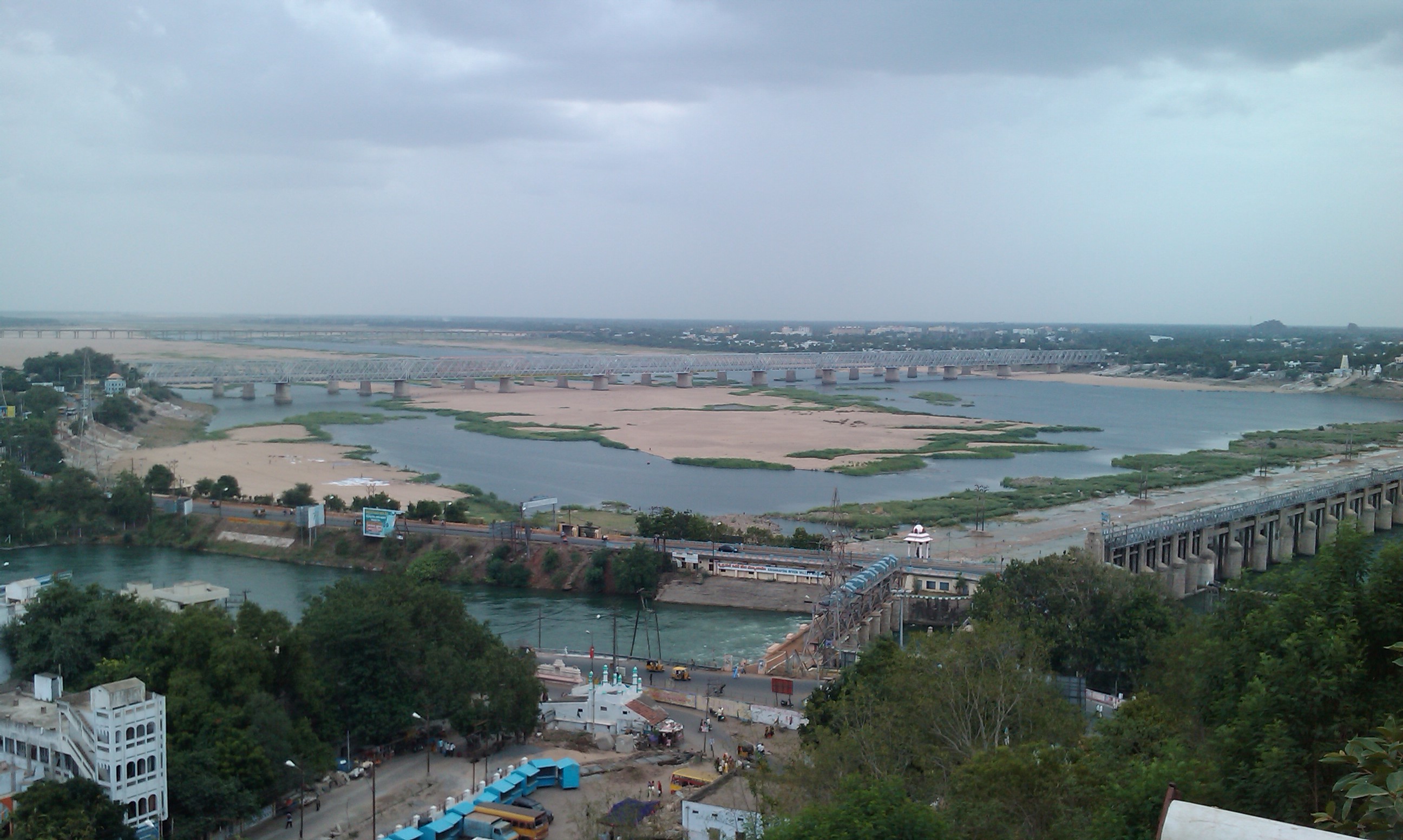
Dams, Disputes, and a Thirsty Plateau
More than a dozen major dams punctuate the Krishna's course, from the Dhom Dam near its headwaters to the Prakasam Barrage at Vijayawada. The Nagarjuna Sagar Dam, completed in 1967, was one of the earliest large-scale infrastructure projects of independent India and created a reservoir stretching 150 kilometers. But all this engineering has made the Krishna one of the most contested rivers on the subcontinent. The Bachawat Tribunal of 1976 attempted to divide its waters among the riparian states, and successive legal challenges have kept the dispute alive for decades. Even Tamil Nadu, which the Krishna does not touch, receives its water through the Telugu Ganga canal system. In 2015, engineers linked the Godavari to the Krishna through the Pattiseema lift scheme, acknowledging that demand had long outstripped supply.
When the River Rises
For all the control that dams impose, the Krishna reminds everyone periodically who is in charge. In October 2009, floods isolated 350 villages and submerged the entire city of Kurnool for three days -- the worst inundation in an estimated thousand years. The pattern repeated in September 2024 when Vijayawada experienced severe flooding after all 70 gates of the Prakasam Barrage were opened simultaneously, discharging water at the highest rate in the barrage's 70-year history. At least 35 people died and some 270,000 were affected. The Krishna basin population has swelled to 80 million, and urban waste pours into a river already stressed by alkaline runoff from coal-fired power stations and the basalt geology it drains. The last surviving mangrove forests in the Krishna estuary, now designated the Krishna Wildlife Sanctuary, shelter fishing cats, estuarine crocodiles, and migratory birds -- a fragile remnant of what the delta once was.
Following the River from Above
From the air, the Krishna's story is written in the landscape. Near Mahabaleshwar, the river is invisible -- a thread lost in dense Western Ghats forest. But as it descends onto the plateau, its presence announces itself through vast reservoirs that glint like mirrors in the sun: the turquoise expanse of Almatti, the long arm of Nagarjuna Sagar. The Srisailam gorge, where the river cuts through the Nallamala Hills, is one of the most dramatic river canyons on the subcontinent. At Vijayawada, the Krishna widens and slows, its delta fanning out in a patchwork of rice paddies and irrigation channels before meeting the Bay of Bengal. It is a landscape shaped entirely by water -- by its presence in the monsoon months and by its scarcity the rest of the year.
From the Air
The Krishna River originates near Mahabaleshwar at approximately 17.92N, 73.66E in the Western Ghats. It flows east across the Deccan Plateau through Maharashtra, Karnataka, Telangana, and Andhra Pradesh before emptying into the Bay of Bengal near Hamsaladeevi. Major landmarks visible from altitude include the Almatti Dam reservoir, Nagarjuna Sagar Dam, and the Prakasam Barrage at Vijayawada. Nearest airports include Pune (VAPO), Kolhapur (VAKP), Vijayawada (VOBZ), and Hyderabad (VOHS). Best viewed at 15,000-25,000 feet to trace the river's course across the plateau.