Krokhino, Vologda Oblast
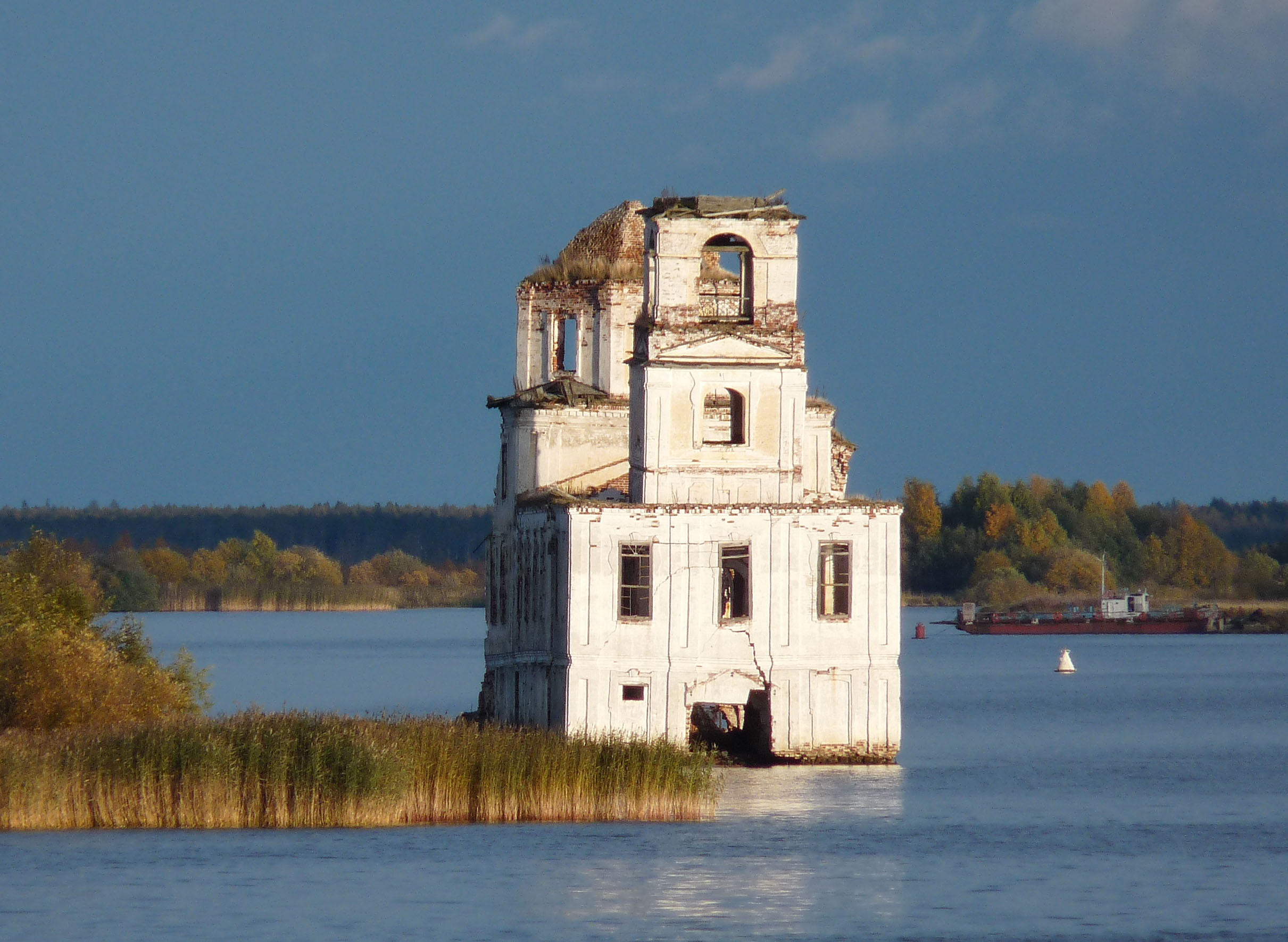
A church stands in the water. Not on an island, not on a pier -- in the water itself, its lower walls submerged, its southern face crumbling faster than its northern one because that is the side the current strikes. The Nativity Church at Krokhino, built around 1790 in the Baroque style, was never meant to be a waterside ruin. It was built on solid ground, in a settlement that had existed since at least 1426. Then, in the early 1960s, the Soviet government raised the water level of Lake Beloye to guarantee depth for ships on the Volga-Baltic Waterway, and Krokhino -- along with its houses, its history, and its people -- went under.
Six Centuries at the Source of the Sheksna
Krokhino first appears in the written record in 1426, in the books of the Kirillo-Belozersky Monastery. It occupied the same ground where the medieval city of Beloozero once stood before relocating 17 kilometers west in 1352. The village was owned by a boyar's son named Gavrila Laptev; when he died without heirs in 1434, the property was donated to the Ferapontov Monastery. For centuries afterward, Krokhino sat at the junction of water and trade. After the Mariinskiy waterway opened in 1810, the settlement became Krokhinskaya Pristan -- Krokhino Wharf -- where cargo was transferred between river barges and lake vessels heading across Lake Beloye. In 1777, Catherine the Great elevated its residents from peasant status to that of city dwellers, and by 1792 Krokhino had its own Town Hall.
The Canal That Passed Them By
Krokhino's first death was economic. In 1846, the Belozersky Canal was built to bypass Lake Beloye entirely, starting 9.5 kilometers below the settlement. The wharf closed. Trade dried up. Local legend holds that the surveyors planning the new channel asked Krokhino's residents for a bribe, and when they refused, the engineers routed the canal away from the town as punishment. Whether or not the story is true, the result was real: by 1865, the settlement had shrunk to 13 stone houses and 179 wooden ones, with residents surviving on fishing, small-scale navigation, and agriculture. Three forges, four pubs, two windmills, and two watermills served a community that had once been a prosperous trading quarter.
The Waters Rise
Krokhino's second death was literal. In the early 1960s, the construction of the deep Volga-Baltic Waterway required raising the water level in Lake Beloye. Krokhino, Kargulino, and other settlements in the Belozersky District fell within the inundation zone. Residents disassembled their wooden houses and carried them to higher ground. What they could not take, they left. The old lock was dropped to the bottom. The waters rose. Only structures built on elevated ground survived, and of those, only the churches had been built to last -- stone buildings on the highest points of a landscape that was vanishing beneath a shallow, muddy lake. The Nativity Church remained above the waterline, but barely. A stone three-altar Baroque building with Nikolskiy and Peter-and-Paul chapels, it now stands half-destroyed, its foundations perpetually submerged.
A Ghost That Refuses to Disappear
Tourist boats on the Sheksna River pass the Nativity Church regularly, and it has become one of the most photographed ruins in Vologda Oblast -- a spectral presence rising from the water where a village used to be. The famed Russian photographer Sergey Prokudin-Gorsky captured the church in 1909, when it still stood on dry land surrounded by a living community. Comparing that image to the present view is a lesson in what infrastructure projects cost when the currency is not just money but memory. In 2009, a project to salvage the church was organized. In 1974, the nearby archaeological site of Old Beloozero, situated on both banks of the Sheksna in the area of the former Krokhino village, was designated an architectural monument of federal significance. The ruins endure as a reminder: the waterway that serves the nation's shipping was built on ground that once held homes, schools, and forges.
From the Air
Located at 60.07N, 38.03E at the source of the Sheksna River where it flows out of Lake Beloye in Vologda Oblast. The ruined Nativity Church is visible as a solitary structure standing in the water, a striking visual feature along the Volga-Baltic Waterway. The lake and river system are prominent from 3,000-6,000 feet. Nearest airports include Cherepovets (ULWC), approximately 120 km to the south. The vast expanse of Lake Beloye and the Sheksna River corridor provide excellent visual navigation references.