Kuressaare Castle
The moat still holds water. The walls still stand. And the bishops who built Kuressaare Castle in the 1380s would recognize its silhouette today, rising from the shores of Saaremaa island as it has for more than six hundred years. This is one of the best-preserved medieval fortresses in the entire Baltic region, a place where the Teutonic Order once imposed Christianity at sword-point, where kings imprisoned their brothers, and where nineteenth-century poverty gave way to twenty-first-century tourism. The castle's survival is remarkable given the violence that has swept across this remote Estonian island, and its story reads like a condensed history of northern Europe itself.
A Fortress for the Faith
When the Teutonic Order began construction of Kuressaare Castle, they were not building for beauty. The people of Saaremaa had resisted Christianization with a ferocity that earned them a reputation as the fiercest defenders of the old ways in the Baltic. The castle rose as a statement of conquered territory, a stronghold for the Bishopric of Osel-Wiek that would anchor crusader control over the island. From its earliest days, it served as the bishop's seat of power, a military installation disguised as architecture. The original fortress may have been wood, but by the late fourteenth century, stone walls began to encircle the complex. A defensive perimeter stretching around the castle was completed by the early fifteenth century. The crusaders built to last, and they built to dominate.
The Tides of Empire
Kuressaare Castle changed hands with the shifting fortunes of Baltic power. In 1559, Denmark-Norway seized control during the dissolution of the Livonian Order, and Danish engineers modernized the fortifications for a new age of gunpowder warfare. The Peace of Bromsebro in 1645 transferred Saaremaa to Sweden, and Swedish military engineers continued improving the defenses until 1706. The renowned fortification expert Erik Dahlbergh designed the Vauban-style bastions and ravelins that still surround the castle today. Then came the Great Northern War, and with it, the Russian Empire. When the Russian garrison abandoned the fortress in 1711, they deliberately blew up much of what they were leaving behind. The castle survived, damaged but unbowed, and the Russians eventually restored portions of what they had destroyed.
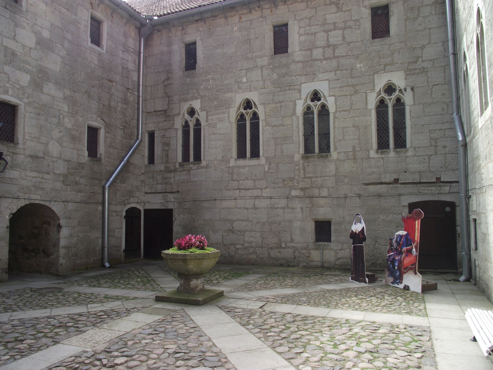
From Poorhouse to Museum
The nineteenth century brought an unlikely chapter in the castle's story. As military significance faded, Kuressaare Castle found a new purpose as a poorhouse, its grand halls echoing with the footsteps of the destitute rather than the armored boots of soldiers. The transformation seems almost cruel, a fortress built to project power reduced to sheltering the powerless. Yet the castle endured this indignity as it had endured everything else. A restoration in 1968 brought the structure back to something approaching its former glory, and today the Saaremaa Museum occupies the ancient halls. Visitors can walk the same corridors where crusader bishops once plotted their campaigns, examine artifacts spanning millennia of Estonian history, and stand on walls that have witnessed the rise and fall of empires.
Stone Testament
What makes Kuressaare Castle remarkable is not just its survival but its completeness. The Gothic architecture remains largely intact, from the original watchtower to the inner courtyard where generations of rulers held court. The star-shaped fortifications designed by Dahlbergh spread outward from the central keep, a textbook example of military engineering from the age of cannon and siege. Of the original medieval structure built by the Teutonic Order, one wall facade still stands, connecting the present to the distant past. Walking through the castle today means walking through layers of history compressed into a single site, each stone carrying the weight of the centuries it has witnessed.
From the Air
Kuressaare Castle sits at 58.25N, 22.48E on the southern coast of Saaremaa, Estonia's largest island in the Baltic Sea. Approach from the east over the Gulf of Riga or from the west across the open Baltic. The castle's distinctive moat and star-shaped fortifications are visible from 2,000-3,000 feet. Kuressaare Airport (EEKE) lies 3 kilometers north of the town center. The island's flat terrain and coastal position make it easy to spot from altitude.