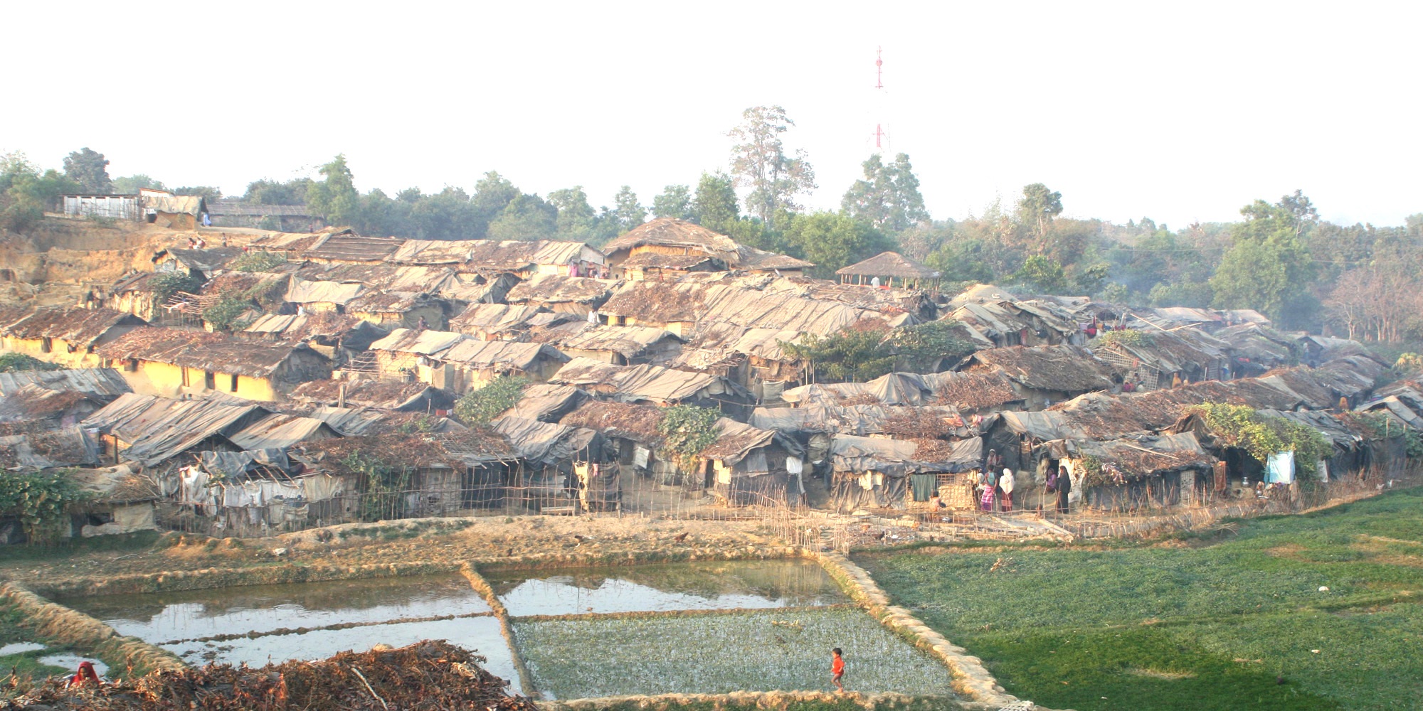
Kutupalong Refugee Camp
From the air, it looks like the hillside is moving. Thousands of bamboo-and-tarpaulin shelters crowd every ridge and gully across what was once forested land near Cox's Bazar, Bangladesh. This is Kutupalong -- the world's largest refugee camp, home to nearly 950,000 Rohingya people as of 2024. The camp did not grow by design. It grew by catastrophe, wave after wave of people fleeing ethnic and religious persecution in neighboring Myanmar, each surge adding new layers of shelters onto slopes already stripped of trees. What began informally in 1991 after the Burmese military's Operation Pyi Thaya -- cynically named "Operation Clean and Beautiful Nation" -- has become a permanent settlement that no one calls permanent, a city-sized humanitarian emergency entering its fourth decade.
The August Surge
For years, Kutupalong and the nearby Nayapara camp held a combined population of roughly 34,000 registered refugees. Then came 25 August 2017. Myanmar's military, joined by local civilians, launched a coordinated campaign of attacks against Rohingya communities in Rakhine State. Hundreds of thousands fled across the border into Bangladesh in what the United Nations would later describe as a textbook example of ethnic cleansing. By September 2017, the UNHCR estimated the two camps' population had surged past 77,000 and was still climbing. Within months, it became the largest refugee settlement on Earth. The speed of the influx overwhelmed every system -- water, sanitation, food distribution, shelter. Refugees built wherever they could, on steep hillsides that would prove disastrous when the monsoon rains arrived, triggering landslides that buried shelters and the families inside them.
A Forest Erased
Kutupalong's expansion came at a staggering environmental cost. By late 2019, more than 8,000 acres of forest had been destroyed -- over 6,000 acres cleared for living space, and nearly 2,000 acres consumed as firewood and building material, primarily bamboo. The ecological losses were estimated at roughly 290 million US dollars. But the consequences went beyond economics. The camps sit on the historical migration routes of critically endangered Asian elephants, and the collision between displaced humans and displaced animals has been lethal. By late 2019, human-elephant conflicts had killed at least 13 Rohingya in the Kutupalong-Balukhali settlement. In response, the UNHCR and the International Union for Conservation of Nature organized hundreds of Rohingya volunteers into Elephant Response Teams -- refugees protecting themselves from animals whose habitat they had been forced to occupy.
Surviving, Not Thriving
In 2019, researchers from the International Food Policy Research Institute surveyed 2,100 refugees and concluded that the Rohingya at Kutupalong were "surviving, not thriving." The food supply met minimum calorie requirements but was monotonous -- rice, lentils, and nutrient-fortified cooking oil distributed to two-thirds of the population, while the remaining third received electronic vouchers for 19 different items. Meat, dairy, fruit, and vegetables were scarce. Mental health was another quiet crisis; a 2013 study of refugees from Kutupalong and Nayapara had already found high rates of depression and PTSD, conditions that the intervening decade of uncertainty and confinement could only have deepened. Authorities restricted refugees' movement outside the camps and their right to work, measures justified as responses to drug trafficking and human smuggling but experienced by the residents as imprisonment. The researchers warned that without improvement, the camps risked becoming sites of "hopelessness, anger or even violence."
Fire, Disease, and Disconnection
Kutupalong's density made it vulnerable to cascading disasters. In May 2020, a fire starting from a gas-cylinder shop destroyed 330 shelters and damaged 300 more. In March 2021, a far worse blaze killed at least 15 people, injured 560, left 400 missing, and displaced over 45,000 refugees. Another fire in March 2023 destroyed more than 2,000 shelters and displaced 12,000. When the COVID-19 pandemic reached the camps in May 2020, the five hospitals serving the population had a combined total of just 340 beds. The Bangladesh government had already imposed an internet communications blackout on the camps in September 2019, reducing cellular service to 2G and banning SIM card sales to Rohingya. Without reliable communication, misinformation spread by word of mouth -- including rumors that health workers were killing patients. People avoided treatment until severely ill, accelerating transmission.
No Way Forward, No Way Back
Bangladesh's government has tried repeatedly to reduce Kutupalong's population. Repatriation to Myanmar failed because refugees refused to return to a country that still denied them citizenship, their land, their property, and their safety. On the second anniversary of the August 2017 attacks, tens of thousands of Rohingya -- some estimates say 100,000 -- gathered in the camps for a mass memorial and protest that caught national authorities off guard. An alternative plan to relocate 100,000 refugees to Bhasan Char, a low-lying silt island 37 miles offshore in the Bay of Bengal, met equal resistance. Refugees feared cyclones, isolation, and effective imprisonment on an island known to flood during storms. International human rights organizations supported their objections. The Rohingya of Kutupalong remain in an impossible position: unwanted where they are, unable to return where they came from, unwilling to accept relocation to a place they consider dangerous. Nearly a million people, stateless and confined, waiting for a resolution that no one is offering.
From the Air
Kutupalong refugee camp (21.21N, 92.16E) is located in Ukhia Upazila, Cox's Bazar District, southeastern Bangladesh, near the Myanmar border. The camp sprawls across deforested hillsides visible from altitude as a dense patchwork of shelters distinct from surrounding vegetation. Nearest airports: Cox's Bazar Airport (VGCB), approximately 30km to the south; Chittagong (Shah Amanat International, VGEG), roughly 150km to the northwest. The Naf River marking the Bangladesh-Myanmar border is visible to the east. The terrain is hilly with the Bay of Bengal coastline to the west.