Kwahu Plateau
Every Easter, the quiet ridgeline towns of the Kwahu Plateau erupt. Paragliders launch from the Odweanoma Mountains near Atibie, riding thermals above a landscape that has quietly shaped Ghana for millennia. The festival, introduced in 2005 and now attracting hundreds of pilots from around the world, is the most visible thing that happens here. But the plateau's real significance runs deeper -- literally. This 260-kilometer spine of uplifted rock forms Ghana's continental divide, the line that decides whether a raindrop flows east into the Volta system or south through the forests to the Atlantic. Stand on the escarpment edge near Mpraeso and you can feel the geography working: the wind shifts, the vegetation changes, and the rivers that begin at your feet set off in opposite directions toward radically different fates.
The Country's Spine
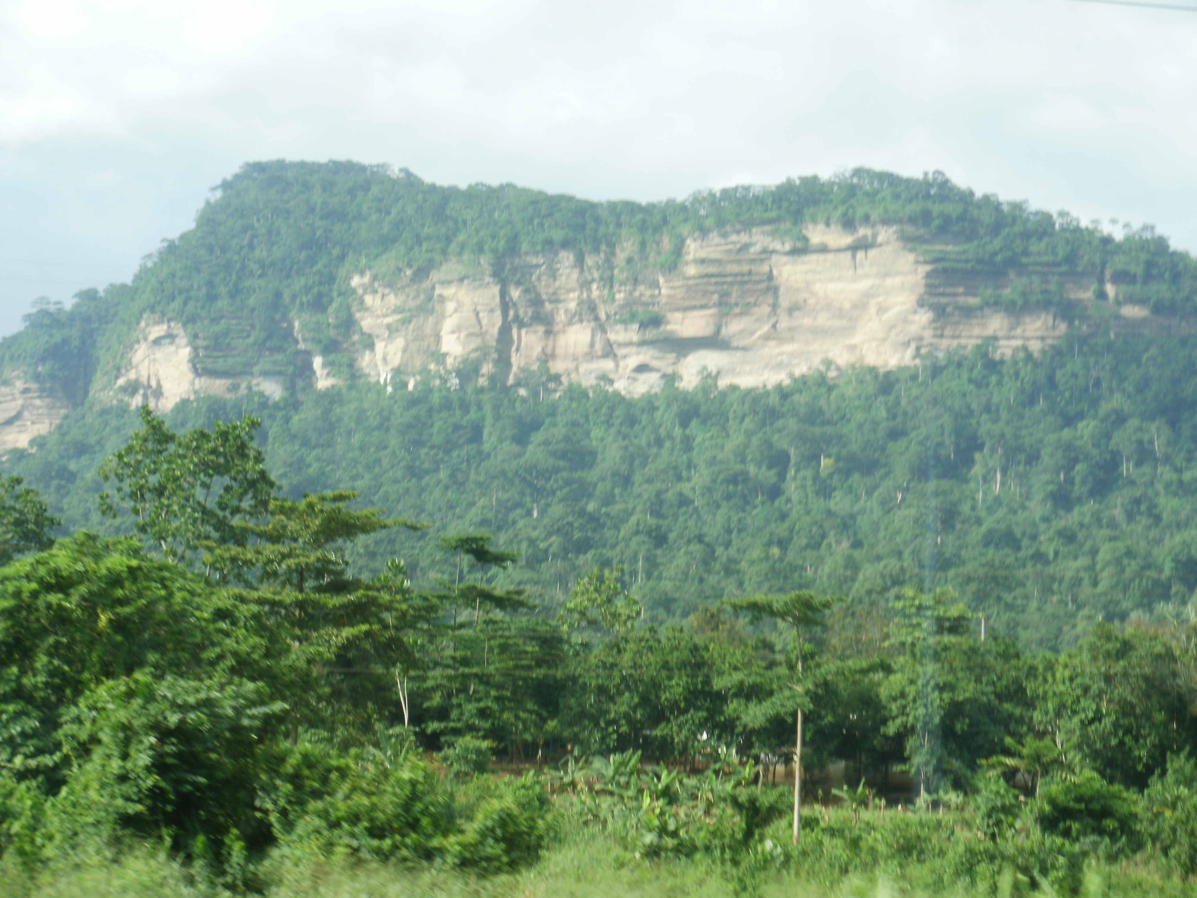
The Kwahu Plateau stretches northwest to southeast from Wenchi to Koforidua, forming the uplifted southern edge of the Volta River Basin. At an average elevation of 460 meters, with its highest point at Mount Akwawa reaching 788 meters, the plateau stands as a bold escarpment above the surrounding lowlands. Erosional scarps border it north and south, and deep valleys dissect its surface into a rumpled topography of peaks and gorges. The plateau is Ghana's principal watershed: rivers born on its western slopes -- the Birim, Pra, and Ankobra -- carve south through dense forest to reach the Atlantic. Those on the eastern side -- the Afram, Pru, and Sene -- drain into the vast Volta basin, eventually reaching Lake Volta, the largest reservoir by surface area in the world. One ridgeline, two entirely different hydrological destinies.
A Shield Against the Desert Wind
To the south of the plateau lies some of Ghana's densest forest. This is not coincidence. The Kwahu escarpment acts as a physical barrier against the harmattan, the dry, dust-laden wind that sweeps southwest from the Sahara between December and March. The harmattan desiccates everything in its path, dropping humidity and coating the landscape in fine Saharan dust. But the plateau breaks the wind's momentum, sheltering the forests on its southern flank. These protected forests have made the region agriculturally rich. Cacao cultivation took hold on the western slopes, where traditional trade routes once carried cocoa and other goods to Atlantic ports. In the eastern sector, vegetable farming dominates, sustained by the cooler temperatures that come with altitude.
Towns on the Edge
The plateau's major settlements -- Wenchi, Mampong, Mpraeso, and Abetifi -- sit along or near the escarpment edge, where the views plunge down to the lowlands below. Abetifi, perched at roughly 600 meters, has long served as a hill station retreat from the tropical heat, its cooler climate drawing missionaries and colonial administrators in the nineteenth century. Near the plateau's eastern edge, Mpraeso marks the headwaters of the Pra River, Ghana's largest south-flowing waterway. These are not large cities, but they carry historical weight disproportionate to their size. The Kwahu people, an Akan group renowned across Ghana as traders and entrepreneurs, have lived on and around this plateau for centuries. Their cultural identity is bound to its geography -- to the cooled air, the forested slopes, the sense of being perched above the ordinary lowland world.
Flight Above the Divide
The Kwahu Easter Paragliding Festival has transformed the plateau from a geographic curiosity into Ghana's biggest annual tourism event. Since its inaugural flight in 2005, the festival has grown into a four-day spectacle held at the summit of the Odweanoma Mountains, attracting seasoned tandem pilots from across the globe. By its twentieth edition in 2025, organizers were targeting 200 paragliders for the event. The thermals are strong here -- warm air rising off the lowlands meets the escarpment face and deflects upward, creating ideal conditions for sustained flight. Participants soar above a patchwork of farmland and forest, the plateau's geology laid bare beneath them. For those few days each April, the plateau becomes exactly what it has always been in geological terms: a place where things rise. The difference is that now, instead of rivers dividing at the ridgeline, it is people launching from it.
From the Air
Located at 6.58N, 0.73W in southern Ghana's Eastern Region. The plateau is a prominent escarpment visible from cruising altitude, stretching 260 km northwest-southeast. Highest point Mount Akwawa at 788 m (2,586 ft). Nearest major airport is Kumasi (DGSI) to the west; Accra International (DGAA) lies roughly 150 km to the southeast. The escarpment edge near Abetifi and Mpraeso offers dramatic visual contrast between the plateau top and lowland forests. Best viewed at 3,000-5,000 ft AGL to appreciate the watershed divide.