La Amistad International Park
The name means "friendship," and it takes two countries to keep this promise. La Amistad International Park straddles the spine of the Cordillera de Talamanca, splitting its vast territory between Costa Rica and Panama in one of the few transboundary World Heritage properties on Earth. At more than 570,000 hectares including its buffer zone, it is the largest protected area in Central America -- a landscape so rugged that significant portions remain unexplored, their rivers unmapped, their species uncatalogued. Between 2003 and 2008, scientific expeditions led by the Natural History Museum in London, Costa Rica's INBio, and the University of Panama ventured into this wilderness and came back with dozens of species new to science. The park does not give up its secrets easily.
Where Continents Collided
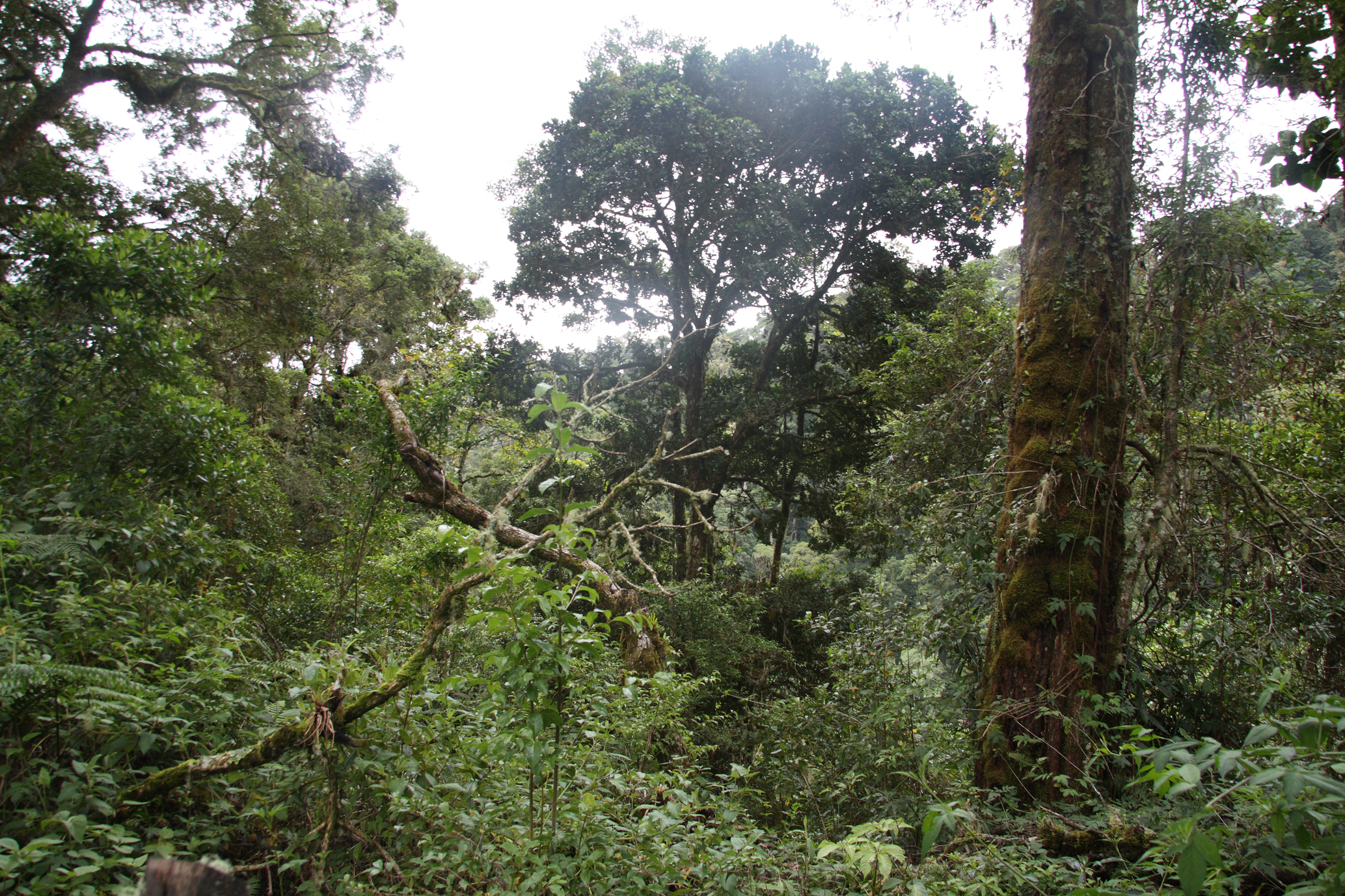
The Talamanca Range is one of the oldest geological formations in the Americas, and its age shows in the complexity of what it supports. From steaming lowland rainforest at a few hundred meters above sea level, the terrain climbs through montane cloud forest -- where oaks and magnolias drip with orchids, bromeliads, and ferns -- to alpine paramo near the summit of Cerro Kamuk, the highest point on the Costa Rican side. These high-altitude grasslands represent the northernmost occurrence of paramo on Earth, an ecosystem more commonly associated with the Andes. Glacial cirques, valleys carved by ice, and highland lakes bear witness to Quaternary glaciation, geological features found nowhere else in Central America. The range itself is estimated to harbor nearly four percent of all terrestrial species on the planet.
A Country on Each Shoulder
La Amistad was declared an international park as a deliberate symbol of cross-border cooperation, and its management reflects that ambition. On the Panamanian side, MiAMBIENTE oversees access through Cerro Punta and Las Nubes in the Chiriqui highlands, where the El Retono Trail winds through cloud forest and lookouts survey the broad valley below. On the Costa Rican side, SINAC manages sectors like Altamira and Biolley, where trails cross oak forests favored by the resplendent quetzal. The park's buffer zone is a patchwork of highland coffee farms, cattle ranches, and indigenous subsistence agriculture -- a working landscape that surrounds the wilderness without quite breaching it. Four indigenous groups live within the park's boundaries: the Bribri, Cabecar, Naso, and Ngobe-Bugle, each maintaining traditional villages and cultural practices that predate the park by centuries.
The Creatures of the Mist
More than 500 bird species have been recorded here, a count that includes the resplendent quetzal, crested eagle, and an array of toucanets and hummingbirds. Jaguars and pumas patrol territories that span the border. Baird's tapir -- Central America's largest native land mammal -- moves through the understory, while howler monkeys and white-faced capuchins occupy the canopy above. Glass frogs, their translucent bellies revealing beating hearts, cling to leaves along stream banks. Endemic salamanders inhabit the cloud forest floor. The park's insect diversity is staggering and still being inventoried: native butterflies, beetles, and colonies of stingless bees are among the species documented so far. Rainfall on the Costa Rican side averages 3,800 millimeters per year across roughly 195 rainy days, and some Panamanian lowland areas receive up to 7,000 millimeters annually. This is a landscape built by water.
Into the Valley of Silence
Reaching La Amistad requires commitment. On the Panamanian side, 4x4 vehicles are often necessary to reach trailheads during the rainy season. On the Costa Rican side, the Sendero Valle del Silencio -- the Valley of Silence Trail -- lives up to its name, threading through forest so dense that sound seems absorbed by the moss and moisture. The Ruta Cerro Kamuk demands a special permit and a certified guide. In Bribri and Cabecar territories, archaeological and cultural sites are accessible only with authorized indigenous guides. The difficulty is the point. This is not a park designed for casual visitors but for those willing to trade comfort for immersion. Horses and mules carry gear into remote sectors where the trails narrow to footpaths and the nearest ranger station communicates by radio because cell signals cannot penetrate the mountains.
From the Air
Centered at approximately 9.40N, 82.94W in the Talamanca Range along the Costa Rica-Panama border. The park spans elevations from lowland forest to peaks above 3,500 meters. Nearest airports include Enrique Malek International Airport (MPDA) near David, Panama, and Juan Santamaria International Airport (MROC) in San Jose, Costa Rica. From the air, look for the dramatic ridge of the Cordillera de Talamanca running southeast, with cloud forest visibly blanketing the upper slopes. Best viewed at 8,000-12,000 feet for the full scale of the range.