La Conner
In early April, the Skagit Valley becomes a patchwork quilt sewn in impossible colors. Tulip fields stretch in geometric blocks of red, yellow, purple, and pink, the blooms so dense and uniform they look artificial from a distance. La Conner sits at the edge of this spectacle, a town of fewer than a thousand residents that swells to gridlock during the annual Tulip Festival. But the tulips are a recent overlay on older identities. La Conner was a fishing and farming community before it became an artist colony, and the creative energy that drew painters here in the 1940s persists in galleries and studios clustered along First Street. The waterfront looks across the Swinomish Channel to the Swinomish Indian Reservation; the rainbow bridge that spans the water has become the town's unofficial symbol. It is a place of layers - agricultural, artistic, indigenous, touristic - compressed into a few walkable blocks.
The Richest Soil
The protected farmland around La Conner is said to be among the most fertile in the world. The Skagit River, which drains more than 3,100 square miles of Cascade slopes, has deposited alluvial soils here for millennia. The result is agricultural land so productive that Skagit County leads Washington in vegetable production. Tulips are the showpiece, but the fields rotate through crops year-round: berries, potatoes, vegetables, seed crops. The drive to La Conner, whether from the north via Burlington or the south via Conway, passes through this working landscape. In spring, the color is overwhelming. But even in other seasons, the scale of the agriculture impresses - flat fields stretching to distant mountains, interrupted only by barns and occasional farmstands.
An Artists' Town
Creativity has flourished in La Conner since the 1940s, when painters discovered the quality of light and the beauty of the surrounding landscape. The Northwest School - Morris Graves, Mark Tobey, Kenneth Callahan, and others - spent time here, drawn by the isolation and the natural beauty. That artistic tradition continues in the galleries and studios along First Street, though the work now ranges from regional landscapes to contemporary abstraction. The Museum of Northwest Art anchors the cultural scene; smaller galleries occupy the historic buildings that line the waterfront. The Skagit County Historical Museum, perched on a hill above town, offers views across the valley and exhibits on local history from Coast Salish culture through the agricultural present.
Waterfront Walking
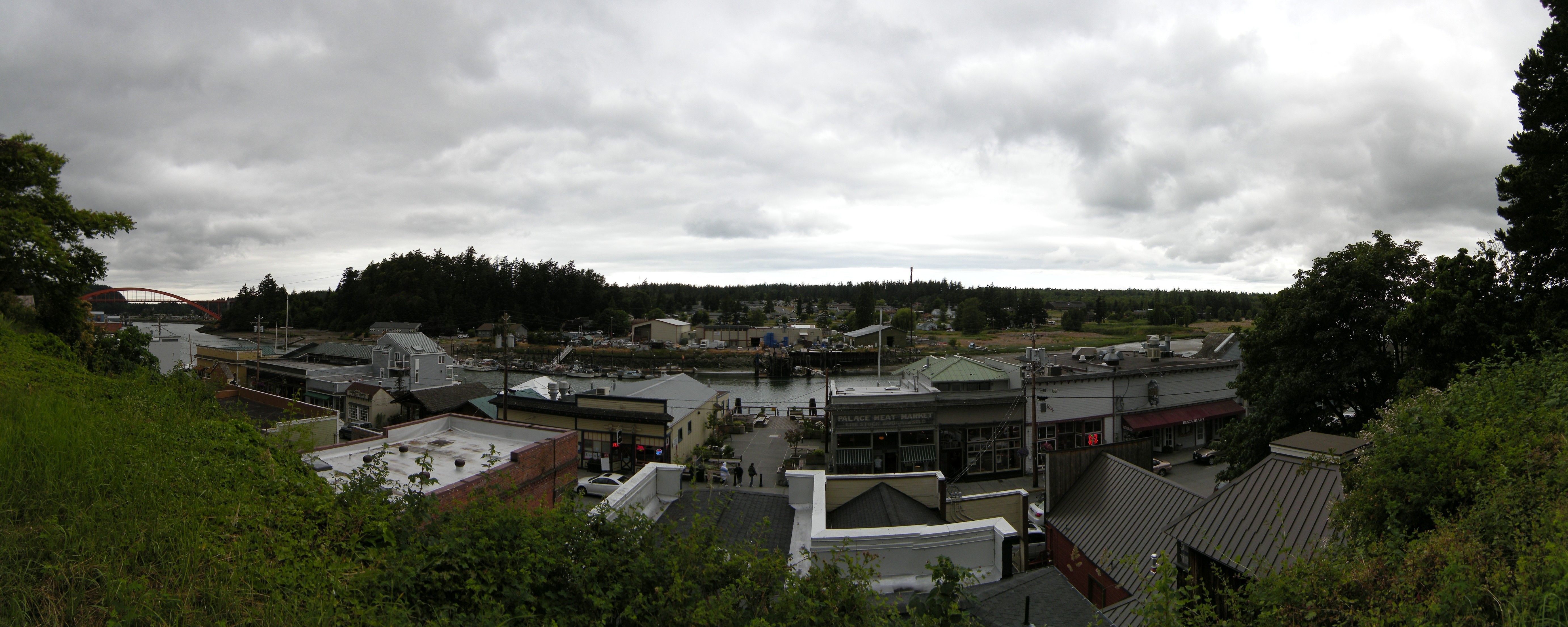
La Conner is best experienced on foot. First Street follows the Swinomish Channel, its wooden sidewalks connecting restaurants, galleries, shops, and the occasional working dock. Morris Street runs the length of town perpendicular to the water, passing more businesses and the post office. The entire downtown fits within a few blocks - you can walk from one end to the other in ten minutes, though the galleries and boutiques encourage lingering. Away from the center, the town thins quickly into farmland. A car is necessary for exploring the valley, but within La Conner itself, walking reveals details that driving misses: the painted doorways, the flower boxes, the views across the channel to the tribal lands beyond.
Beyond the Tulips
The Tulip Festival brings crowds and traffic that can overwhelm La Conner's small streets. Those who come at other times find a quieter town, its rhythms shaped by tides and seasons rather than tourist schedules. Biking is popular - the flat farmland offers easy miles on quiet roads. Boating is possible from the channel, which connects to Puget Sound and the San Juan Islands beyond. Nearby Anacortes serves as the ferry gateway to the islands; Deception Pass State Park offers dramatic coastline and old-growth forest. La Conner sits on the North Cascade Loop, an itinerary that connects the valley to the mountains. The town makes no pretense of being a destination for extended stays - a day or a weekend suffices. But what it offers in that time is concentrated: beauty, art, and the fleeting spectacle of flowers in bloom.
From the Air
Located at 48.39N, 122.50W on the Swinomish Channel, approximately 10nm west of Interstate 5 and 60nm north of Seattle. The town sits at sea level in the flat Skagit River delta, surrounded by agricultural fields. The Rainbow Bridge crossing the channel is a visual landmark. Nearest airports: Skagit Regional (KBVS, 8nm northeast, 5,477 ft paved), Anacortes (74S, 8nm west), Bellingham (KBLI, 25nm north). The terrain is flat; the Cascade foothills rise 15nm to the east. Marine weather dominates: low clouds, fog, and drizzle common, especially in fall and winter. During the April Tulip Festival, expect heavy traffic on surface roads. Mount Baker (10,781 ft) is visible to the northeast on clear days.