La Grande Soufrière
In 1976, Werner Herzog drove through the empty streets of Basse-Terre, Guadeloupe, looking for a single peasant farmer who had refused to evacuate. The volcano looming above the town — La Grande Soufrière, the highest peak in the Lesser Antilles at 1,467 meters — was shaking, venting steam, and terrifying scientists into public disagreement about whether it would blow. Seventy-two thousand people had already fled. Herzog wanted to find the man who stayed behind, and he wanted to film whatever happened next.
A Summit Built by Fire
La Grande Soufrière is a stratovolcano on the island of Basse-Terre, the western half of Guadeloupe's butterfly-shaped landmass. Its current lava dome was emplaced during the last magmatic eruption around 1530, an event violent enough to reshape the mountain's summit. Since then, the volcano has expressed itself through phreatic eruptions — steam-driven explosions caused by groundwater meeting hot rock below the surface. These are less catastrophic than magmatic events but still deadly. On February 8, 1843, a phreatic eruption triggered by an earthquake killed over 5,000 people across Guadeloupe. The mountain's name, drawn from the French word for sulfur, hints at what any visitor notices first: the acrid smell of volcanic gases seeping from fumaroles near the summit, staining the rock yellow and filling the air with the sharp tang of a landscape still very much alive.
The Quarrel That Emptied an Island
When seismic activity intensified in 1976, two prominent French scientists found themselves on opposite sides of a very public argument. Geochemist Claude Allègre urged immediate evacuation, warning that a catastrophic eruption could be imminent. Volcanologist Haroun Tazieff countered that the Soufrière was essentially harmless — steam and noise, but no real danger. The prefect of Guadeloupe sided with caution and ordered the island's 72,000 residents to leave. For months, Basse-Terre sat empty while the scientific community watched and argued. On August 30, 1976, the volcano erupted — but far less violently than Allègre's camp had predicted. No one died. No significant damage occurred beyond the enormous cost of the evacuation itself. The episode became a landmark case study in volcanic risk management, raising questions that volcanologists still debate: How much certainty do you need before you uproot an entire population?
Herzog and the Man on the Mountain
The deserted streets of Basse-Terre proved irresistible to German filmmaker Werner Herzog, who arrived during the evacuation with a small crew and a simple mission: find the peasant who had refused to leave. Herzog's 1977 documentary, La Soufrière, captures the eerie atmosphere of a tropical city abandoned overnight — laundry still on lines, dogs wandering empty markets, the volcano growling above it all. The film is barely thirty minutes long, but it distills something essential about the relationship between people and the volatile landscapes they inhabit. The farmer Herzog sought had his own logic for staying: he had lived on the mountain's slopes his entire life, and he saw no reason to leave now. In the end, the volcano proved him right — though Herzog, characteristically, seemed almost disappointed by the anticlimax.
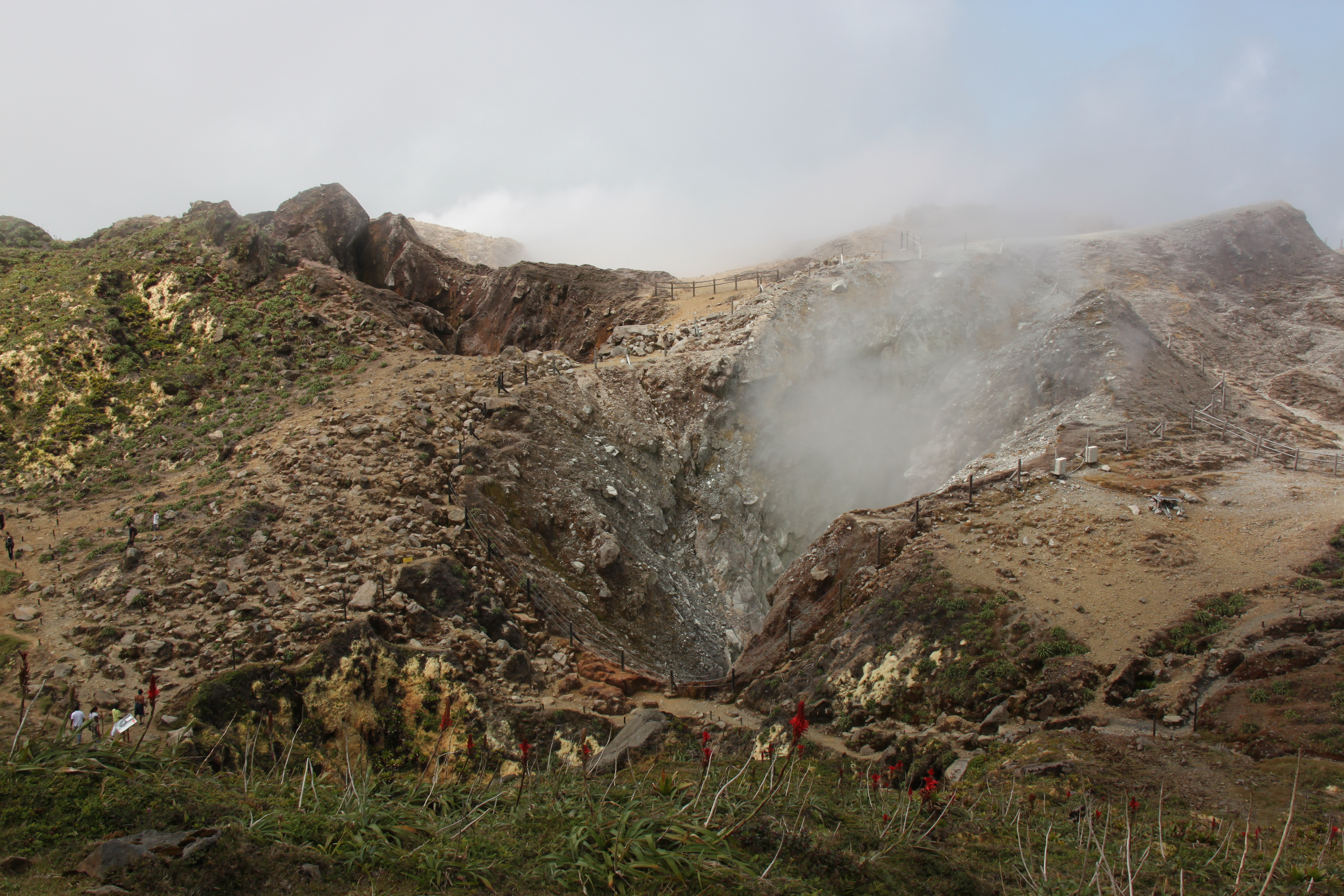
Walking the Sulfur Crown
Today, La Grande Soufrière sits within the Guadeloupe National Park, and a well-maintained trail leads hikers from the trailhead at Bains Jaunes up through tropical rainforest to the summit. The climb takes roughly two hours, passing through a landscape that shifts from dense vegetation to bare volcanic rock as altitude increases. Near the top, fumaroles hiss from crevices, and the Gouffre Tarissan — a deep, acid-filled pit named after a nineteenth-century explorer — drops away into the mountain's interior. On clear days, the summit offers views across Basse-Terre's green ridgelines to the sea, with the islands of Les Saintes and Dominica visible on the horizon. Cloud cover rolls in quickly, however, and the peak spends much of its time wrapped in mist. The Observatoire Volcanologique et Sismologique de Guadeloupe monitors the mountain continuously, tracking every tremor and gas emission from a facility devoted entirely to understanding what this volcano will do next.
From the Air
La Grande Soufrière sits at 16.04°N, 61.66°W on the island of Basse-Terre, Guadeloupe. At 1,467 m (4,813 ft), it is the highest point in the Lesser Antilles and easily visible from altitude. The summit is frequently cloud-covered. Nearest major airport is Pointe-à-Pitre Le Raizet (TFFR). Pilots should maintain safe altitude and be aware of orographic turbulence and rapidly changing mountain weather on approach to Basse-Terre's western coast.