La Malinche National Park
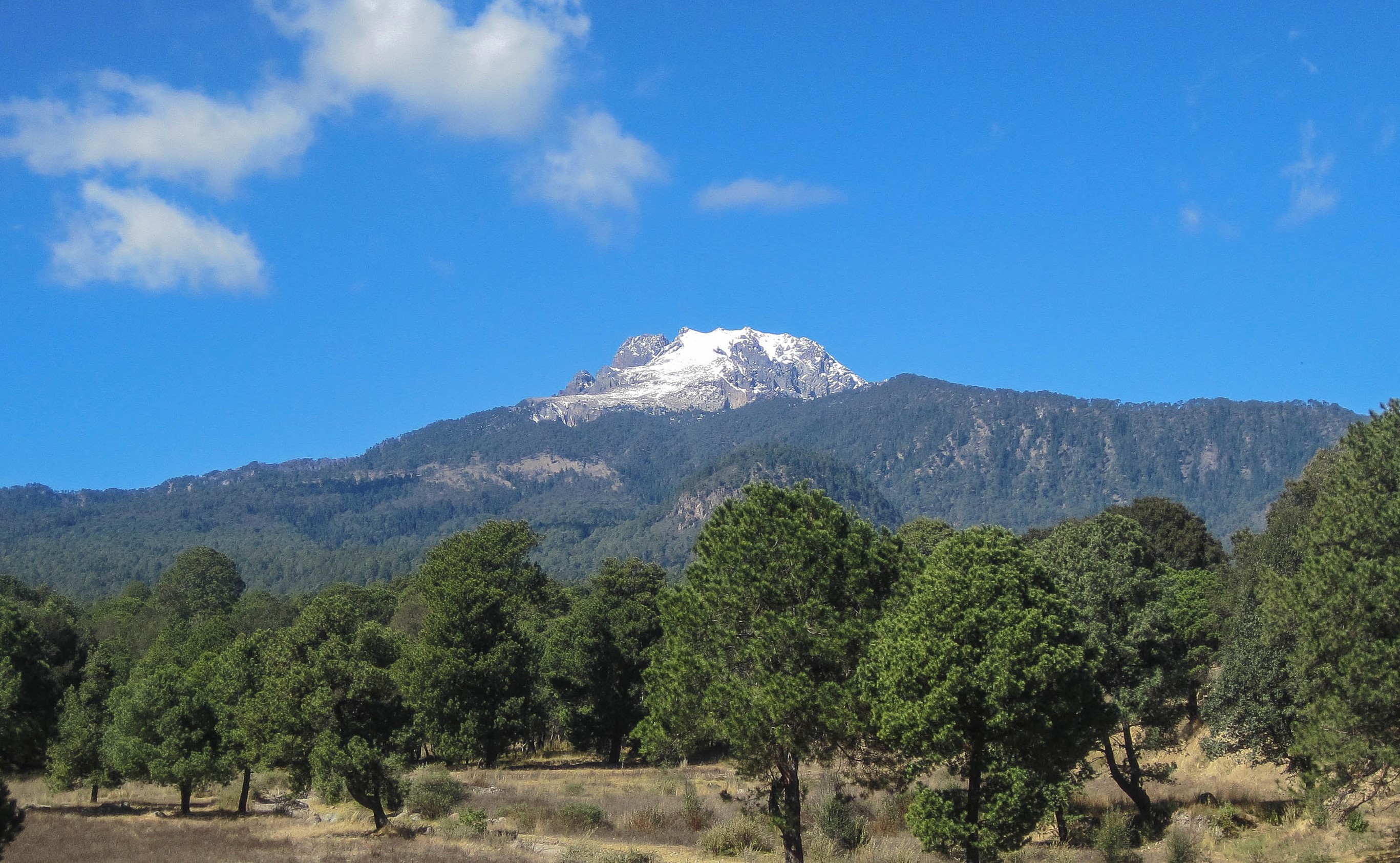
The colectivo marked 'La Malintzi' bounces along a winding road that climbs through dense pine forest, passengers swaying together as the driver navigates switchbacks carved into the volcano's western flank. Outside the windows, the trees thin gradually, revealing glimpses of the valley far below where the colonial city of Puebla spreads across the plateau. At 4,462 meters, La Malinche stands as Mexico's sixth-highest peak, but its accessibility has made it famous for reasons beyond mere altitude. This is where mountaineers come to test themselves, where families escape the heat of the lowlands on weekend camping trips, and where nearly a thousand cataloged species find refuge in one of Central Mexico's largest protected pine forests.
The Training Ground
Serious mountaineers preparing to summit Pico de Orizaba or the challenging faces of Iztaccihuatl often make La Malinche their first proving ground. The volcano's relatively gentle slopes and the paved road that reaches 3,100 meters allow climbers to focus on acclimatization without technical difficulties. From the trailhead, the summit is a demanding but straightforward hike through zones that shift from shaded forest to exposed alpine terrain. Lower elevations offer cool respite under the pine canopy; higher up, the sun beats down on rocky slopes swept by wind. It is here that legs learn the rhythm of high-altitude climbing and lungs adjust to air that holds less oxygen with each ascending meter.
A Forest of Life
The 45,711 hectares protected within La Malinche National Park support an astonishing diversity of life. According to Mexico's CONABIO, scientists have cataloged 920 species within the park's boundaries, including more than 100 mammals, 150 bird species, and numerous amphibians and reptiles. Sixteen of these reptile and amphibian species are found nowhere else except the Trans-Mexican Volcanic Belt that stretches across the country's heart. The park also faces challenges: 40 species are classified as at risk, and 52 non-native species have established themselves in the ecosystem. Conservation efforts continue in a landscape that has been protected since 1938, when La Malinche became a national park.
The Indigenous Name
Long before Spanish conquistadors renamed the volcano after Hernan Cortes's interpreter and consort, the indigenous Nahua people called this peak Matlalcueitl, meaning 'She of the Blue Skirt' in Nahuatl. The name evokes the mountain as she appears from the valleys below, her lower slopes cloaked in the dark blue-green of pine forest that fades to pale rock and snow at the summit. Both names remain in use today, a linguistic layering that mirrors the cultural complexity of Central Mexico. The mountain has witnessed the rise and fall of empires, from the pre-Hispanic civilizations of Tlaxcala to Spanish colonial rule to modern Mexico, standing as a constant landmark visible for many miles in every direction.
Visiting the Park
La Malinche offers few amenities beyond raw natural beauty. There are no stores past the trailhead, no reliable water sources, and visitors must bring everything they need for the day or overnight. The Centro Vacacional IMSS La Malintzi provides the exception: a vacation center with 40 cabins, camping areas, a small shop, and even soccer fields where families gather on weekends. For most visitors, the journey begins in Apizaco, where colectivos depart from the corner of Avenida Hidalgo and Avenida Serdan starting around seven in the morning. The last colectivo descends at five in the afternoon, a schedule that encourages early starts and honest fatigue by day's end.
From the Air
Located at 19.23N, 98.03W in Central Mexico on the border of Tlaxcala and Puebla states. Summit elevation 4,462 meters (14,639 feet). The dormant volcano is prominently visible from aircraft approaching Mexico City from the east. Nearest major airport: Puebla International Airport (MMPB) approximately 50 km to the south. Mexico City International Airport (MMMX) lies about 120 km to the west.