La Push, Washington
The name probably comes from the French La Bouche -- 'the mouth' -- a legacy of shipwrecked French sailors who washed ashore centuries ago and lived with the Quileute people long enough to leave their language behind. La Push sits where the Quillayute River meets the Pacific Ocean on Washington's Olympic Peninsula, and it holds the westernmost ZIP code in the contiguous United States: 98350. It is the de facto capital of the Quileute Indian Reservation, a one-mile-square homeland established by executive order in 1889. And it is a village in the process of moving itself to higher ground, building by building, because the ocean that has sustained its people for thousands of years is now threatening to swallow them.
Whalers, Seal Hunters, and Woolly Dogs
The Quileute people have lived on this coast for millennia, building cedar canoes that ranged from two-person craft to ocean-going freight vessels capable of carrying three tons. They ranked second only to the Makah as whalers and first among all the tribes of the region as seal hunters. They bred a now-extinct variety of woolly-haired dogs, spinning and weaving the hair into warm blankets prized along the entire coast. According to Quileute oral tradition, their only kin, the Chimakum, were separated from them by a great flood that swept the Chimakum to the Quimper Peninsula on the far side of the Olympic Peninsula. The Quileute language itself is an isolate -- unrelated to any root language in the world and one of only five known languages without nasal sounds. Everything about this community speaks to deep, singular roots in a specific place.
A One-Mile-Square Nation
The Quileute signed their first treaty with the United States in 1855, but the territory they called home was so remote that the government's intent to relocate them to a reservation at Taholah was never enforced. For decades, bureaucratic neglect served as a kind of inadvertent protection. Finally, in February 1889, President Grover Cleveland issued an executive order establishing a one-mile-square reservation at La Push. At the time, the town had 252 inhabitants. Later that same year, while villagers were away picking hops in Puyallup, arsonists destroyed La Push. The community rebuilt on the same ground, as it had done before and would do again -- stubbornness being a quality that the Quileute share with the coast itself.
Moving to Higher Ground
In 2017, La Push began doing something most communities only talk about: physically relocating to escape the rising sea. The Move to Higher Ground initiative aims to rebuild the village's critical infrastructure on elevated terrain, out of reach of the tsunamis and flooding that climate change has made increasingly likely. The plan required modifying the boundaries of Olympic National Park -- in 2012, President Obama signed legislation granting the tribe 785 acres of parkland for relocation. The first building moved was the K-12 Quileute Tribal School, which completed its relocation in 2022. It is a practical, unsentimental response to a threat that many coastal communities acknowledge but few have acted on. The Quileute are not waiting for the water.
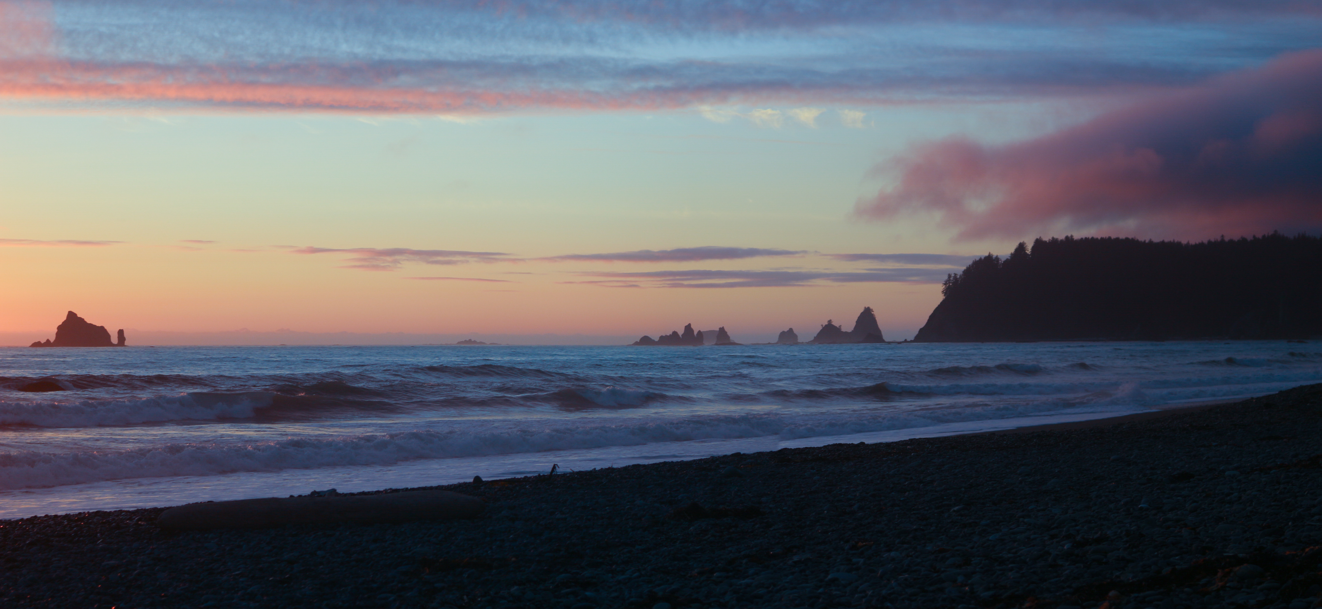
Where the River Meets the Surf
Two beaches frame La Push: Rialto Beach to the north of the river mouth and La Push Beach to the south. The climate is profoundly wet -- an oceanic system moderated by the Pacific, with mild winters for the latitude but enormous rainfall driven against the Olympic Mountain front. Forks, the nearest incorporated city at 14 miles inland, is famous for its rain. La Push receives even more. Today the village operates oceanfront resorts, a seafood company, a fish hatchery, and a marina, all tribally owned. The Pacific Northwest National Scenic Trail passes through on its way to Cape Alava. The Quileute have revived traditional skills and crafts, teaching them alongside the Quileute language in schools. The annual Quileute Days celebration in July draws visitors with salmon bakes, traditional dancing, and a fireworks display over the ocean.
From the Air
La Push is located at 47.91°N, 124.63°W at the mouth of the Quillayute River on Washington's Olympic Peninsula coast. The village and river mouth are visible from moderate altitude, flanked by Rialto Beach to the north and La Push Beach to the south. Nearest airport is Quillayute (KUIL) just 2 nm east. Forks is 14 miles inland. The area frequently experiences low cloud, fog, and heavy rain, especially in fall and winter. Best viewed at 2,000-4,000 ft in clear conditions.