Lachine Canal
The name comes from a dream that never came true. European explorers pushing up the Saint Lawrence River believed a route to China lay just beyond the rapids upstream of Montreal. They called the region La Chine, and the name stuck long after the dream evaporated. What endured was the obstacle itself: the Lachine Rapids, a churning stretch of whitewater that forced every traveler, every fur trader, every barrel of goods onto a grueling eight-mile portage between Montreal's port and the village of Lachine. For over two centuries, people imagined a canal that would cut through the problem. When it finally opened in 1825, the Lachine Canal did not lead to China, but it did something nearly as transformative: it turned Montreal into the dominant port of British North America and birthed the largest industrial corridor in Canada.
Two Centuries of Frustrated Ambition
The idea of a canal to bypass the rapids dates back to Samuel de Champlain. But wanting and building proved very different things. The King of France granted the canal land to the Sulpician Order, who held a monopoly on grain on the island. In 1689, the Sulpicians began the first construction, intending to bring water to their flour mills and improve the flow of goods. An Iroquois attack in August of that year halted the project. A peace treaty in 1701 raised hopes, but the Sulpicians lacked the capital to restart. The canal existed only as an idea for another century. Construction finally commenced on July 17, 1821, under Chief Engineer Thomas Burnett and Construction Engineer John Richardson. The original canal stretched 14.5 kilometres with seven locks. Four years of digging through the island's bedrock produced a passage that officially opened in 1825, and Montreal's destiny as a continental port was sealed.
The Engine Room of a City
The canal's first enlargement in the 1840s, under Chief Engineer Charles Atherton, changed everything. Workers deepened the channel to accommodate heavier ships, and crucially, the project introduced hydraulic power to the industries along the banks. What had been a shipping bypass became an industrial powerhouse. Factories lined the waterway, harnessing the canal's current to drive machinery. Working-class neighborhoods rose from the mud: Griffintown, Saint-Henri, Pointe-Saint-Charles. Montreal's population quadrupled between the mid-1800s and early 1900s. At its zenith from 1880 to 1940, the Lachine Canal Manufacturing Complex was the largest industrial zone in Canada, both in the number of firms and the diversity of their output. Over twenty percent of the Island of Montreal's workforce clocked in at factories along these banks. The five locks that replaced the original seven in 1848, at Lachine, Cote-Saint-Paul, Saint-Gabriel, and the Old Port of Montreal, regulated the flow of commerce and power alike.
A Boon for Montreal, a Blow to the Maritimes
The canal's success reshaped Canadian geography in ways no one fully anticipated. By creating a navigable route past the rapids, it opened the upper Saint Lawrence to shipping and pulled trade away from Quebec City. Montreal became the natural transfer point between ocean vessels and inland craft, concentrating wealth and industry along its waterfront. A second enlargement between 1873 and 1885 lengthened and deepened the locks further, responding to industrialists who demanded more hydraulic power and faster currents. But while the canal proved an enormous boon for Montreal and the Province of Quebec, it delivered a slow economic blow to Canada's Maritime Provinces. As trade routes consolidated around the Saint Lawrence corridor, Atlantic ports lost traffic and influence. The Lachine Canal was, in the words of one historian, the first major nail in the Maritimes' economic coffin.
Silence on the Water
The canal that built Montreal also fell victim to the forces of modernization. The opening of the Saint Lawrence Seaway in 1959 rendered the canal obsolete for large-scale shipping. Traffic dwindled. The lower section was entirely filled in between 1965 and 1967, and commercial navigation ceased altogether in 1970. The neighborhoods that had thrived on canal-side industry crumbled as factories closed and jobs vanished from Le Sud-Ouest. Deindustrialization stripped the banks bare. Many of the brick and stone factories that once thundered with machinery were torn down and replaced by housing. By 1990, there was a growing sense that the area's industrial heritage was being erased. The Historic Sites and Monuments Board responded by designating the Lachine Canal Manufacturing Complex a National Historic Site in 1996, layering that recognition on top of the canal's own National Historic Site status.
A Second Current
Parks Canada took over administration and the canal found a second life. In 2002, the waterway reopened to pleasure craft, and cyclists discovered that the towpaths made for one of North America's finest urban bike routes. Time magazine would name it one of the world's top ten urban cycling trips. The Atwater Market, built as a Depression-era public works project on the site of the old William Rutherford lumberyard, anchors the canal's eastern stretch as a year-round food destination. Condominiums and loft conversions now fill the shells of former factories. In winter, sections of the canal freeze solid enough for skating. The Fur Trade at Lachine National Historic Site sits near the western end, a reminder that commerce along this waterway predates European construction by centuries. The Lachine Canal no longer leads to China, and it no longer powers factories. But its 14.5 kilometres still trace the line where Montreal became Montreal.
From the Air
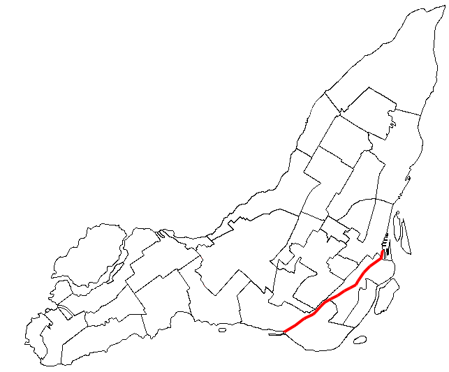
The Lachine Canal stretches from 45.50N, 73.56W (Old Port of Montreal) southwest to 45.43N, 73.67W (Lake Saint-Louis), a 14.5-kilometre ribbon cutting through Montreal's southwestern boroughs. From the air, the canal is clearly visible as a linear water feature running parallel to the Saint Lawrence River, distinguishable by the lock structures at Lachine, Cote-Saint-Paul, Saint-Gabriel, and the Old Port. The Atwater Market building is a useful visual reference near the canal's midpoint. Montreal-Pierre Elliott Trudeau International Airport (CYUL) lies approximately 5 nm to the west. Recommended viewing altitude is 3,000-4,000 feet AGL to appreciate the full length of the canal and its relationship to the surrounding urban fabric.