Lagash
In 2022, archaeologists digging at a site in southern Iraq uncovered a public eatery complete with ovens, a refrigeration system, benches, and stacks of bowls and beakers. The food preparation area had been buried for nearly five thousand years. This was Lagash, a Sumerian city-state that thrived at the junction of the Euphrates and Tigris rivers when much of the world's population still lived in scattered villages. At its peak around 2500 BC, Lagash covered roughly 500 hectares and governed a network of cities, temples, and canals. Its rulers left behind thousands of cuneiform inscriptions, the earliest known depiction of a phalanx in battle, and enough administrative records to reveal what daily life looked like at the very beginning of urban civilization.
A State of Three Cities
Lagash was not a single city but a small state. The political capital sat at modern Al-Hiba, about 22 kilometers east of the town of Al-Shatrah in Iraq's Dhi Qar Governorate. Twenty-five kilometers to the northwest stood Girsu, the religious heart of the state, where the great temple E-ninnu honored the god Ningirsu. A third city, Nina, marked the southern boundary at modern Tell Zurghul. A canal linked all three, connecting the E-ninnu temple at Girsu with the E-sirara temple of Nanshe at Nina and the Bagara temple at Lagash itself. Significant occupation at Al-Hiba began around 2900 BC, in the Early Dynastic I period. By the Early Dynastic III period, around 2500 BC, the city had reached its greatest extent. The site stretches 3.5 kilometers north to south and 1.5 kilometers east to west, though it rises only six meters above the surrounding plain. Much of the oldest occupation lies beneath the modern water table, beyond the reach of excavation.
Kings, Wars, and the Stele of the Vultures
The first ruler of consequence was Ur-Nanshe, who built temples, conquered Umma and Ur, and received timber tribute from Dilmun across the Persian Gulf. His grandson Eannatum transformed Lagash into a regional power. Eannatum's inscriptions claim he destroyed Kish, Akshak, and Mari, killed the king of Akshak, and exacted tribute as far as the middle Euphrates. But it is a long-running border dispute with neighboring Umma over the fertile Gu'edena plain that left the most vivid record. The Stele of the Vultures, carved around 2450 BC, depicts Eannatum dismounting from his chariot to lead his infantry on foot. His soldiers advance in a dense phalanx with lowered spears. This is one of the earliest images of organized military formation in human history. Seven fragments of the stele survive, now in the Louvre, showing both the battle and its divine sanction by Ningirsu.
Gudea and the Golden Aftermath
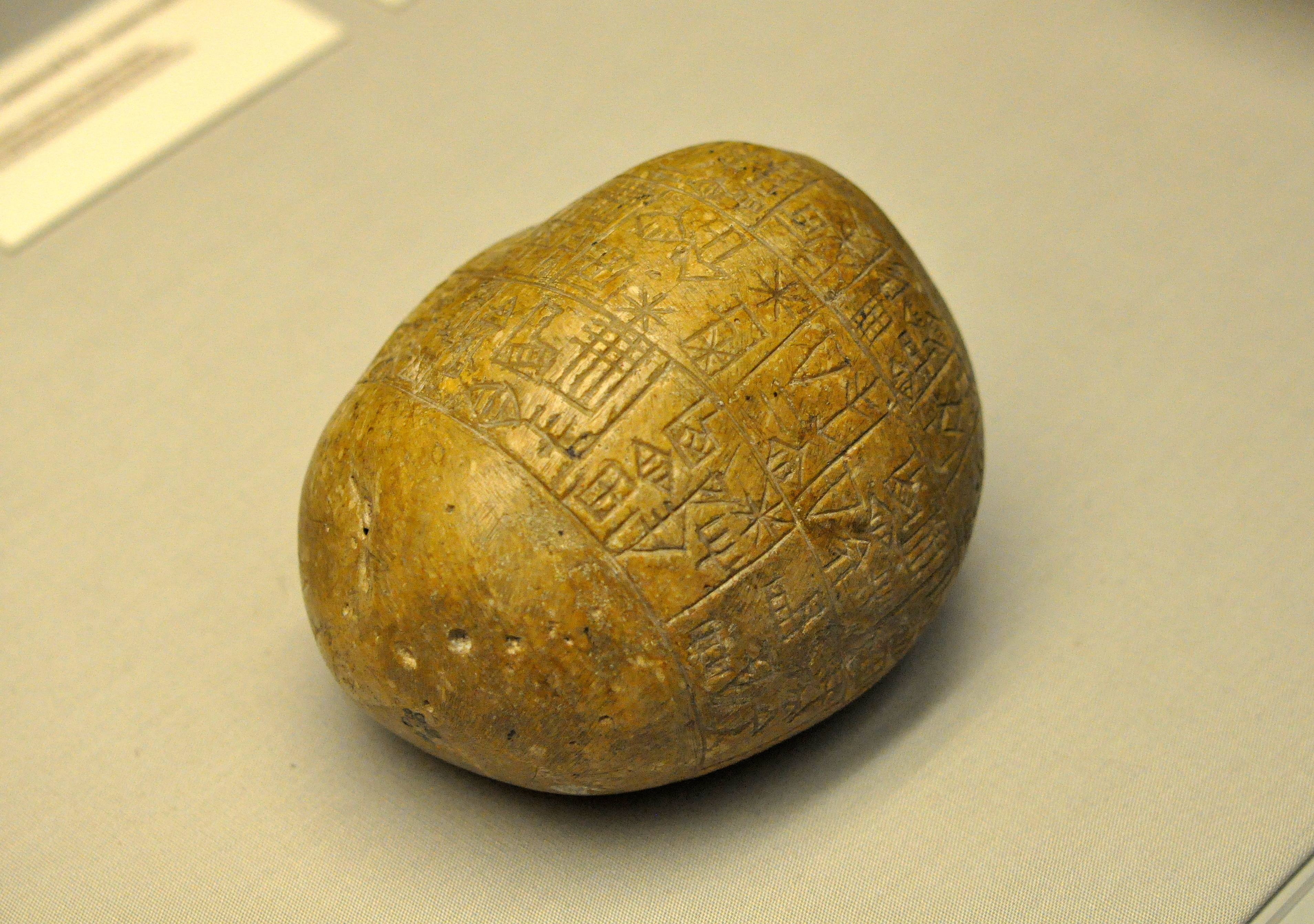
Lagash fell under Akkadian control when Sargon of Akkad swept through Sumer around 2300 BC. His successor Rimush faced revolts and introduced mass slaughter to suppress them, keeping meticulous records of the destruction. After the Akkadian Empire collapsed, Lagash entered a second period of independence under its most famous ruler: Gudea. Governing around 2144 to 2124 BC, Gudea presided over a cultural flourishing. Thousands of his inscriptions survive, along with numerous statues depicting him in a calm, almost meditative pose. The Gudea cylinders, discovered at Girsu, contain the longest known text in the Sumerian language. He built and restored temples throughout the state and conducted military operations against Anshan and Elam to the east. Twenty of Gudea's year names are recorded. All but one celebrate religious achievements; the exception marks the year Anshan was smitten by weapons.
Digging Through the Water Table
Western archaeologists first reached Lagash in 1887, when Robert Koldewey excavated for six weeks. Thorkild Jacobsen and Fuad Safar confirmed the site's identity during a 1953 survey. Between 1968 and 1976, a team from the Metropolitan Museum of Art and New York University conducted five seasons of excavation, uncovering twelve archaeological layers, the bottom nine dating to the Early Dynastic period, with the lowest submerged beneath the water table. The team focused on the Ibgal temple of Inanna and the Bagara temple of Ningirsu. Field work resumed in 2019 under the University of Pennsylvania's Lagash Archaeological Project, in collaboration with Cambridge and the University of Pisa. Drone mapping and satellite imagery revealed that Lagash may have developed across four marsh islands, some of which were gated, though the idea of a marsh-based city remains debated. The 5,000-year-old tavern, with its ovens and stacked dishware, emerged during the 2022 season, a reminder that the ordinary business of eating and drinking predates written history itself.
What Remains in the Dust
After the fall of the Third Dynasty of Ur around 2000 BC, Lagash faded. Some modest occupation continued during the Isin-Larsa and Old Babylonian periods, and a Seleucid fortress was built there in the second century BC. Then the site was abandoned to wind and alluvial dust. Today, the mound sits low on the Iraqi plain, barely distinguishable from the surrounding terrain. But what it yielded to excavation reshaped understanding of early civilization: administrative tablets revealing trade networks that stretched to the Persian Gulf and the Indus Valley, artistic masterworks now in the Louvre and the British Museum, and the evidence that organized warfare, bureaucratic governance, and communal dining all have roots in this unassuming stretch of southern Iraq.
From the Air
Located at approximately 31.41N, 46.41E in Iraq's Dhi Qar Governorate, about 22 km east of Al-Shatrah. The archaeological site appears as a low mound on the alluvial plain, roughly 3.5 km north to south. The nearest significant airport is Nasiriyah Airport (ORNI) to the west. From altitude, the site is difficult to distinguish from surrounding terrain; look for the flat expanse between the Tigris and Euphrates, southeast of the ancient site of Uruk.