Laguna Mountains
Stand on the summit of Cuyapaipe Mountain at 6,378 feet, and the contradiction of this landscape becomes immediate: to the east, the Colorado Desert stretches flat and copper-colored toward the Salton Sea; to the west, green chaparral rolls toward the Pacific. The Laguna Mountains occupy a narrow strip of high country in eastern San Diego County, never more than a few miles wide, yet they mark one of Southern California's sharpest ecological transitions. The Kumeyaay called this place home for thousands of years, moving seasonally between the cool heights and the warm lowlands as resources required.
Sky Island Above the Desert
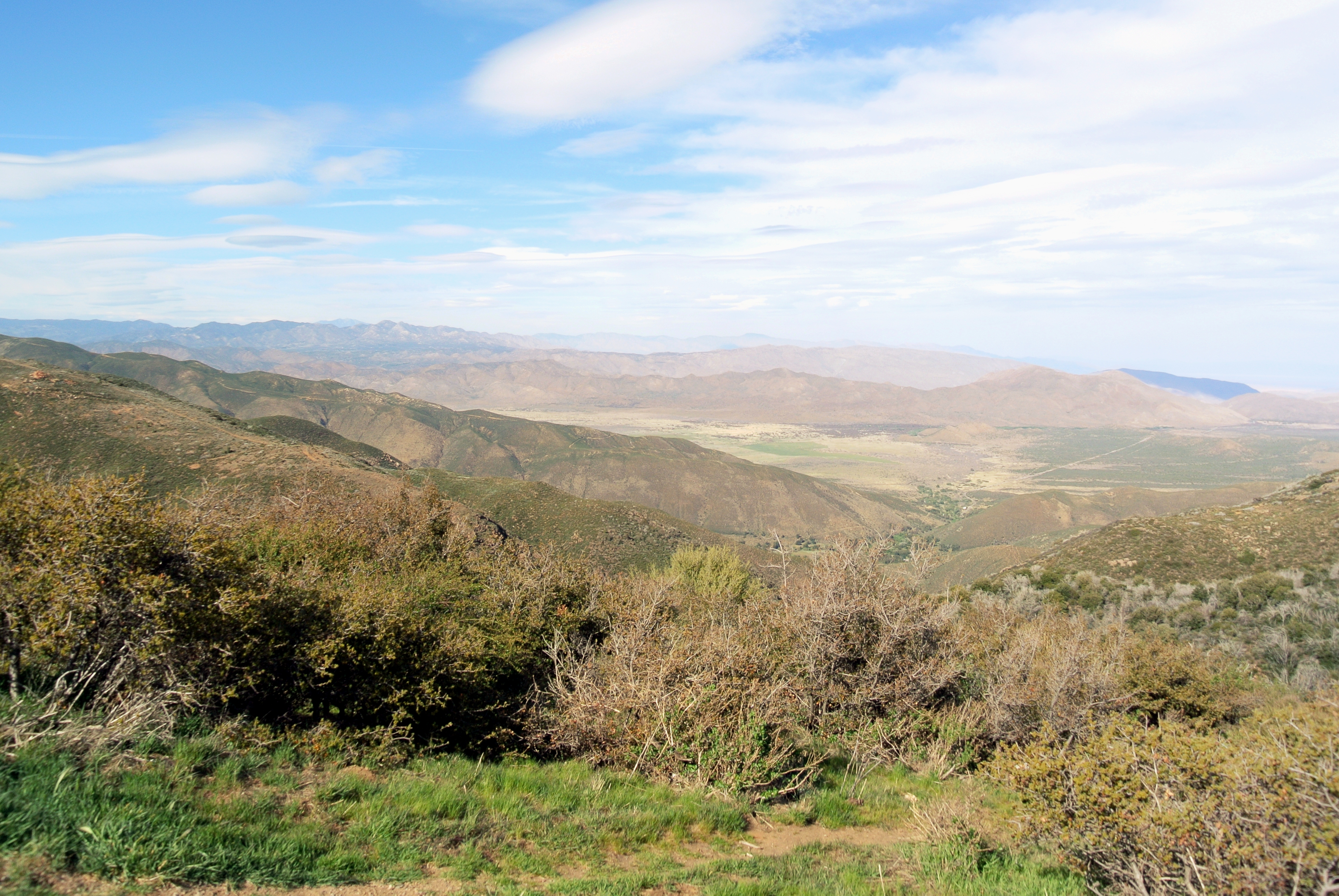
The Lagunas rise from the desert floor with unusual abruptness — the eastern face drops thousands of feet in just a few miles, creating a rain shadow that generates two dramatically different worlds separated by a single ridgeline. West of the crest, marine air delivers enough moisture to sustain oak woodlands, meadows, and the dense chaparral that characterizes coastal Southern California. East of the ridge, the Colorado Desert begins almost immediately, defined by ocotillo, cholla, and the silence of a landscape that receives only inches of rain each year. Cuyapaipe Mountain, at 6,378 feet, marks the high point, though the ridge maintains substantial elevation for much of its length.
The Southernmost Miles of the PCT
The Pacific Crest Trail's southern terminus lies near Campo, and its final miles run across the Laguna crest before descending to the Mexican border. This stretch carries hikers across the highest snowfall zone in San Diego County — the Lagunas can receive significant accumulation in winter, a fact that surprises those who associate the county primarily with beach weather. The trail here follows open meadows and exposed ridgeline, offering views that on clear days extend to the Pacific Ocean, the Coronado Islands to the southwest, and the Salton Sea depression far to the east. This combination of views — ocean and desert from the same ridge — is one of the distinctive experiences the Lagunas offer.
Kumeyaay Homeland
The Laguna Mountains were central to the seasonal round of the Kumeyaay people, the indigenous inhabitants of San Diego County and northern Baja California. The high country provided acorns, game, and relief from summer heat. The springs and seeps along the western slopes supported human habitation at elevations where water was otherwise scarce. The Kumeyaay maintained cultural ties to this landscape through trade, ceremony, and generations of careful resource management — burning chaparral to encourage new growth, tending oak groves, navigating the same passes that would later become emigrant trails. Several Kumeyaay bands retain reservations in and around the Laguna Mountains today.
Fire and Recovery
Chaparral ecosystems are built around fire — the plant communities of the Lagunas have evolved to burn and regenerate, with many species requiring fire to release seeds or clear competing vegetation. The region has seen significant wildfires in the modern era, most dramatically the 2003 Cedar Fire, which burned through much of the area and reshaped the forest mosaic. Recovery follows predictable patterns: first the opportunistic annuals, then the resprouting shrubs, then the slower return of mature oak woodland. What fire takes, the land eventually reclaims, though the timeline spans decades rather than years.
Where the Desert Begins
The eastern scarp of the Lagunas is one of the great visual transitions in California: standing at the overlooks near Mount Laguna village, the ground falls away toward the Anza-Borrego Desert below, the Colorado River somewhere beyond, and Mexico closer than most visitors expect. The Carrizo Badlands stretch to the south, ancient marine sediments exposed by erosion into a landscape of slot canyons and badland formations. The mountains contain this view from above, the last high ground before the desert takes over completely.
From the Air
The Laguna Mountains run roughly north-south along approximately 116.45°W, with Cuyapaipe Mountain at 32.81°N, 116.45°W at 6,378 feet elevation. The abrupt eastern escarpment is clearly visible from the air — the ridge drops sharply toward the Anza-Borrego Desert floor thousands of feet below. The closest airports are Gillespie Field (KSEE) to the west and the Desert Airpark near Borrego Springs (L08) to the east. At cruising altitude, the contrast between the green mountain terrain and the tan desert floor on either side defines the Laguna ridgeline visually.