Lake Abaya
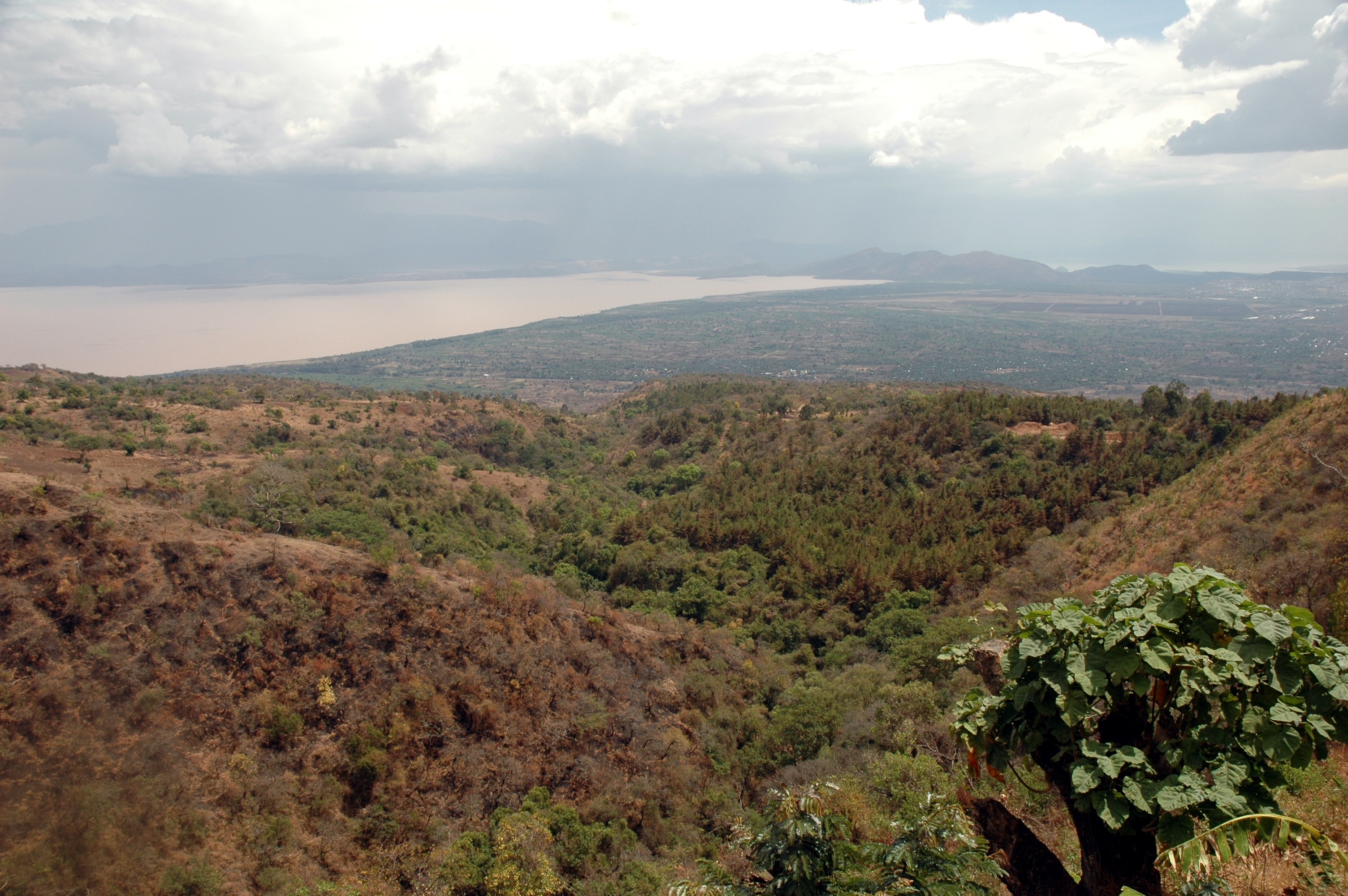
From a Dorze village high in the hills above Arba Minch, Lake Abaya looks like a wound in the landscape. Its water is not the blue or green you expect from a lake. It is reddish-brown, stained the color of laterite clay by the enormous sediment loads carried in by three rivers draining the Ethiopian highlands. At sixty kilometers long and twenty wide, Lake Abaya is the largest lake in the southern rift valley system, and its ruddy surface dominates the view from every high point in the region. To the south, separated by a narrow ridge that locals call the Bridge of God, the bluer waters of Lake Chamo provide a striking contrast. Between them sits Nechisar National Park, but Abaya itself is the quieter, less-visited giant of the pair.
Three Rivers, One Red Lake
Lake Abaya's distinctive color tells the story of its watershed. The Bilate River rises on the southern slopes of Mount Gurage and flows southward to enter the lake at its northern shore, carrying volcanic soils from the highlands. The Gidabo River begins on the western slopes of the Bale Mountains and reaches the lake at its northeastern tip after crossing broad floodplains that add their own sediment burden. The Gelana River takes the most dramatic path, rising at the western escarpment of the Rift Valley and flowing northward through the Gelana Graben, a narrow trough between the Amaro Mountains, before passing through the Bore swamps and draining into the lake's eastern shore. Together, these three rivers deliver a continuous supply of suspended particles that keep the water permanently turbid. The reddish-brown hue is not pollution but geology made visible, the Ethiopian highlands slowly dissolving into their lowest point.
Islands in the Red Water
Several islands rise from Lake Abaya's shallow basin. Aruro, the largest, sits near the center of the lake and supports small communities that fish the surrounding waters. Gidicho, Welege, Galmaka, and Alkali are smaller islands, some inhabited seasonally by fishermen who camp on their shores during productive fishing periods. The lake yields roughly 412 tonnes of fish annually, which the Ethiopian Department of Fisheries and Aquaculture estimates represents sixty-nine percent of its sustainable harvest. Local fishing communities work the lake from simple boats, targeting tilapia and catfish species adapted to the turbid, sediment-rich water. The islands also serve as resting points for migratory and resident waterbirds, and the savanna surrounding the lake supports diverse birdlife alongside larger wildlife drawn to the water's edge.
A Lake That Barely Overflows
Lake Abaya sits at an elevation of roughly 1,175 meters within the Main Ethiopian Rift, east of the Guge Mountains. Despite receiving inflow from three rivers, the lake's only outflow is through the lower reaches of the Kulfo River, which acts as a spillway when the lake level rises above 1,190 meters. In practice, this overflow rarely occurs. Over the past fifty years, the lake level has oscillated only about 1.5 meters above and below its mean, staying well below the overflow threshold. In 2002, the maximum depth was measured at just 13.1 meters. This makes Abaya a broad, shallow basin, more like a flooded plain than a deep lake. The shallowness contributes to its color. Wind-driven waves churn the fine sediments on the lake bed, keeping them perpetually suspended in the water column. The result is a lake that looks nothing like its neighbor to the south but sustains an equally rich, if less photogenic, ecosystem.
Arba Minch's Forty Springs
The town of Arba Minch, whose Amharic name means "forty springs," sits on Lake Abaya's southwestern shore and serves as the gateway to both the lake and neighboring Nechisar National Park. The springs that give the town its name emerge from the base of the escarpment separating the two lakes, feeding lush groundwater forest in an otherwise dry landscape. From Arba Minch, the view encompasses both lakes simultaneously: Abaya's reddish expanse to the north, Chamo's bluer surface to the south, and the green isthmus of Nechisar between them. The town lies approximately 510 kilometers south of Addis Ababa along paved roads, making it one of the more accessible points in the southern rift system. Surrounding the lake, savanna grasslands support wildlife and pastoral communities whose lives have been organized around the lake's rhythms for generations.
From the Air
Lake Abaya is centered at approximately 6.24N, 37.83E in the Main Ethiopian Rift, running 60 km north-south with a width of 20 km. From 10,000-15,000 feet, the lake's reddish-brown water is immediately distinctive against the green surrounding landscape. Lake Chamo is visible just to the south, separated by the narrow Bridge of God ridge. The town of Arba Minch and its airport (HAAM) are located at the southwestern shore. Islands including Aruro are visible in the lake. The Guge Mountains rise to the west. Expect afternoon convective activity during rainy seasons.