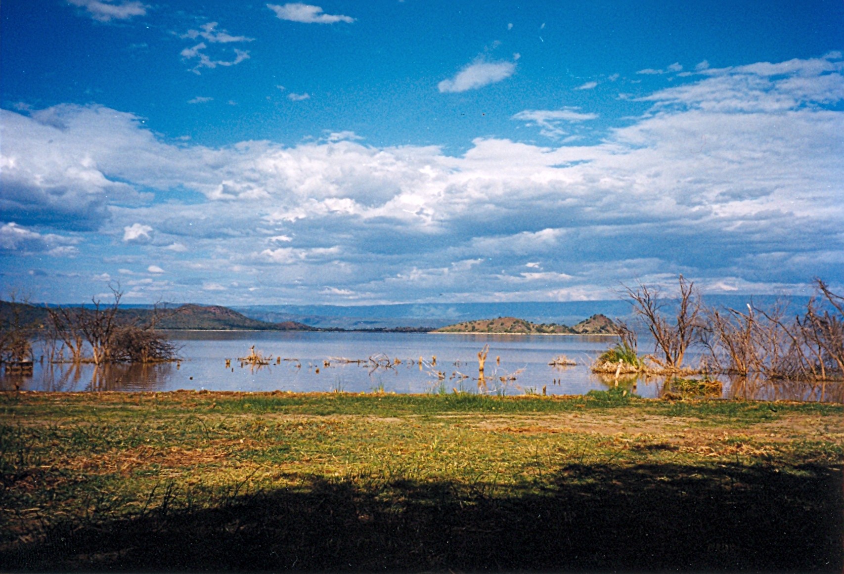
Lake Baringo
Between 2010 and 2020, Lake Baringo doubled in size. A Kenyan government report estimated its surface area had swelled from 130 to 268 square kilometers, swallowing lakeside villages and displacing communities who had lived along its shores for generations. Crocodile and hippopotamus populations expanded with the water, and encounters between these animals and the people now living at the lake's new edges grew more frequent and more dangerous. It was a dramatic reminder that in Kenya's Rift Valley, the boundary between land and water has never been fixed.
The Freshwater Exception
Lake Baringo is an anomaly. Most of the lakes strung along Kenya's Rift Valley are alkaline soda lakes, their waters too caustic for most fish and too concentrated for human use. Baringo, along with Lake Naivasha far to the south, is one of only two freshwater exceptions. Fed by the Molo, Perkerra, and Ol Arabel rivers carrying runoff from the Mau Hills and Tugen Hills, the lake has no visible outlet. Its waters seep through sediments into faulted volcanic bedrock below, a slow underground drainage that keeps the lake fresh despite having no surface river flowing out. This endorheic hydrology makes Baringo sensitive to changes in rainfall and land use. The lake's turbidity, a persistent milky-brown quality to its water, comes from intense soil erosion in the surrounding catchment, particularly on the Loboi Plain to the south.
An Island of Volcanic Memory
Several small islands break the lake's surface, the largest being Ol Kokwe Island. Ol Kokwe is an extinct volcanic center related to Korosi volcano to the north, and it still steams. Hot springs and fumaroles punctuate the island's landscape, some precipitating sulfur deposits that stain the rocks yellow. A group of hot springs discharges along the shoreline at Soro, near the island's northeastern corner. The Tugen Hills west of the lake hold deeper secrets still: fossil hominoids and hominins have been recovered from Miocene to Pleistocene sedimentary sequences exposed in the hillsides, evidence spanning 14 to 4 million years ago. A rocky islet in the lake known as Gibraltar hosts a Goliath heronry, one of the nesting colonies of the world's largest heron species. The juxtaposition is characteristic of Baringo: ancient geology, active geothermal features, and abundant birdlife packed into one basin.
Wings Over Alkaline and Fresh
More than 500 species of birds have been recorded around Lake Baringo, making it one of the premier birding destinations in East Africa. Migrating flamingos visit occasionally, though they prefer the more alkaline waters of nearby Lake Bogoria. The lake itself supports seven freshwater fish species, including an endemic subspecies of Nile tilapia, Oreochromis niloticus baringoensis. Tilapia stocks have declined in recent decades, but the marbled lungfish, introduced to the lake in 1974, has thrived and now provides the majority of the commercial catch. Hippopotamus and Nile crocodile inhabit the lake and its margins, and the pastoralist communities around Baringo, including the Il Chamus, Turkana, and Kalenjin, have long navigated a relationship with these large and sometimes dangerous neighbors. The main settlement near the lake is Marigat, while Kampi ya Samaki on the western shore serves as the primary base for tourist accommodation and boat services.
A Lake Rewriting Its Own Shores
The dramatic expansion of Lake Baringo between 2010 and 2020 was part of a broader pattern affecting multiple Rift Valley lakes. Rising water levels have been attributed to changing rainfall patterns, increased runoff from degraded catchment areas, and possible shifts in subsurface hydrology. Villages that had existed for decades found themselves underwater. Schools, health clinics, and homes were submerged. The rising waters brought the lake's wildlife, particularly its crocodiles, into closer contact with displaced communities adjusting to new shorelines they had not chosen. European knowledge of the lake began around 1850, when German missionaries Ludwig Krapf and J. Rebmann, stationed at Mombasa, first reported its existence. Early maps wildly exaggerated its size, confusing it with the Kavirondo Gulf of Lake Victoria. Joseph Thomson, traveling through Maasai territory in 1883, became the first European to see the lake and correct those inflated estimates. Native tradition, however, asserts that the lake formerly covered a much larger area. The recent expansion suggests that tradition may have been more accurate than the colonial cartographers realized.
From the Air
Located at 0.63°N, 36.08°E at 970 m elevation. The lake's freshwater surface (130-268 km² depending on current levels) is readily distinguishable from the surrounding semi-arid terrain. Ol Kokwe Island and its volcanic features are visible at lower altitudes. Lake Bogoria lies immediately to the south. The Tugen Hills rise to the west and the Laikipia Escarpment to the east. Nearest town with airstrip access is Marigat. Eldoret International Airport (HKEL) is approximately 100 km west. Best viewed from 6,000-10,000 ft AGL.