Lake Cerknica
The ancient geographer Strabo called it a marsh named Lugeon -- his Greek rendering of a local name, possibly Illyrian in origin. Two thousand years later, the place still defies easy description. Lake Cerknica, in southwestern Slovenia's Inner Carniola region, is Europe's largest intermittent lake: a body of water that fills, empties, and refills itself according to rhythms that no calendar can fully predict. In wet seasons, it stretches across roughly 26 square kilometers of the Cerknica Polje, a karst depression ringed by limestone hills. In dry summers, the lake drains entirely through sinkholes and underground channels, leaving behind meadows so lush that farmers once harvested hay from the lakebed. Fish vanish with the water. When the rains return, so do the fish.
The Breathing Earth
The mechanics are extraordinary. Beneath the lake's shallow basin, the limestone is riddled with openings -- some above the water level in surrounding hills, some below. When summer rainfall drops, water drains into subterranean reservoirs through these karst conduits. The lakebed, ordinarily about six meters deep under normal conditions, empties completely, and vegetation colonizes the exposed ground within weeks. Come autumn, heavy rains fill the higher reservoirs first, and they discharge suddenly through underground passages back into the polje. The lake can regain its full volume with startling speed, sometimes inundating surrounding farmland. But the rhythm is irregular. In 1834, the lake vanished and did not return for over a year. Other times it persists for several consecutive years without drying. The lake breathes on its own schedule, indifferent to human expectation.
A Polymath's Puzzle
In November 1687, Johann Weikhard von Valvasor -- a Carniolan nobleman, cartographer, and polymath -- wrote to London's Royal Society describing the lake's bewildering behavior. An excerpt of his letter appeared in the Society's Philosophical Transactions that December, bringing this Slovenian curiosity to the attention of Europe's scientific elite. Valvasor proposed a model for the lake's filling and emptying based on Cartesian mechanics, an ambitious attempt to impose order on what appeared to be chaos. Nearly a century later, in 1781, Tobias Gruber became the first to accurately describe how the karst hydrology actually worked. Belsazar Hacquet refined the understanding further in 1784. The lake had already appeared in some of Europe's finest atlases -- Joan Blaeu's Atlas Maior depicted it in 1659 -- but the science behind its disappearing act took centuries to unravel.
A Sanctuary Between Appearances
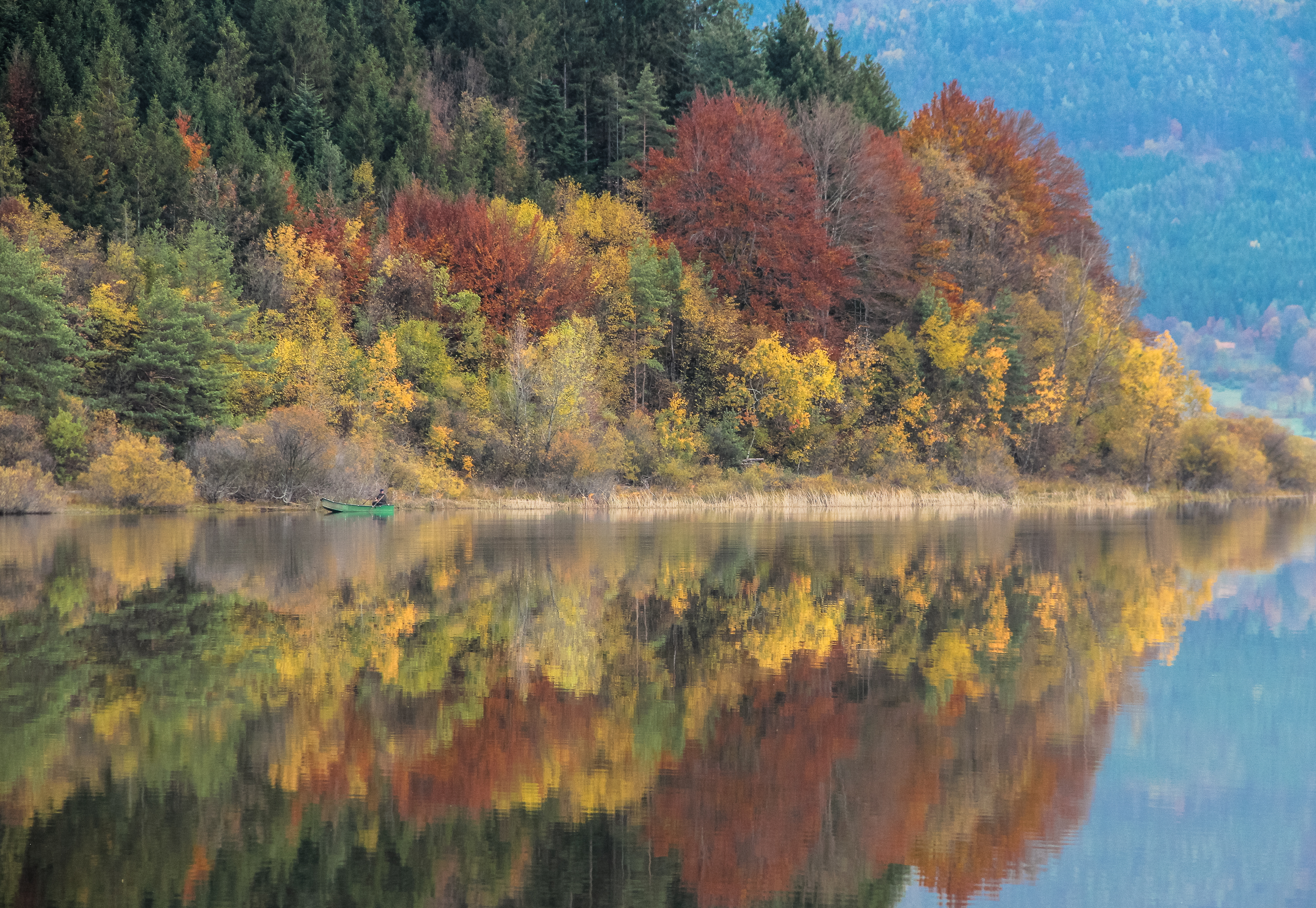
The lake's dual nature -- aquatic habitat in one season, grassland in the next -- creates an ecosystem of unusual richness. Amphibious plants thrive in the transitional zone between water and dry land. The wetland is an Important Bird Area designated by BirdLife International, serving as a critical nesting ground for numerous bird species that depend on the seasonal rhythms of flooding and retreat. The broader landscape falls within two Natura 2000 protected areas and anchors the Inner Carniola Regional Park. With a continental climate averaging 9.2 degrees Celsius and annual precipitation of about 1,700 millimeters, the region receives enough rain to sustain the lake's cycle through most years. The result is a landscape that functions as both lake and meadow, sometimes simultaneously at its margins -- a place where the boundary between land and water is genuinely provisional.
Where Water Writes the Rules
From the air, the Cerknica Polje reads differently depending on when you fly over. In autumn and winter, a broad lake reflects the sky, bordered by the slopes of Mount Slivnica to the southeast. By midsummer, the same depression may be entirely green, the sinkholes invisible beneath tall grass, only faint depressions hinting at where the water will pool again. The town of Cerknica sits at the northern edge, close enough that the lake's presence -- or absence -- shapes daily life. Boating is possible in the wet months; the Inner Carniola Regional Park manages access. The lake has no fixed shoreline, no permanent docks, no boardwalks. It offers instead something rarer: a landscape that refuses to hold still, a place where the earth itself decides when to be land and when to be sea.
From the Air
Located at 45.752N, 14.385E in the Cerknica Polje of southwestern Slovenia. From altitude, the lake appears as a large bright oval in the karst depression when filled (autumn through spring), or as an anomalously green flat area when dry (summer). Mount Slivnica (1,114 m) rises to the southeast. Best viewed from 3,000-5,000 feet AGL. Nearest airport: Ljubljana Joze Pucnik Airport (LJLJ), approximately 40 nm northeast. Portoroz Airport (LJPZ) is roughly 50 nm to the southwest.