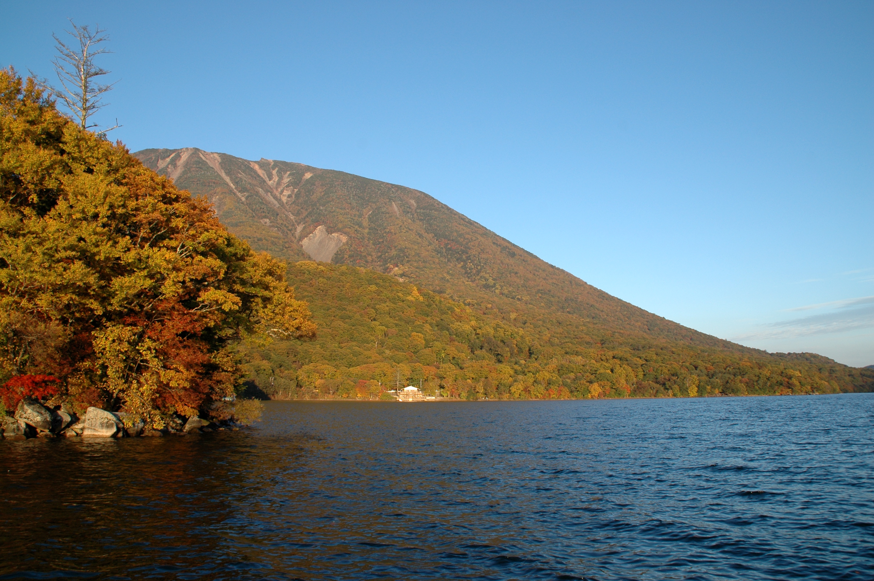
Lake Chuzenji
Its other name tells you everything: the Sea of Happiness. Lake Chuzenji sits at 1,269 meters above sea level in the mountains of Tochigi Prefecture, making it the highest natural lake in Japan, and for over a thousand years people have been climbing to its shores seeking something -- spiritual awakening, diplomatic escape, or simply the staggering beauty of a volcanic lake ringed by forest and overshadowed by the sacred peak that created it. Mount Nantai, rising to 2,484 meters on the lake's northern shore, erupted roughly 20,000 years ago and sent lava flows pouring down the valley, blocking the river and creating this 11.62-square-kilometer body of water. The lake is 25 kilometers around and plunges to a depth of 163 meters. At its eastern edge, the water spills over a cliff and becomes Kegon Falls, one of Japan's three most famous waterfalls.
The Priest Who Opened the Mountain
Lake Chuzenji entered recorded history in 782, when a Buddhist priest named Shodo Shonin and his followers succeeded in climbing Mount Nantai. Born Wakata Fujiitomari in 735 in Shimotsuke Province -- the region that is now Tochigi Prefecture -- Shodo had been drawn to religious life from childhood. He founded Futarasan Shrine to honor the deities of Nikko's three most sacred mountains: Nantai, Nyoho, and Taro. Two years after his ascent, in 784, he built Chuzenji Temple at the foot of the volcano, giving the lake the name it still carries. The mountain was considered so sacred that women, horses, and cows were forbidden from climbing it for nearly eleven centuries, a ban that held until 1872. Futarasan Shrine, built in 790, still stands near the lake's shore, its vermilion torii gate reflected in the water on calm mornings.
A Diplomatic Summer Haven
In the late nineteenth century, foreign diplomats stationed in Tokyo discovered that Lake Chuzenji offered something the sweltering capital could not: cool mountain air and quiet forests. During the middle of the Meiji period and into the early Showa era, several European embassies built summer villas along the lakeshore, transforming the sacred mountain retreat into an unlikely outpost of international diplomacy. The British were among the most enthusiastic residents. Sir Ernest Satow, Britain's envoy to Japan from 1895 to 1900, made the lake his favorite summer escape, documenting his stays in detailed diaries that survive today. He built a house by the water that the British Embassy used as a summer villa for over a century. The former Italian embassy villa has been restored and is now open to visitors, offering a glimpse of the era when European diplomats traded their formal dress for hiking boots and fishing rods in the shadow of Mount Nantai.
Four Faces of the Lake
Lake Chuzenji reinvents itself with each season in ways that have made it one of central Japan's premier natural destinations. Spring arrives late at this altitude, and when the cherry blossoms finally open along the shoreline, the surrounding peaks are still dusted with snow -- a contrast the Japanese call a mark of the mountain's character. Summer transforms the lake into a cool refuge from the lowland heat, drawing hikers, birdwatchers, and boaters who move across water so clear the rocky bottom is visible in the shallows. Autumn is the headline act. The maple, beech, and birch forests that blanket the mountainsides erupt in reds, oranges, and golds, and the traffic on the Irohazaka switchback road -- the only route connecting Nikko city to the lake -- crawls bumper to bumper with leaf-peepers. Winter brings the Snow and Ice Festival, along with skiing and skating, and reduces the lakeside to a spare, monochrome beauty that few tourists witness.
Where the Water Escapes
The Yukawa River feeds Lake Chuzenji from the west, carrying snowmelt and rain down from the higher slopes. But the lake's most dramatic feature is where it empties. At the eastern end, the water finds the only gap in the volcanic dam -- a notch in the hardened lava -- and plunges 97 meters over Kegon Falls in a single, unbroken column. The relationship between lake and waterfall is inseparable: the serene surface above and the thundering cascade below are two expressions of the same water, separated by a cliff edge. Other sites around the lake complete the picture of a landscape shaped equally by geology and devotion: Chuzenji Temple, Futarasan Shrine, and the forested hiking trails that follow the shoreline for 25 kilometers, passing through groves of ancient cryptomeria and offering views across the water to Nantai's volcanic cone.
From the Air
Lake Chuzenji is located at 36.741N, 139.462E, at an elevation of 1,269 meters (4,164 feet) in mountainous terrain. The lake is 11.62 square kilometers and highly visible from altitude as a dark water feature in the forested mountains. Mount Nantai (2,484 meters / 8,150 feet) rises prominently on the northern shore and serves as an excellent visual landmark. Kegon Falls is visible at the eastern outlet. The Irohazaka switchback road is identifiable as a zigzag line climbing the southern slope. The nearest airfield is Utsunomiya (RJTU), approximately 40 km southeast. Ibaraki Airport (RJAH) lies about 120 km to the south. Narita International (RJAA) is approximately 190 km south-southeast. Best viewed at 4,000-6,000 feet AGL. Terrain rises sharply on all sides; maintain awareness of surrounding peaks.