Lake Cunningham
The Spanish called it Laguna Socayre. It was one of three permanent wetland complexes in Santa Clara Valley - a broad, marshy lowland where Thompson Creek slowed and spread before draining into Lower Silver Creek. For centuries it sat there, unremarkable and essential, filtering water and sheltering wildlife at the base of the Diablo Range foothills. Today, an artificial lake occupies a fraction of that footprint, hemmed in by Capitol Expressway, a shopping mall, and a water park. Lake Cunningham is a flood control basin disguised as a park, and the story of how it got that way is the story of Silicon Valley's transformation from orchards and wetlands to concrete and code.
Before the Pavement
Between 1769 and 1850, during the initial Euro-American settlement of the valley, the area around present-day Lake Cunningham was known as Laguna Socayre, sometimes spelled Secayre. It formed part of the Rancho Yerba Buena, a Mexican land grant issued in 1833 - also referred to as Rancho Socayre. The laguna covered far more ground than the current park. Water arrived from the surrounding hills, percolated through gravel, and sustained a wetland ecosystem that persisted through California's dry summers. The land eventually passed into private hands, including those of James Farnham Cunningham, whose name the lake and park now carry. Cunningham owned the property before the City of San Jose acquired it for flood control, converting a rancher's land into civic infrastructure.
Taming Thompson Creek
As San Jose grew eastward through the twentieth century, the hills above Laguna Socayre were paved and built upon. Rainwater that once seeped into canyon gravel was channeled instead into pipes beneath streets, rushing downhill through Thompson Creek with new urgency. Winter storms brought surges the old landscape would have absorbed. The city's solution was engineered containment: Lake Cunningham, an artificial retention basin designed to catch floodwater before it could damage the neighborhoods downstream. It is not, technically, a lake in the geological sense - the Geographic Names Information System does not recognize it as a natural feature. But it holds water, reflects sky, and anchors 50 acres of parkland in one of the most densely urbanized corners of the South Bay.
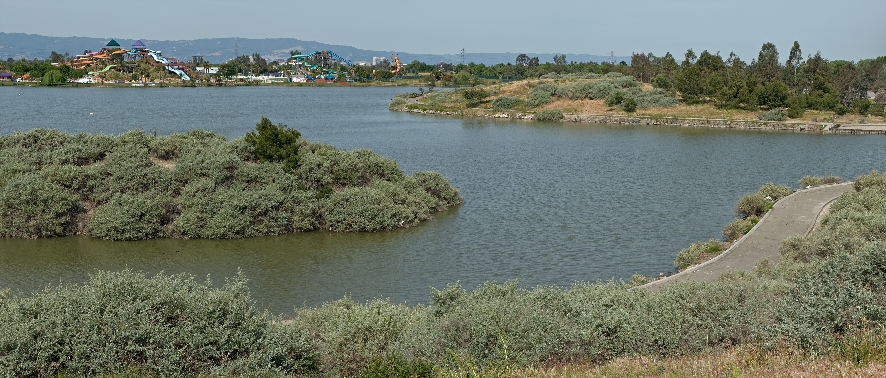
A Park Between Runways and Retail
Lake Cunningham Park sits in a neighborhood defined by infrastructure. Reid-Hillview Airport borders it to the north, its single runway handling training flights and light aircraft. Eastridge Mall and its transit center anchor the commercial corridor to the south. Capitol Expressway runs along the western edge. Despite these surroundings, the park has become a genuine recreation hub for East San Jose. The Lake Cunningham Skate Park draws boarders and BMX riders from across the Bay Area. Raging Waters, a water theme park, operates seasonally within the park boundaries. Walking paths circle the lake, and on calm evenings the water reflects the foothills to the east - a faint echo of the landscape Laguna Socayre once dominated.
Water's Long Memory
Every winter, when storms sweep in from the Pacific and the hills run with water, Lake Cunningham fills and does exactly what it was built to do. The outflow drains into Lower Silver Creek, following roughly the same path water has taken through this valley for millennia. It is a practical arrangement, unremarkable by engineering standards. But there is something worth noting in the persistence of water here - the way it continues to collect in this low spot between the hills and the bay, just as it did when the Spanish named it, just as it did before anyone named it at all. The laguna is gone, replaced by a basin with a concrete edge. The water, indifferent to the change, keeps coming back.
From the Air
Coordinates: 37.34°N, 121.81°W. Lake Cunningham is immediately visible from the air as a dark oval of water in East San Jose, adjacent to the northwest-southeast runway of Reid-Hillview Airport (KRHV). Look for Eastridge Mall just to the south. San Jose International Airport (KSJC) lies 7 nm to the northwest. At 2,000-3,000 feet AGL, the lake contrasts sharply with the surrounding urban grid. The Diablo Range foothills rise to the east, providing useful terrain reference.