Lake Disappear
Visit on a dry June day and you will find a flat expanse of alluvial grassland with a muddy stream running through it. Return after a week of heavy Waikato rain and that same valley holds a sizable lake, its waters backed up behind an ancient lava dam because the limestone sinkhole that normally swallows the Pakihi Stream cannot drain fast enough. Lake Disappear, just over 20 kilometers from the surf town of Raglan in New Zealand's North Island, is the country's largest known polje, a type of intermittent lake formed by the interplay of volcanism and soluble rock. Its name is not a metaphor. The lake literally disappears.
Fire and Limestone
The geology that creates Lake Disappear begins roughly two million years ago with the Okete Volcanics. A lava flow from a vent on Whataipu, just over a kilometre away, poured down the Pakihi Valley and hardened into a natural dam. Beneath that basalt cap lies much older Elgood Limestone, part of the Glen Massey Formation. Where the stream meets the limestone, it has carved a sinkhole, and under normal conditions the Pakihi drains through it, travels roughly a kilometre underground, and re-emerges with barely a ripple near Te Maari Stream before flowing into Aotea Harbour. During prolonged heavy rain, the sinkhole cannot keep pace with the volume of water backing up behind the lava dam. The valley floods, and Lake Disappear appears. The same volcanic forces that created nearby Bridal Veil Falls, where a separate lava flow hardened into the cliff the waterfall pours over, are responsible for this valley's peculiar hydrology.
A Landscape Twice Transformed
The watershed surrounding Lake Disappear was once podocarp forest, dense stands of kahikatea and other native conifers that anchored the soil and regulated water flow. Today, most of that catchment is sheep and beef farmland, with the turbines of Te Uku Wind Farm turning on the ridgeline above the stream's source. A 1999 ecological survey found the dry lake bed dominated by adventive pasture grasses, though indigenous sedges persist in patches and a remnant of secondary kahikatea forest still stands. The transformation from forest to farmland has consequences that extend underground. Agricultural runoff enriches the Pakihi with nutrients, and surveys have documented significant growths of filamentous algae upstream of the lake, indicators of water quality that Landcare Research describes as problematic.
Life in Vanishing Water
Despite its intermittent nature, Lake Disappear's stream system supports a surprising array of life. Inanga, longfin eels, koura (freshwater crayfish), freshwater snails, shrimps, and banded kokopu have all been documented in the Pakihi. The climbing galaxias may also be present. A 2008 macroinvertebrate survey cataloged caddisflies, stony-cased caddisflies, crustaceans, mud snails, sandflies, and the rare New Zealand freshwater mussel, each species an indicator of stream health. The caddisfly Olinga feredayi, sensitive to pollution, was recorded as occasional rather than abundant, a finding consistent with the moderate ecological health rating the stream received. These creatures have adapted to a system that alternates between flowing stream and temporary lake, a hydrological rhythm dictated by rainfall and the capacity of a single sinkhole.
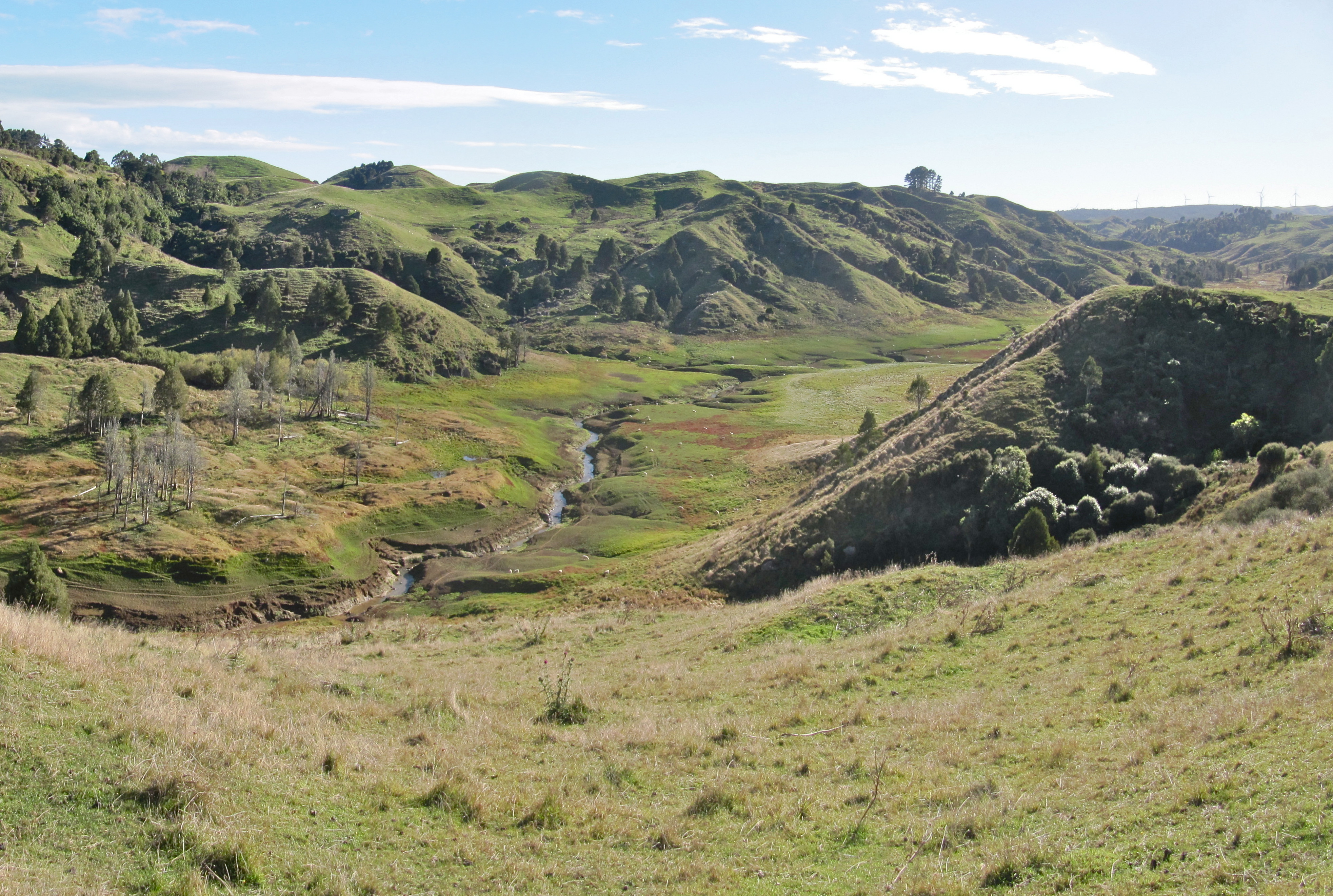
The View from Plateau Road
Lake Disappear can be glimpsed from two vantage points. The south end is visible from Kawhia Road, where the lava flow that blocked the valley rises in the background. When the lake fills to its northern extent, it can also be seen from the end of Plateau Road on the Pipiwharauroa Way, a walking and biking trail that follows the ridgeline. Photographs taken from this point on the same date in different years tell the whole story: one shows green pastoral flats stretching to the valley walls, the other shows those same flats submerged under a lake that reflects the sky. Four kilometres beyond Bridal Veil Falls, tucked into hill country that most travelers pass through on their way to somewhere else, Lake Disappear is a geological curiosity that rewards the patient observer. You just have to time your visit to the rain.
From the Air
Lake Disappear (37.926S, 174.917E) sits in the Pakihi Valley in the Waikato District, about 20 km from Raglan. When full, the lake is visible as a distinct body of water in an otherwise pastoral valley. When dry, it appears as flat green alluvial flats. The nearby Bridal Veil Falls and Te Uku Wind Farm turbines serve as landmarks. Raglan Aerodrome lies approximately 18 km to the northwest. Hamilton Airport (NZHN) is about 55 km to the east. Approach at 2,000-3,000 feet AGL for the best view of the valley and surrounding lava flow topography.