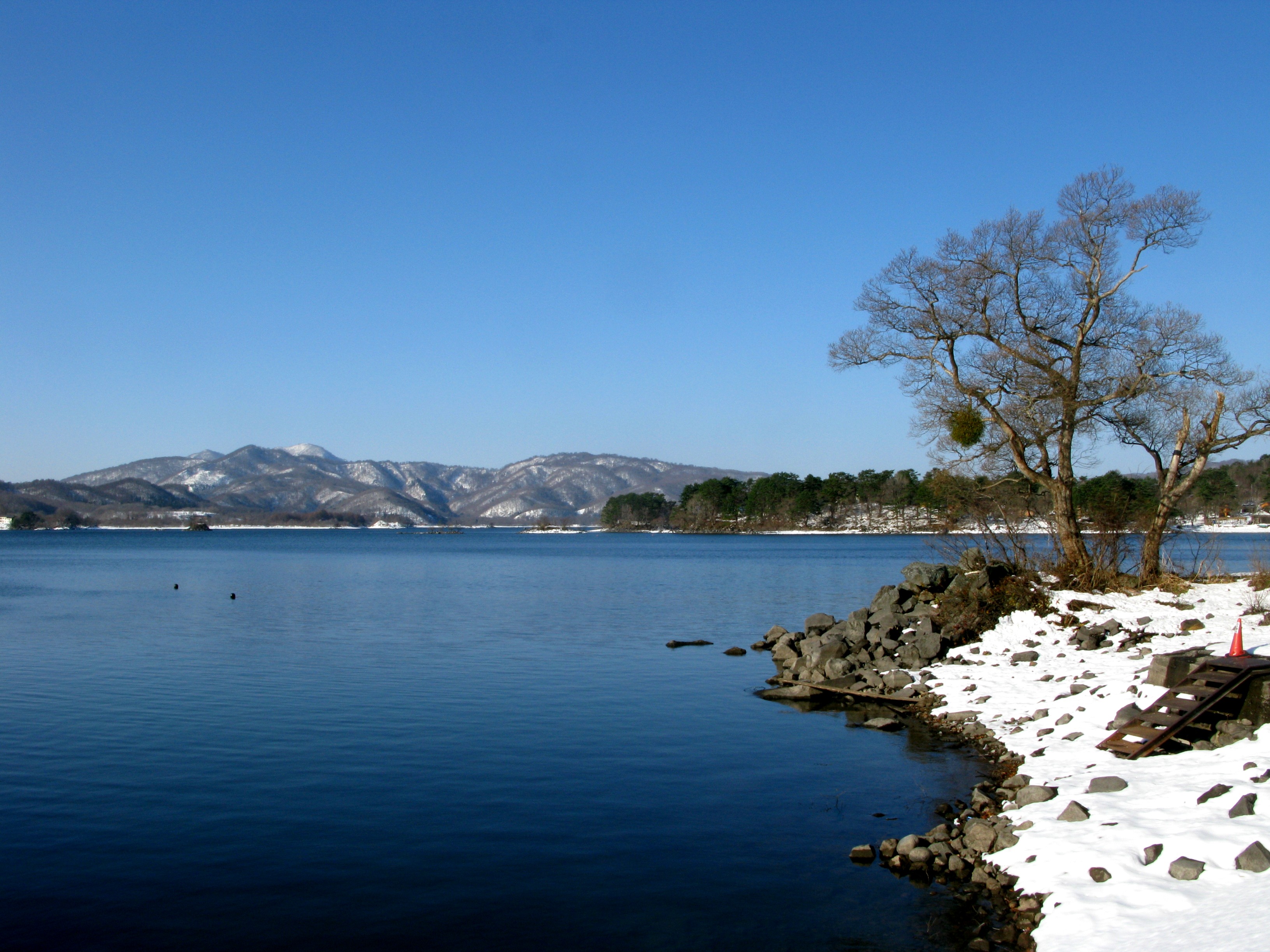
Lake Hibara
Somewhere beneath the calm, glassy surface of Lake Hibara, stone steps descend into darkness. They once led worshippers uphill to Ooyama Sumi Shrine, in a village that greeted travelers along the Yonezawa Highway. Today, only the tips of the shrine's torii gate break the waterline, a silent monument to the 477 people who lost their lives when Mount Bandai tore itself apart on the morning of July 15, 1888. The largest lake in the Bandai Highland exists because a mountain exploded, and the village that gave the lake its name now sleeps sixty feet below the boats that cruise its waters.
The Morning the Mountain Broke
Mount Bandai had been rumbling for days. On July 15, 1888, a phreatic eruption blasted open the volcano's northern flank in a catastrophic sector collapse. Within ten minutes, a debris avalanche towering 75 meters high surged down the mountainside at 80 kilometers per hour, burying five villages beneath an estimated 1.5 cubic kilometers of rock, mud, and volcanic debris. The avalanche covered 34 square kilometers, reshaping the entire northern face of Bandai. Where the south side of the mountain still presents a tidy, conical silhouette, the north side reveals jagged cliffs and exposed bedrock, a permanent scar from that single devastating morning. The debris dammed river valleys and created an entirely new landscape: Urabandai, the 'back of Bandai,' a region of small hills, forested valleys, and newly formed lakes.
A Village Beneath the Waves
Hibara-juku was an Edo-period post town, a waypoint for travelers crossing between the Aizu domain and the Yonezawa Highway. It had homes, shops, and a shrine where villagers passed through the torii gate to pray. When the debris avalanche blocked the valley's drainage, water began filling the basin. Slowly, the village disappeared. The rooftops went first, then the treetops, and finally the shrine gate itself slipped below the rising surface. Today, a partially submerged set of torii gates and stone steps are the last visible traces of Hibara Village. In recent years, researchers from JAMSTEC have used microtopographic analysis to create 3D reconstructions of the submerged town, mapping streets and structures preserved beneath the lakebed sediment. The village that gave the lake its name has become a subject of modern underwater archaeology.
Five Colors, Five Lakes
Lake Hibara is the largest of the lakes created by the 1888 eruption, but it is far from the only one. The debris avalanche formed Lake Onogawa, Lake Akimoto, and the famous Goshiki-numa, the 'Five-Colored Ponds,' a cluster of small volcanic lakes whose waters shift between emerald, cobalt, turquoise, and rust depending on the season, the angle of sunlight, and the mineral content of their volcanic substrate. The entire Urabandai region, now part of Bandai-Asahi National Park, is a landscape that did not exist before 1888. Classified as a mesotrophic lake, Hibara sustains a balanced ecosystem that supports recreational fishing year-round. In winter, when snow blankets the highlands and the lake surface freezes solid, ice fishers drill through and drop lines into the cold, still water, sitting in silence over the drowned village below.
Highland Seasons
The Bandai Highland transforms with each season. Summer brings hikers to the trails that ring the lake, pleasure boats cruise the water, and campgrounds fill with families escaping the lowland humidity. Autumn sets the surrounding forests ablaze with red and gold maples reflected in the mirror-still surface. Winter is quieter but no less dramatic: heavy snowfall buries the shoreline, and the frozen lake becomes a vast white plain dotted with the dark silhouettes of ice fishers hunched over their holes. Through it all, Mount Bandai looms to the south, its rugged northern face a constant reminder of the event that made this landscape possible. The village is gone, but the lake it left behind has become one of Fukushima Prefecture's most beloved destinations.
From the Air
Lake Hibara is located at 37.683N, 140.056E in the Bandai Highland of Fukushima Prefecture. The lake is a prominent blue feature on the northern side of Mount Bandai, easily spotted from altitude alongside the smaller Goshiki-numa ponds. Look for the dramatic contrast between Bandai's smooth southern cone and its scarred, collapsed northern face. The nearest airport is Fukushima Airport (RJSF), approximately 80 km to the south. Recommended viewing altitude is 5,000-8,000 feet for the full Urabandai lake system. The highlands experience heavy snowfall in winter, which can reduce visibility but creates striking white-on-blue contrasts.