Lake Hodges Bridge
Lake Hodges sits south of Escondido in a valley that San Diego County's rainfall either fills or empties, depending on the year. When the lake is full, it is scenic. When it is low, dense chaparral vegetation springs up from the exposed lakebed — enough growth that locals have taken to calling the area below the bridge 'Hodges National Forest.' The bridge that carries Interstate 15 across this fluctuating body of water has been built four times in a century. The pedestrian bridge immediately beside it, which opened in 2009, became the longest stress-ribbon bridge in the world.
A Century of Bridge-Building
The first crossing at Lake Hodges was built in 1919, a modest structure serving a highway that had not yet been designated. It was absorbed into US Route 395 when that road was established, then demolished in 1968 as part of a realignment project. A replacement opened in 1969, which was itself replaced in 1981 when Interstate 15 was built to supersede US 395. The current concrete viaduct was widened and substantially rebuilt again between 2006 and 2009, as part of a project to add managed lanes to the I-15 corridor.
Four structures in a hundred years is a lot of building for one crossing. Each replacement reflects a different era's traffic volumes, engineering standards, and funding priorities. The 2009 version is the widest, the most expensive, and the most recent — built for the managed-lane era of California freeway design, with variable tolls and express lanes intended to smooth traffic flow.
The Bottleneck
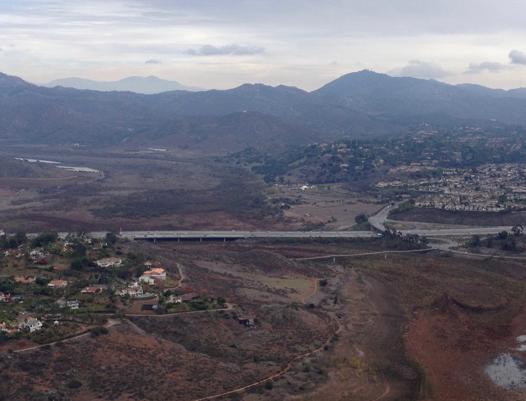
The Lake Hodges Bridge is the critical chokepoint on San Diego's north-south I-15 corridor. The lake's location and the surrounding terrain make the bridge effectively the only practical crossing for drivers traveling between inland North County and the city of San Diego. The alternatives are not attractive: the Del Dios Highway is a two-lane winding road that eventually reaches Interstate 5 via Del Mar; the route through Ramona into Escondido adds approximately 25 miles to the journey.
Paved access roads exist through San Pasqual Valley to the east of the lake, but they are lightly traveled and not designed for heavy traffic. In practical terms, everyone moving between Escondido and San Diego on the inland route crosses at Lake Hodges. When accidents or construction stop traffic on the bridge, the backup extends for miles in both directions.
The Stress-Ribbon Bridge
The more architecturally interesting structure at Lake Hodges is not the freeway viaduct but the pedestrian span beside it. The David Kreitzer Lake Hodges Bicycle Pedestrian Bridge — named for a retired planning commissioner — opened to the public on May 15, 2009, immediately south of the I-15 span.
The bridge uses a stress-ribbon design: a thin, ribbon-like concrete deck suspended from cables that curve downward in a catenary between supports, with the deck acting in tension rather than compression. The design is elegant and structurally efficient, and it has the practical advantage of requiring minimal support infrastructure in the water. At 995 feet from end to end, the Kreitzer Bridge is the longest stress-ribbon bridge in the world and was only the sixth of its type built in the United States. The design was chosen specifically to minimize construction impact on the environmentally sensitive habitats along the lake's edge.
The Lake Itself
Lake Hodges is a reservoir created by Hodges Dam on the San Dieguito River. It is connected to Olivenhain Reservoir via a pump-storage system that allows water to be moved between the two bodies as part of San Diego County's emergency water storage infrastructure — a system that makes Lake Hodges both a local water supply and a component of the region's long-term drought response.
The lake's fluctuating water level is its most visible characteristic for residents and commuters. In wet years it fills, and the crossing is dramatic. In dry years the lakebed is exposed, and the vegetation that colonizes it creates the 'Hodges National Forest' effect that the bridge's regular users have named. Either way, the freeway crosses it, the pedestrian bridge hangs over it, and the same geography that has required four generations of engineering since 1919 continues to present itself as a valley worth spanning.
From the Air
Lake Hodges and its bridges are visible at 33.06°N, 117.07°W south of Escondido on Interstate 15. The lake is clearly identifiable from altitude as an elongated reservoir west of I-15, with the freeway viaduct crossing its narrowest point. The stress-ribbon pedestrian bridge is visible immediately south of the freeway span. McClellan-Palomar Airport (CLD) is approximately 13 miles to the west. Best viewed at 3,000-5,000 feet AGL.