Lake Iguaque
Before there were people, there was a lake. That is what the Muisca believed about Iguaque, a body of still water nested in the paramo above 3,600 meters in Colombia's Eastern Andes. From its surface, according to their origin story, the goddess Bachue rose one day carrying a boy in her arms. When the child grew, she married him, and their children populated the Earth. When their work was done, Bachue and her husband returned to the lake in the form of snakes, disappearing beneath the water that had given them life. The lake has been sacred ever since.
Where the Sky Meets the Water
Lake Iguaque sits within the Santuario de Fauna y Flora Iguaque, a protected area declared a Flora and Fauna Sanctuary in 1977. The sanctuary spans elevations between 2,400 and 3,800 meters, encompassing four distinct ecosystems: paramo and subparamo, paramo wetlands, high Andean forest, and Andean forest. The dominant landscape at the lake's altitude is the paramo -- that uniquely South American ecosystem found only in the high tropical Andes, where the air averages 12 degrees Celsius and the vegetation has evolved extraordinary adaptations to cold, ultraviolet radiation, and dramatic temperature swings. Frailejones raise their fuzzy rosettes above the ground, ferns cling to mist-dampened rocks, lichens colonize every surface, and puya plants send up towering flower spikes that can take decades to bloom.
The Mother of Humanity
Bachue's name in the Chibcha language means "the bare-breasted one," and she holds a place in Muisca cosmology that few deities in the Americas can match: she is the origin of the species. The Muisca, who inhabited the Altiplano Cundiboyacense before the Spanish conquest, organized their society under caciques and priests, with the zaque in Hunza (modern Tunja) governing the northern territories. Lake Iguaque was not merely a feature of their landscape but the literal source of human existence. The creation myth bound the Muisca to this particular body of water with an intimacy that made pilgrimage to the lake a spiritual necessity. Other sacred lakes existed in Muisca territory -- Lake Guatavita, Lake Tota, the Siecha Lakes -- but Iguaque was where it all began.
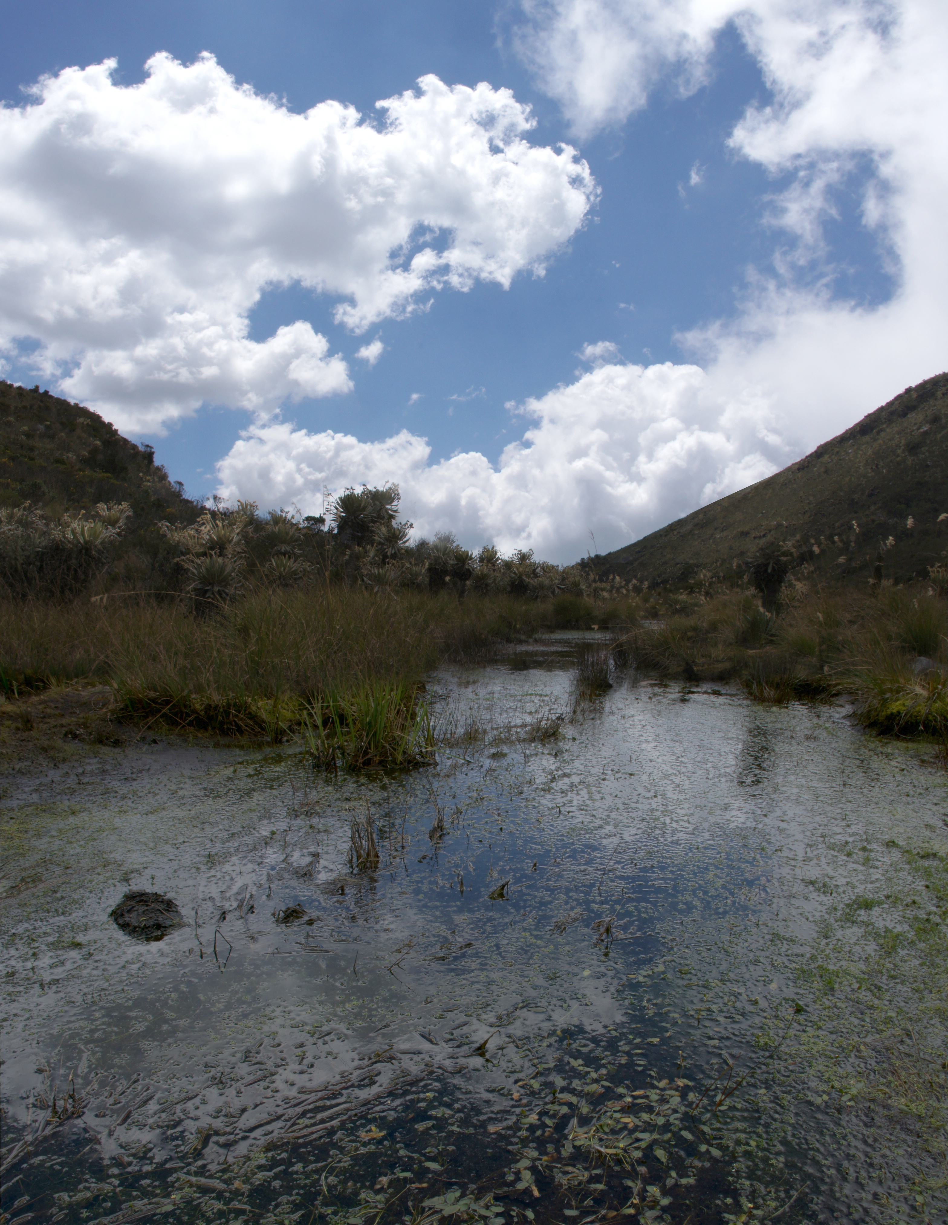
The Trail to Bachue's Waters
Reaching the lake requires effort that feels appropriate for a pilgrimage. The Bachue trail runs 4.7 kilometers from the Carrizal administrative center to the lake shore, a route that takes roughly six hours round trip and passes through three of the sanctuary's four ecosystems. Hikers climb from Andean forest through high Andean forest and into the open paramo, watching the trees shrink and the sky expand as altitude strips away the canopy. The visitor center at Furachiogua offers accommodation for up to 48 people and a camping zone, though the sanctuary limits daily visitors to protect the fragile paramo ecosystem. The access route from Bogota runs through Tunja -- 147 kilometers -- and then 39 kilometers west to Villa de Leyva, from which the sanctuary entrance lies to the northeast.
Life at the Margins
The paramo is one of the most biodiverse yet least understood ecosystems on Earth, and Iguaque's sanctuary harbors species found nowhere else. In 2006, scientists described a new species of sweat bee, Neocorynura muiscae, discovered near the lake and named after the Muisca people whose mythology gave the place its significance. The naming was a small act of recognition -- linking a newly discovered species to the civilization that had recognized the lake's importance centuries before Western science arrived. The sanctuary's paramo wetlands act as natural water storage, feeding streams that sustain communities downstream. In a region where climate change threatens to push the paramo's lower boundary upward, shrinking the ecosystem from below, Lake Iguaque is both creation myth and conservation imperative.
From the Air
Located at 5.64N, 73.56W in the Eastern Andes of Boyaca Department, northeast of Villa de Leyva. The lake sits at approximately 3,600 meters elevation within the Santuario de Fauna y Flora Iguaque. From the air, the paramo landscape is distinctive -- treeless, golden-brown grassland above the cloud forest line, with the lake visible as a dark pool. El Infiernito archaeological site is visible in the valley below to the southwest. Nearest airport: Tunja Airport (SKTJ), approximately 45 km northeast. Bogota El Dorado (SKBO) is about 150 km southwest. Best viewed at 5,000-8,000 ft AGL to appreciate the elevation transition from valley to paramo.