Lake Inawashiro
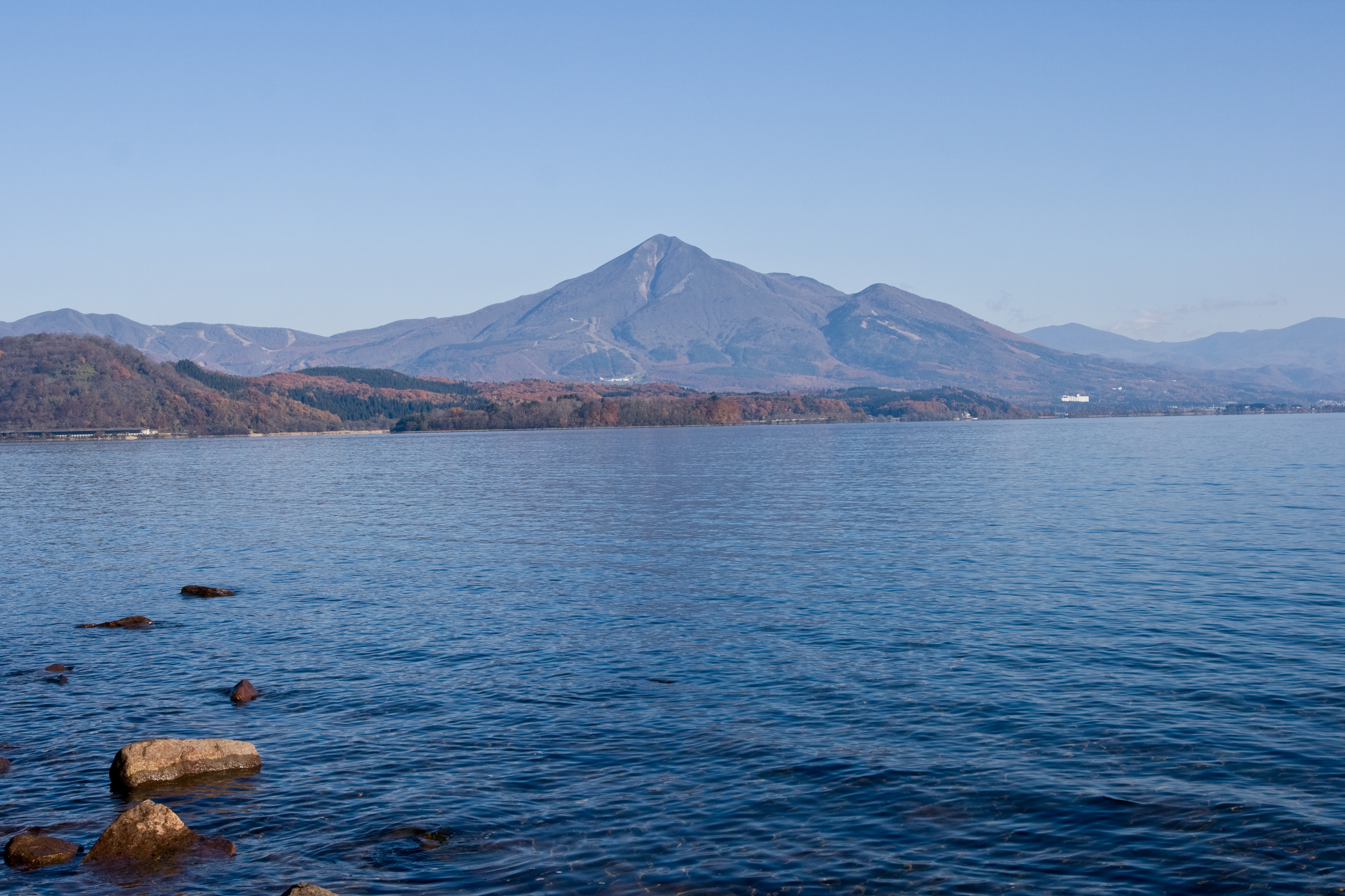
The locals call it Tenkyoko -- the Heavenly Mirror Lake -- and on a still morning the name earns itself. Mount Bandai's volcanic cone reflects so perfectly in Lake Inawashiro's surface that it is difficult to tell where rock ends and water begins. Covering 104 square kilometers of central Fukushima Prefecture, this is Japan's fourth-largest lake, a body of water so transparent and so acidic that little grows in its depths. It sits at 514 meters above sea level within the borders of Bandai-Asahi National Park, fed by the same volcanic forces that created it tens of thousands of years ago. Every winter, swans arrive at its beaches and stay until spring, as if drawn by the same quiet clarity that has pulled humans to these shores since the Jomon period.
Born of Fire
Lake Inawashiro owes its existence to catastrophe. Between 30,000 and 40,000 years ago, a massive eruption from Mount Bandai sent pyroclastic flows pouring down the mountainside, damming a tectonic depression and trapping water in what would become one of the largest lakes in the Japanese archipelago. The water is unusually acidic, with a pH of approximately 5.0 -- a lingering signature of the volcanic geology beneath. That acidity gives the lake its remarkable transparency; few organisms thrive in water this sharp, leaving it startlingly clear. During the Jomon period, water levels were considerably lower than today, and archaeologists have recovered ceramic fragments and stone tools from offshore sites -- evidence that ancient settlements once occupied ground now submerged beneath the lake's surface.
The Canal That Changed Everything
For centuries, Lake Inawashiro's water sustained the rice paddies of the Aizu region through irrigation canals first dug during the Edo period. But the most ambitious engineering project came in 1882, when the Asaka Canal was completed -- the Meiji government's first national-scale land reclamation effort. Workers bored a 585-meter tunnel through the Ou Mountain Range using dynamite, steam pumps, and cement, technologies that were cutting-edge for Japan at the time. The canal channeled water from the lake approximately 130 kilometers eastward to irrigate the parched Asaka Plains around present-day Koriyama, transforming roughly 300 square kilometers of barren ground into productive rice fields. A third canal, completed in 1915, extended the lake's reach further, supplying Koriyama with drinking and industrial water. Today the lake also feeds multiple hydroelectric power plants, its ancient volcanic water quietly powering modern Fukushima.
The Boy from Inawashiro
On the northern shore of the lake, in a farming hamlet called Sanjogata, a boy named Hideyo Noguchi was born in 1876 into deep poverty. As a toddler he fell into the family's firepit, severely burning his left hand -- an injury that would have ended most rural careers. Instead, it propelled him toward medicine. Local doctors repaired his hand, and the experience ignited an obsession with science that carried him from this lakeside village to the laboratories of the Rockefeller Institute in New York. Noguchi became one of the most celebrated bacteriologists of his era, researching syphilis, yellow fever, and other tropical diseases across the Americas, Europe, and Africa. He was nominated for the Nobel Prize multiple times between 1913 and 1927. He died in 1928 in Accra, Ghana, after contracting yellow fever during his research. In 2004, his face was placed on Japan's 1,000-yen note -- a farm boy from the shores of Inawashiro staring back from every wallet in the country.
A Mirror in All Seasons
Lake Inawashiro shifts character with the calendar. In summer, its beaches draw swimmers and windsurfers from across the Tohoku region, the volcano reflected in water warm enough to wade into. Autumn paints the surrounding highlands in rust and gold. Winter transforms the lake into a staging ground for migratory swans -- hundreds of them arriving from Siberia to rest on the cold beaches, their white forms startling against the gray water. The lake is a centerpiece of Bandai-Asahi National Park and remains one of Fukushima Prefecture's most important tourist attractions, though its significance runs deeper than scenery. This single body of water irrigates farms, generates electricity, supplies drinking water to a major city, and cradles the memory of a scientist who changed the world. For a lake born of volcanic destruction, it has spent its long life giving.
From the Air
Located at 37.475N, 140.094E, Lake Inawashiro is an unmistakable visual landmark from any altitude -- a broad, roughly oval body of water measuring approximately 104 square kilometers, sitting at 514 meters elevation in the Fukushima highlands. Mount Bandai (1,816m) rises dramatically to the north. The lake is within Bandai-Asahi National Park. Nearest airport: Fukushima Airport (RJSF) approximately 40km to the southeast. Inawashiro town sits along the northern shore. The Aizu Basin and Aizuwakamatsu city lie to the west. Expect mountain weather patterns; clouds can form rapidly around Mount Bandai, and winter brings heavy snowfall to the region.