Lake Kossou
The Bandama River once flowed unbroken through the center of Côte d'Ivoire, carving its way south toward the Gulf of Guinea. In 1973, an earthen dam sealed its path at the town of Kossou, and water began to rise across the valley. Some 75,000 Baoulé people watched their villages disappear beneath the surface. The government relocated them from 200 settlements into 54 newly constructed villages and promised that the lake would bring electricity, irrigation, and a thriving fishing industry. Half a century later, the lake has never reached even half its intended size.
The Dam and Its Promise
The Kossou Dam stretches roughly 1,500 meters across the Bandama valley, an embankment of earth and rockfill located about 32 kilometers northwest of Yamoussoukro, the nation's capital. At full capacity, the reservoir was designed to cover 1,855 square kilometers -- a surface 180 kilometers long and 45 kilometers wide, sitting 206 meters above sea level. The hydroelectric plant generates 174 megawatts of power. Beyond electricity, planners envisioned the lake as a catalyst for agricultural development, hoping residents would use its water for irrigation and that commercial fishing would provide a new economic foundation for the region. The Autorité de Vallée du Bandama oversaw the resettlement program, building new villages and launching an intensive farming initiative.
A Lake That Would Not Fill
By 1975, the lake had reached its highest recorded level: 193 meters above sea level, roughly 50 percent of its full potential surface area. Then it stopped rising. Rainfall in the Bandama catchment declined year after year, falling persistently below the long-term average. Upstream water extraction through dikes compounded the problem. By 1994, the lake had grown no larger. The vast shoreline that was supposed to be underwater remained dry, and some of the Baoulé farmers who had been forcibly relocated began reclaiming the land they had lost. The gap between what planners projected and what nature delivered became one of the defining stories of large-dam development in West Africa.
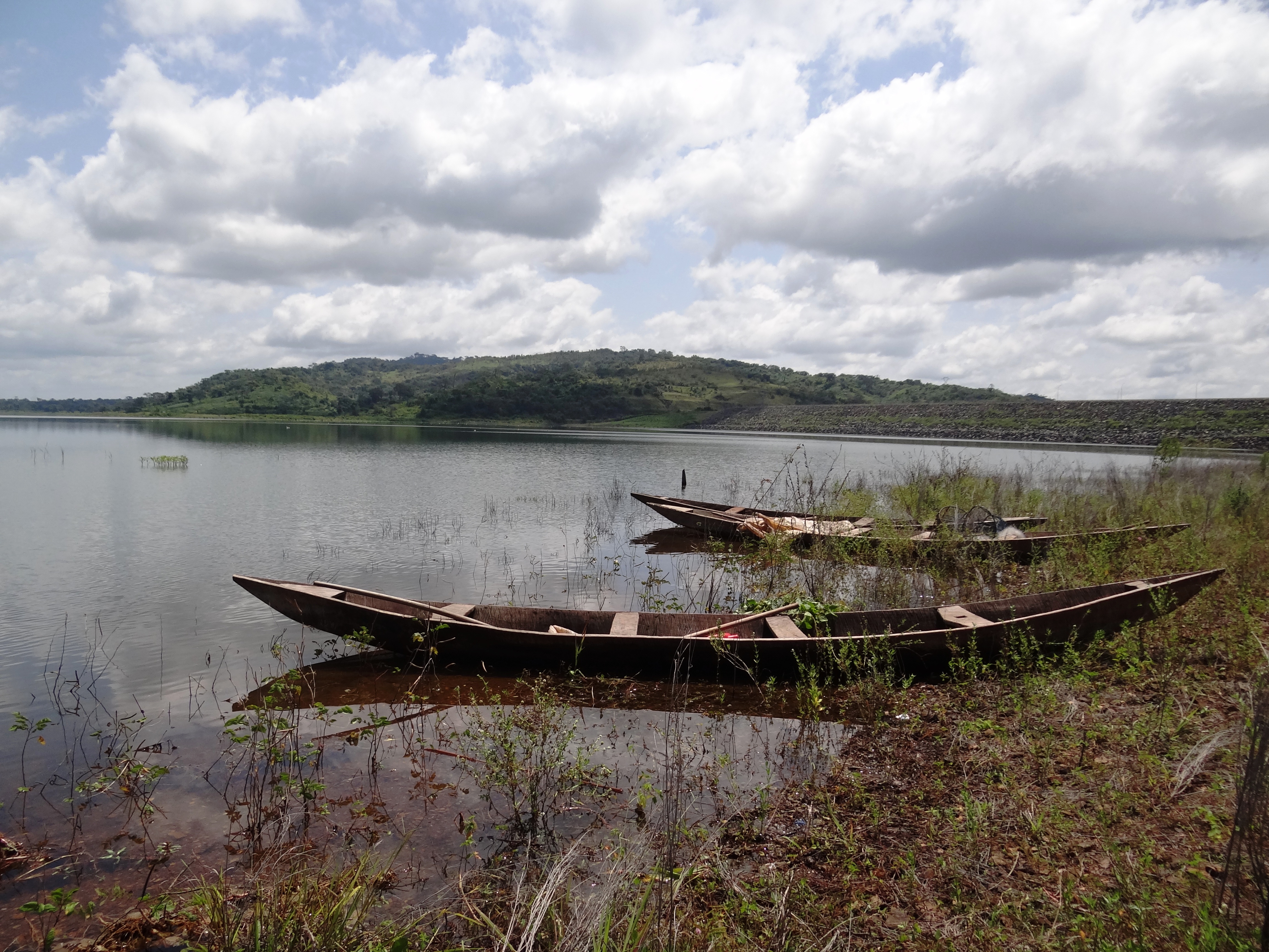
Life on a Half-Filled Lake
Despite its stunted growth, Lake Kossou developed its own ecosystem. Invasive water cabbage -- Pistia stratiotes -- colonized large stretches of the surface early on, its dense green mats choking open water. Hippopotamuses took up residence, and an increasing number of bird species arrived to exploit the wetland habitat. The fish populations transformed entirely. Before the dam, the river had been dominated by Labeo coubie and Alestes rutilus. After impoundment, the lake shifted toward species better suited to still water: Nile perch, African butter catfish, and several species of tilapia colonized the new environment. The fishery that planners had hoped for did materialize in modest form, though never at the scale originally imagined.
The Weight of Displacement
The human cost of Kossou remains difficult to calculate. Seventy-five thousand people lost their homes, their farmland, and the river that had shaped their way of life. The Baoulé, one of Côte d'Ivoire's largest ethnic groups, had lived along the Bandama for generations. Resettlement disrupted kinship networks, traditional governance structures, and agricultural knowledge tied to specific landscapes. The new villages offered houses but not continuity. When the lake failed to fill as promised and the anticipated economic benefits fell short, the sense of loss deepened. Kossou stands as both an engineering achievement and a cautionary tale about the distance between development plans and the lives they reshape.
From the Air
Located at 7.15°N, 5.59°W in central Côte d'Ivoire, approximately 32 km northwest of Yamoussoukro. Lake Kossou is the country's largest body of water and highly visible from altitude as a sprawling, irregularly shaped reservoir surrounded by savanna. Nearest airport is Yamoussoukro Airport (DIYO/ASK). The dam structure and the lake's distinctive shoreline make excellent visual navigation references. Best viewed at 5,000-10,000 feet AGL. The contrast between the lake's actual extent and its dry intended shoreline is visible from the air.