Lake Pátzcuaro
Five billion pesos spent since 2006. Twenty-three hundred studies conducted since 1934. And yet Lake Pátzcuaro keeps shrinking. The numbers, cited by the Supreme Indigenous Council of Michoacán in 2021, tell the story of a body of water that has lost 40 square kilometers of surface area and 2.6 meters of depth in half a century -- a lake that once anchored an empire and now anchors an environmental crisis. Sitting at 2,035 meters elevation in a volcanic basin ringed by pine-clad mountains, Lake Pátzcuaro in Michoacán is shallow, averaging just 5 meters deep, but its significance runs far deeper than its waters.
Heartland of an Empire
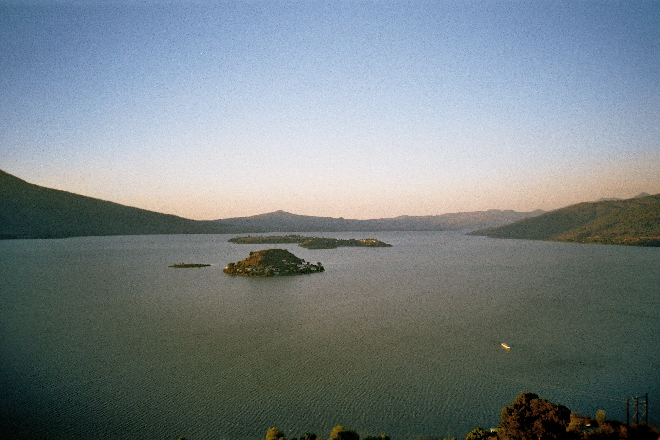
The Purépecha people made the Lake Pátzcuaro basin the core of the Tarascan state, a pre-Columbian power that controlled much of what is now central-western Mexico. The towns around the lakeshore -- Ihuatzio, Tzintzuntzan, and Pátzcuaro -- were not just settlements but seats of authority for a civilization that successfully resisted every Aztec military campaign sent against it. The Purépecha language remains a complete isolate, related to no other known language on Earth. Their culture diverged sharply from their Mesoamerican neighbors in ways scholars still work to explain. Six islands dot the lake's surface: Janitzio, with its tourist facilities and iconic hilltop statue; Pacanda, the largest and flattest; and smaller islands like Yunuen, Uranden, Tecuena, and Jaracuaro. The lakeside towns each developed distinct specialties -- Tocuaro for woodworking and maskmaking, Opongio for mezcal, Santa Fe La Laguna for crafts -- a tradition of artisanal village identity that dates back to the colonial-era system established by Bishop Vasco de Quiroga.
A Basin That Swallowed Its Rivers
Lake Pátzcuaro sits in an endorheic basin -- a closed system with no outlet to the sea. A watershed of 929 square kilometers drains into a lake that covers just 126.4 square kilometers, stretching 50 kilometers east to west and 33 kilometers north to south. The basin is volcanic in origin, and it was once part of a continuous hydrological system connecting Lake Cuitzeo, Pátzcuaro, and Lake Zirahuén, all draining into the Lerma River. Those connections have long since closed. The surrounding mountains rise steeply from the lakeshore, layered with xeric scrub at lower elevations, pine and oak forests interwoven with scrub between 2,100 and 2,400 meters, and pure pine-oak forests on the highest peaks reaching 2,900 meters. These forests belong to the Trans-Mexican Volcanic Belt pine-oak forests ecoregion. In the last fifty years, over 10,000 hectares of that forest have been lost to logging, fires, fuelwood gathering, and clearance for farming and ranching.
Species Found Nowhere Else
The lake's isolation created a refuge for species that evolved here and exist nowhere else. The Pátzcuaro chub, a fish scientifically named Algansea lacustris, and the Pátzcuaro allotoca, Allotoca diazi, are both endemic. The dwarf crayfish Cambarellus patzcuarensis inhabits these waters, as does a subspecies of the Mexican garter snake named patzcuaroensis. But the lake's endemic species now face existential pressure. Siltation adds roughly one centimeter of sediment per year -- about 1.2 million cubic meters annually -- as logging and agriculture strip the surrounding watershed of its natural cover. Water diversion for farming and urban growth has physically diminished the lake. Untreated sewage flows in from lakeside communities, exotic species compete with native ones, and chemical pollution compounds the damage. The lake is slowly being filled in, poisoned, and drained at the same time.
Poverty at the Water's Edge
In February 2021, the Supreme Indigenous Council of Michoacán laid bare a devastating paradox. Despite decades of spending and thousands of studies, 79 percent of the inhabitants around the lake's four major towns -- Pátzcuaro, Erongarícuaro, Quiroga, and Tzintzuntzan -- live in poverty. Forty percent live in extreme poverty. Political opportunism and corruption, the council charged, had undermined every cleanup effort. The crisis is not just ecological. It strikes at the economic foundation of communities that have fished these waters, farmed these shores, and crafted their goods here for centuries. Restoration plans call for repairing water treatment facilities, building new ones, reforesting the watershed, and installing barriers to prevent stream contamination. Whether these measures arrive in time depends on something the lake's 2,300 studies have not yet produced: sustained political will to match the scale of the problem.
From the Air
Located at 19.615N, 101.65W in the Michoacán highlands at 2,035 meters elevation. Lake Pátzcuaro is a prominent visual landmark, a roughly oval body of water surrounded by volcanic mountains. Several islands are visible within the lake, the largest being Pacanda. The towns of Pátzcuaro (southeast shore), Tzintzuntzan (northeast), Quiroga (north), and Erongarícuaro (west) ring the shoreline. Nearest major airport is Morelia International Airport (ICAO: MMMM), about 55 km east. Expect afternoon convective clouds typical of the Trans-Mexican Volcanic Belt. The basin sits among peaks reaching 2,900 meters, so terrain awareness is important at lower altitudes.