Lake Suwa
Every winter since at least 1443, priests at Yatsurugi Shrine on the shore of Lake Suwa have watched the water and waited. When temperatures drop far enough, the shallow lake freezes solid, and then something remarkable happens: daily expansion and contraction crack the ice surface, forcing it upward into jagged pressure ridges that can stretch from shore to shore. The Shinto faithful call this the omiwatari -- the 'divine crossing' -- believing it marks the path of the god Takeminakata walking across the frozen lake to visit his consort Yasakatome at the shrine on the opposite shore. For more than six centuries, the priests recorded the date of each crossing. They created, without knowing it, the oldest continuous human-observed climate record on Earth.
The God's Footprints
The legend is specific and romantic. Takeminakata, the warrior deity enshrined at Suwa-taisha's Upper Shrine on the lake's southern shore, crosses the frozen water each winter to reach Yasakatome, the goddess of the Lower Shrine to the northwest. The ice ridges are his footprints. Observers from across Japan once gathered for a three-day religious ceremony celebrating the spectacle, and the direction and height of the ridges were read as omens for the coming year's harvest, weather, and fortune. In the first 250 years of priestly records, there were only three years when the lake failed to freeze at all. The omiwatari was not an occasional wonder but a reliable winter event, as certain as the turning of the seasons.
A Lake with a Hot Spring Beneath It
Lake Suwa sits in the Suwa Basin of central Nagano Prefecture, a shallow body of water ranking 24th in surface area among Japan's lakes. The cities of Suwa and Okaya and the town of Shimosuwa line its shores. The Tenryu River -- one of Japan's major waterways -- begins here, flowing south and west to the Pacific. Beneath the lake's surface lies something unexpected: a natural hot spring, an underwater geyser whose output increased after recreational development in the 1950s. Since 1945, complete ice cover has been defined as the entire surface frozen except for the persistent opening around this geyser. The hot spring is a reminder that this landscape is volcanic at its roots, shaped by the same tectonic forces that created the obsidian deposits in the surrounding Kirigamine Highlands.
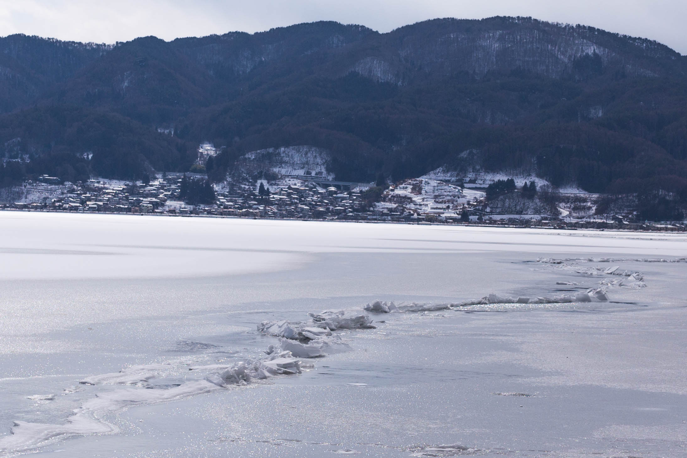
Six Hundred Years of Vanishing Ice
The priestly records at Yatsurugi Shrine constitute a scientific treasure. Researchers have used the omiwatari dates to study the effects of sunspots, industrialization, and rising atmospheric carbon dioxide on lake ice formation. Combined with similar records from the Torne River in Finland, the data paint an unambiguous picture: ice seasons are shortening, freezing is arriving later, and thaws are coming earlier. Lake Suwa, as a shallow body of water, is acutely sensitive to temperature variation. Since the mid-twentieth century, the number of winters without omiwatari has increased sharply. As of 2025, the last time the divine crossing appeared was 2018, and the ridge that formed was only a few inches high -- a whisper compared to the towering formations once recorded. Scientists project that Lake Suwa may remain ice-free through nearly all of the twenty-first century's winters.
A Godless Winter
In Japanese, a winter without the omiwatari is called a 'godless year' -- the deity did not walk, and the crossing did not appear. What was once an extraordinary rarity has become the norm. The cultural loss runs deeper than meteorology. The three-day ceremony cannot be held. The omens cannot be read. A tradition linking the living to the mythological, stretching back through more than six centuries of continuous practice, sits suspended, waiting for cold that may never return. Meanwhile, the lake endures in other ways. Epson, the global technology company, was founded and remains headquartered in Suwa. A rowing facility built in Shimosuwa ahead of the Tokyo 2020 Olympics added a new layer of activity to the lakefront. But for those who watch from the shrine, the unfrozen water reflects only absence -- a god who no longer walks, and a record that now documents its own ending.
From the Air
Lake Suwa is located at approximately 36.05N, 138.08E in the Suwa Basin of central Nagano Prefecture, surrounded by the Kiso Mountains to the west and the Yatsugatake range to the southeast. The lake is a prominent terrain feature easily visible from the air, roughly oval-shaped and bordered by the urban areas of Suwa, Okaya, and Shimosuwa. The Tenryu River exits from the lake's southern end. The nearest airport is Matsumoto Airport (RJAF), approximately 40 km to the northwest. In winter, the lake may show ice formation patterns. Mountain weather conditions can change rapidly in this basin. Best viewed at 3,000-6,000 feet AGL where the lake's full extent and the surrounding urban-mountain contrast are most apparent.