Tamblingan: The Lake the Gods Keep Hidden
A copper inscription, roughly eleven centuries old, names a settlement on the southern shore of a lake in Bali's highlands. The inscription was found not at the lake itself but in the nearby village of Gobleg, carried there by someone, at some point, for reasons no one recorded. The settlement it describes is Tamblingan, and the lake it once bordered still fills the lowest pocket of an ancient volcanic caldera more than a thousand meters above the sea. Orchids cling to the trees along its banks. Macaques watch from the canopy. A single village, Gubug, remains on the shore - the last inhabited point on a body of water that Bali's government has designated a spiritual tourism zone, protected from modern development. Lake Tamblingan is the smallest of three caldera lakes here, the quietest, and arguably the one that Bali's highland civilization cared about most.
Born from a Volcano's Collapse
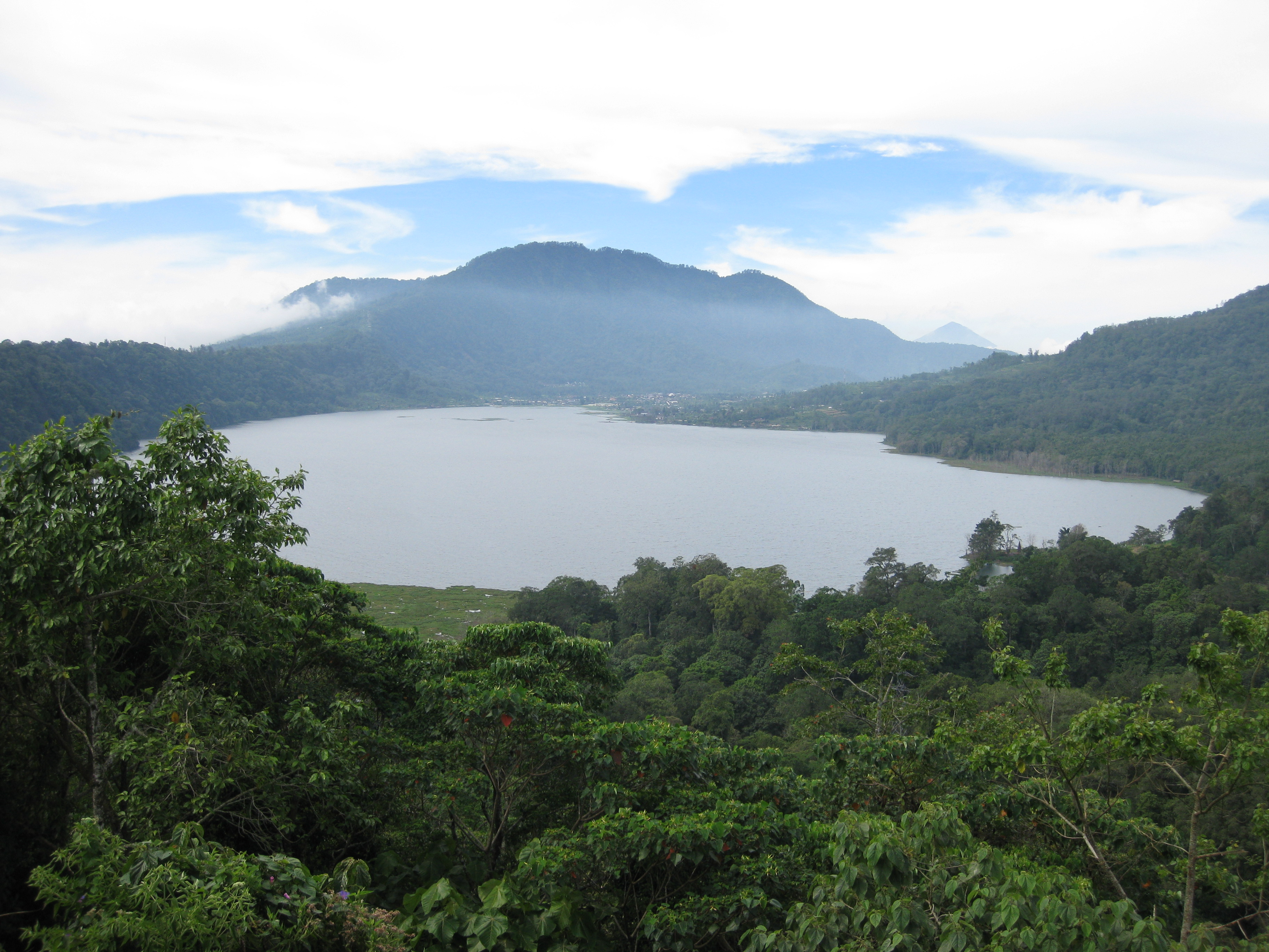
The caldera that holds Lake Tamblingan is the remnant of a massive volcanic event that predates human memory on the island. When the ancient volcano collapsed, it left a broad basin in the highlands of what is now the Buleleng Regency, and over millennia, water filled three separate depressions within it. To the east lie Lake Buyan and Lake Bratan, both larger and better known. Tamblingan occupies the western end, separated from Buyan by a narrow isthmus of forested ridge. Several dormant volcanic cones stand within the caldera walls, reminders that the geology here is not finished - only sleeping. The plateau sits above a thousand meters in elevation, giving Tamblingan an alpine coolness that feels nothing like the tropical coast below. Mist gathers over the water in the early morning and often does not lift until midday. The rainforest pressing against the shore is dense, unmanaged, and old - a rare thing on an island where almost every other landscape has been sculpted by agriculture.
The Civilization That Scattered
The copper inscription from around AD 900 places Tamblingan among the earliest documented settlements in Bali's interior highlands. The civilization that grew here was significant enough to leave behind a constellation of temples, but at some point - for reasons that remain unclear - the people of the original Tamblingan village dispersed. They migrated to four places in the surrounding hills, establishing the communities now known collectively as Catur Desa, the "four villages": Munduk, Gobleg, Gesing, and Umejero. What bound these successor villages together was not politics or trade but a shared spiritual obligation - the duty to maintain the sanctity of Lake Tamblingan. Each village took responsibility for particular rituals and particular temples. The lake was not merely a water source or a geographic feature. It was a sacred trust, parceled out among communities who had once been one people and who remained connected through their obligation to its shores.
Temples at the Water's Edge
Small ancient temples dot the lakeshore and the surrounding ridges, their stonework softened by moss and humidity. The principal temple, Pura Dalem Tamblingan, sits on the eastern shore and dates to the same 10th-century period documented in the Gobleg inscription. As a dalem temple, it is associated with death and the passage from one state of existence to another - dalem temples are traditionally placed at the kelod, or southern, end of a Balinese village, oriented toward the sea and the realm of dissolution. Nearby stand Pura Embang and Pura Tukang Timbang, likely contemporaries. Pura Ulun Danu Tamblingan guards the southern shore near Gubug, while Pura Pekemitan Kangin perches on the ridge overlooking the isthmus between Tamblingan and Buyan, commanding a view of both lakes simultaneously. There are others - Pura Endek, Pura Tirta Mengening, Pura Naga Loka, Pura Pengukiran - scattered along the shore like prayer beads dropped along a path. The cumulative effect is not of a single monument but of a landscape that has been consecrated, feature by feature, over a thousand years.
Water That Rises and Remembers
Lake Tamblingan's water level fluctuates with the monsoon. During intense rainy seasons, the lake swells and inundates some of the temples along its banks - sacred stone submerged beneath sacred water. This is not treated as damage or disaster but as part of the lake's nature, a reminder that the boundary between the spiritual and physical worlds here is permeable. The ecosystem surrounding the lake has drawn concern in recent decades. A Jakarta Post report flagged threats to the ecosystems of both Tamblingan and neighboring Buyan, as development pressures from Bali's booming tourism industry creep closer to the caldera rim. For now, the spiritual tourism designation holds. No hotels rise from the shore. No motorboats cut across the surface. The only way to experience Tamblingan is on foot or by traditional canoe, paddling through mist that smells of wet earth and frangipani, past temple walls that appear and disappear as the fog shifts.
From the Air
Located at 8.26S, 115.10E in Bali's central highlands at approximately 1,200 meters elevation. Lake Tamblingan is the westernmost and smallest of three caldera lakes visible from the air - Lake Buyan lies immediately to its east, separated by a narrow forested ridge, and Lake Bratan further east. The three lakes form a distinctive cluster inside an ancient volcanic caldera that is unmistakable from altitude. Mount Lesung rises at the caldera's edge. The nearest major airport is Ngurah Rai International (WADD/DPS), roughly 70km to the south. From the air, the lakes appear as dark mirrors set in bright green highland forest, contrasting sharply with the terraced agricultural land on the slopes below. The caldera rim and dormant volcanic cones within it are clearly visible. Northern Bali's drier climate generally provides excellent visibility, particularly in the dry season (April-October). Singaraja, the largest city on Bali's north coast, is visible about 20km to the north.