Lake Taupō
Around 232 CE, give or take five years, something happened that people noticed on the other side of the world. Skies turned red over Rome. Chinese astronomers recorded the anomaly. The cause was a volcanic eruption so violent it ejected 100 cubic kilometres of material from a vent in New Zealand's North Island - 30 cubic kilometres of it in a matter of minutes. No humans witnessed it up close. Māori would not arrive for another thousand years. What they eventually found was a lake: vast, blue, and deceptively calm, filling the caldera of a volcano that had been erupting for 300,000 years and has not yet finished.
The Volcano Beneath
Lake Taupō sits inside a caldera carved primarily by the Oruanui eruption roughly 25,600 years ago - a supervolcanic event that rates among the largest in geological history. The volcano has erupted 29 times in the last 30,000 years, most recently with a smaller lava dome extrusion that formed the Horomatangi Reefs about 30 years after the great Hatepe eruption of 232 CE. That eruption scored a 7 on the Volcanic Explosivity Index, placing it alongside the Minoan eruption of Santorini, the Tianchi eruption of Baekdu, and the 1815 eruption of Tambora among the most powerful blasts of the last five millennia.
The volcano is not extinct. Underwater hydrothermal vents still bubble near the Horomatangi site, and geothermal hot springs steam along the lakeshore at Rotokawa and Tūrangi. Extremophile micro-organisms thrive in water too hot for anything else. GNS Science monitors the volcano continuously. Taupō sleeps, but it breathes.
Taonga of Ngāti Tūwharetoa
For the iwi Ngāti Tūwharetoa, who trace their lineage to the Te Arawa waka, the lake is a taonga - a treasure of deep ancestral significance. They own the lakebed and its tributaries, granting the public free access for recreation, a generosity that many visitors take for granted without realizing it.
On the northwestern cliffs of Mine Bay, a 10-metre-high carving stares out across the water. Created in the late 1970s by Matahi Whakataka-Brightwell and John Randall, it depicts Ngātoro-i-rangi, the navigator who guided the Tūwharetoa and Te Arawa peoples to this region over a thousand years ago. The carving is more than art - it is a spiritual guardian intended to protect the lake from the volcanic forces beneath it. Hundreds of boats visit the cliff each year, approaching by water since no road reaches the site.
A Landscape Shaped by Water
New Zealand's largest lake drains into the Waikato River, the country's longest, fed by tributaries including the Tongariro, the Waitahanui, and the Tauranga Taupō. Eight hydroelectric dams downstream depend on the lake's outflow, and gates built in 1940-41 control the water level to prevent flooding and maintain a minimum river flow of 50 cubic metres per second. The lake surface sits roughly 356 metres above sea level.
Beech and podocarp forest blankets much of the watershed. Native kōura - freshwater crayfish - and kōkopu inhabit the shallows alongside introduced brown and rainbow trout, brought from Europe and California in the late nineteenth century. The trout fishery became world-renowned, attracting anglers from across the globe. Smelt were later introduced as trout food, completing an imported ecosystem layered onto a native one.
Tragedy at Te Rapa
The lake's beauty masks its dangers. On 7 May 1846, a landslide struck the Ngāti Tūwharetoa village of Te Rapa, near the springs of Maunga Kākaramea. Sixty people were killed, including the iwi's chief, Mananui Te Heuheu Tūkino II. The disaster buried the entire settlement - a reminder that the volcanic landscape capable of creating such beauty can also destroy without warning.
Modern Taupō has embraced the lake as playground and proving ground. The Lake Taupo Cycle Challenge loops the entire perimeter, taking riders between four and ten hours. Ironman triathletes swim, bike, and run through the volcanic terrain. In 2020, Michael Wells became the first person to breaststroke across the lake's 40.2-kilometre length, battling exhaustion, exposure, and hypothermia in open water above a supervolcanic caldera.
From the Air
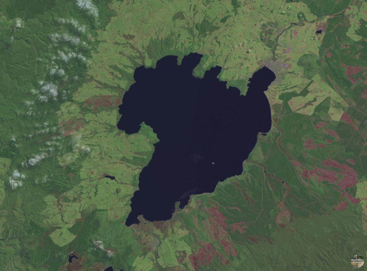
Located at 38.82°S, 175.92°E. New Zealand's largest lake by surface area, filling the Taupō supervolcanic caldera. Clearly visible from altitude as an irregular blue expanse roughly 40 km long in the central North Island. Taupō Airport (NZAP) sits on the northeastern shore near the town of Taupō. The Tongariro volcanic complex rises to the south. Motutaiko Island is visible in the southeastern portion of the lake. Recommended viewing altitude: 5,000-10,000 ft for full lake panorama. The Mine Bay Māori rock carving is on the northwestern shore cliffs. Steam may be visible from geothermal features along the lakeshore in calm conditions.