Lake Temagami
The name tells you what matters here. In Ojibwe, dimii-agamiing means "deep water by the shore," and Lake Temagami delivers on that promise with a complexity that defies easy mapping. Five major arms -- north, northeast, southwest, northwest, and south -- reach across nearly 50 kilometers of northeastern Ontario, studded with 1,259 islands and fringed by some of the last remaining old-growth red and white pine forests in the province. This is not a lake you glance at from the highway. It is a landscape you enter, by canoe if possible, and one that has been shaping the people who come here since the Hudson's Bay Company first set up a trading post on its shores in 1834.
Ancient Rock, Deep Water
Lake Temagami sits on the Canadian Shield, one of the largest exposures of Precambrian rock on Earth. The hills surrounding the lake are the worn-down remnants of mountain ranges that once stood taller than anything on the planet today, buckled upward by enormous tectonic pressure during the Precambrian era and then ground down over billions of years by ice and water. Part of the lake overlies the Temagami Magnetic Anomaly, an egg-shaped geologic structure with striking similarities to the Sudbury Basin, one of the world's richest mining camps. Beneath the water's surface, the northeast arm is underlain by a fault zone of sheared volcanic rocks associated with the Temagami Greenstone Belt, an Archean formation 2.7 billion years old. Pillow lava about 2 billion years old has been found in the area, evidence of submarine volcanoes that erupted during the earliest stages of the Earth's crust formation. The region even holds potential for diamondiferous kimberlites. This is geology on a planetary scale, and the lake sits right on top of it.
The Canoe Tradition
Over 2,000 kilometers of interconnecting canoe routes thread through Lake Temagami and its surrounding waterways, making this one of the premier canoe-camping destinations in North America. The tradition runs deep. Keewaydin Canoe Camp, founded in 1893 and based on Devil Island in the shadow of Devil Mountain, is the earliest known private business on Temagami after the Hudson's Bay Company post on Bear Island. Its campers still paddle cedar-and-canvas canoes and carry wannigans -- wooden food boxes -- on portages through terrain that has barely changed in a century. Camp Temagami, founded by A.L. Cochrane in 1903, emphasized wilderness canoe trips as character-building for young men. Camp Wabun has run trips from its island in the hub of the lake since 1933, including expeditions all the way to Hudson Bay. Camp Wanapitei, on the lake since 1956, runs a legendary 52-day trip for 18-year-olds into northern rivers and provinces. Nearly all of these camps, originally for boys, have become co-ed -- Keewaydin being the last to make the transition, in 1999.
Islands Only
A quirk of early 20th-century policy shaped Lake Temagami's character in ways that persist to this day. The Forest Reserves Act of 1898 established the Temagami Forest Reserve in 1901, restricting settlement on the lakeshore to preserve the surrounding forests for future logging. The practical effect was stark: cottages and resorts could only be built on the lake's islands, not on the mainland. That restriction remains in force, giving Lake Temagami a distinctive feel. Between 630 and 746 cottages dot the islands today, alongside 9 youth camps and 12 commercial lodges. Access to most of them requires a boat. The result is a lake where the shoreline stays wild and the human footprint concentrates on islands scattered across the water -- a built landscape that mirrors the archipelagic geography of the lake itself.
Steamboats and Railways
Lake Temagami's golden age as a vacation destination began in the early 20th century, when the Timiskaming and Northern Ontario Railway brought city dwellers from Ontario and the northeastern United States into the backcountry. The Ferguson Highway, opened in 1927, added road access. A large passenger steamboat, the Belle of Temagami, carried vacationers and campers throughout the lake from the 1900s into the 1940s. Lodges and canoe-tripping camps flourished during the interwar years, but the Great Depression and Second World War nearly killed the resort economy. Several lodges reinvented themselves as youth camps to survive. Camp Cayuga reopened in 1940 as the first girls' camp on the lake. Camp Wabikon became the first co-ed youth camp in 1945. The transition from adult resort to youth wilderness camp defined the lake's modern identity.
Copper and Consequence
Beneath the canoe routes and summer camps, Lake Temagami holds mineral wealth. A copper mine opened on Temagami Island in 1954, extracting what was considered the purest copper ore in Canada. Over its 18-year lifespan, the Temagami Mine produced $34 million Canadian in output before closing in 1972. The mine's presence on one of the lake's own islands was an unusual juxtaposition -- industrial extraction in the middle of a wilderness recreation landscape. That tension between resource extraction and wilderness preservation has defined the Temagami region for over a century, from the original forest reserve that locked development onto the islands, to the logging battles and indigenous land claims that have continued into the modern era. From the air, the lake's fractal geometry of arms, islands, and peninsulas makes the boundaries between wild and settled almost impossible to trace.
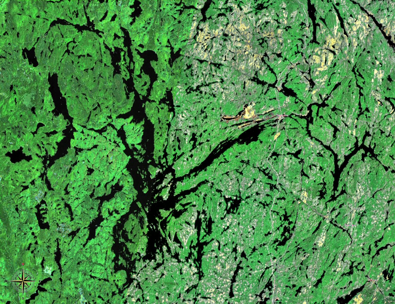
From the Air
Located at 46.95°N, 80.08°W in Nipissing District, northeastern Ontario, approximately 80 km north of North Bay. The lake extends nearly 50 km north-south and 35 km east-west, with five distinct arms visible from altitude. Approximately 1,259 islands are scattered across the water surface. Nearest airport: North Bay/Jack Garland Airport (CYYB), approximately 40nm south. The town of Temagami sits at the end of the northeast arm. Best viewed from 5,000-8,000 ft AGL to appreciate the full fractal extent of the lake's arms and island archipelago. Old-growth pine forests visible along the shoreline. Canadian Shield granite terrain with numerous smaller lakes in the surrounding area.