Lake Temescal
In the summer of 1892, at a campout beside a small reservoir in the Oakland hills, a teenager named Richard Partington introduced his friend to an older man with a fearsome reputation. The older man was Ambrose Bierce - satirist, Civil War veteran, author of "The Devil's Dictionary" - and the friend was George Sterling, who would become one of San Francisco's most celebrated poets. Bierce became Sterling's mentor that day, setting the course of Sterling's literary life. The lake where this encounter happened still sits in its fold of the hills, though almost everything around it has changed. Lake Temescal, once Oakland's drinking water supply, is now a small urban park straddling one of California's most dangerous earthquake faults.
Mustangs and Bedrock
Before the dam, there was already a depression in the earth here - a sag pond, formed where the Hayward Fault pulled the ground apart. In 1868, the Contra Costa Water Company, owned by Anthony Chabot, decided to dam Temescal Creek and turn this geological accident into a reservoir for East Bay drinking water. Chinese immigrants, many of whom had come to California to build the railroads, provided the backbreaking labor of removing soil and digging down to bedrock. To compact the tons of earth needed for the dam, crews drove herds of wild mustangs back and forth across the dirt. The result was a structure 600 feet long, 16 feet wide, and 105 feet above the creek. The lake it created was originally 80 feet deep - four times deeper than it is today.
Trestles, Tunnels, and Vanished Arms
For the first half of the twentieth century, a railroad ran along the eastern shore. The Sacramento Northern's tracks crossed a trestle that spanned a narrow arm of the lake extending northeast into Temescal Canyon. That arm no longer exists. In the mid-1930s, the inlet was filled in as part of the Caldecott Tunnel project, which required extending Landvale Road as a connecting viaduct and building a large concrete retaining wall along the lake's east side. The railroad trestle came down, the tracks were relaid below the wall, and the lake shrank. By 1957, the Sacramento Northern was gone entirely. A decade later, the Warren Freeway and the Grove-Shafter Freeway replaced the old roads above the wall. The retaining wall itself survives, a concrete monument to the way infrastructure remakes landscapes without asking permission.
One of the First Three
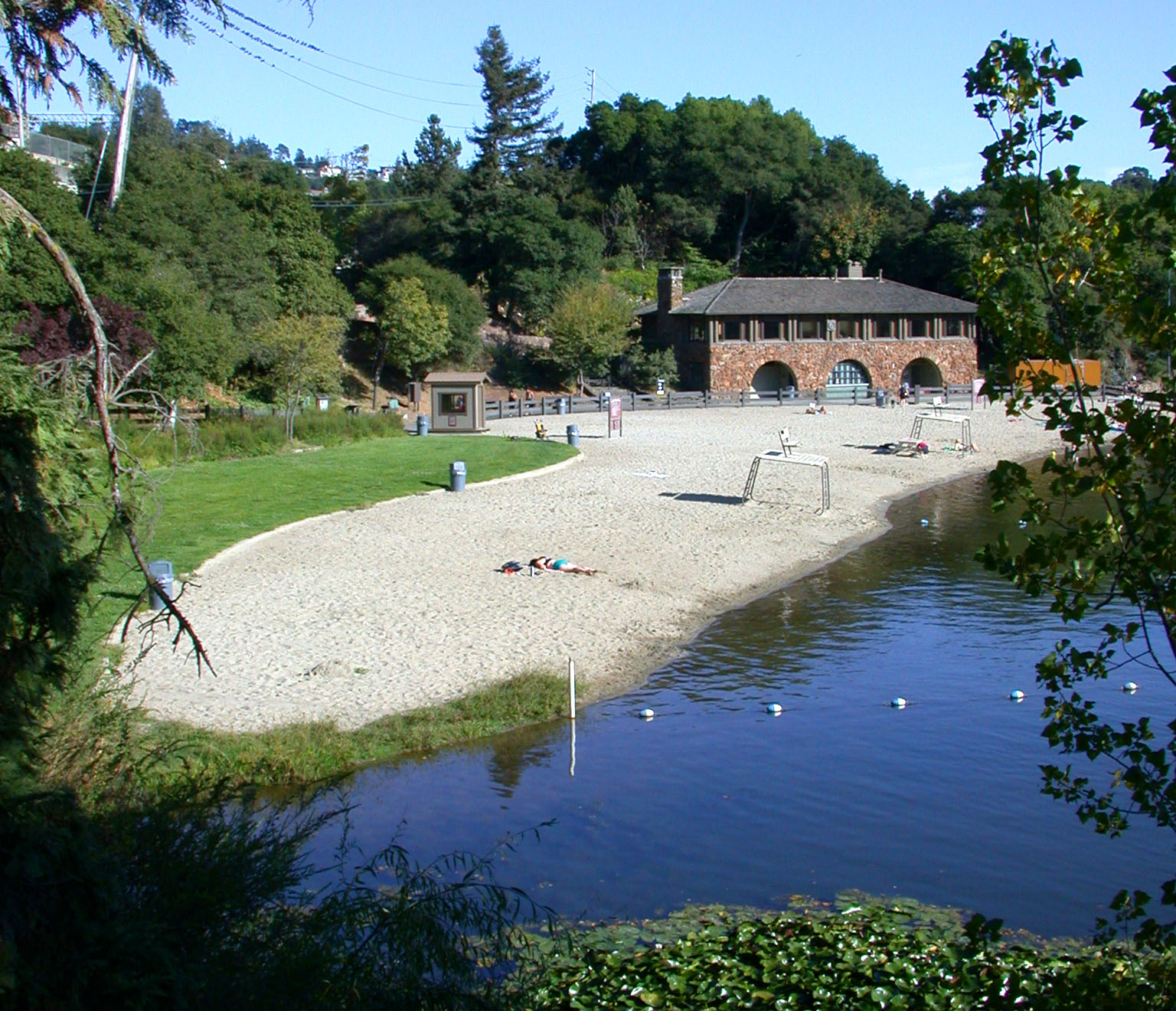
In 1936, Lake Temescal became one of the first three parks established by the East Bay Regional Park District - a system that now manages over 125,000 acres across Alameda and Contra Costa counties. The Works Progress Administration built a boathouse on the shore, and the park offered a beach for swimming, trails around the water, and picnic areas among the hills. The British painter J.H.E. Partington, who had arrived in Oakland in 1889, once lived here in a tent with his family. Pacific Gas and Electric built its Claremont substation directly above the lake in 1921, a facility that remains operational more than a century later. The layers of history stack up quickly at Temescal: fault line, reservoir, railroad corridor, WPA construction, power infrastructure, each generation pressing its needs into the same small piece of geography.
Fire, Fault, and Shallow Water
On October 20, 1991, a firestorm swept through the Oakland hills, killing twenty-five people and destroying more than three thousand homes. Water-equipped helicopters scooped from Lake Temescal again and again, largely draining it in the process. The lake refilled, but it never returned to its original depth. Sediment runoff has been steadily filling the basin for over a century, requiring periodic dredging. Today the deepest point is approximately 20 feet - a quarter of what it once was. And beneath the dam lies the Hayward Fault, one of the most seismically active faults in the San Francisco Bay Area. A rupture could theoretically cause dam failure and flood parts of Oakland, Berkeley, and Emeryville downstream, though engineers note that additional fill placed between the dam and Highway 24 has made catastrophic failure unlikely.
Two Hundred Thousand Visitors and a Warning Sign
Lake Temescal today receives roughly 200,000 visitors a year. The park is stocked with rainbow trout, largemouth bass, bluegill, redear sunfish, and catfish - though the California Office of Environmental Health Hazard Assessment has issued safe-eating advisories due to mercury and PCBs found in the fish. The artificial beach opens seasonally, weather and water quality permitting, though outbreaks of toxic blue-green algae have forced periodic closures. The beach house is available for weddings. It is a peculiarly Oakland kind of place: beautiful and compromised, beloved and fragile, sitting on a fault line in every sense. The reservoir that Chinese laborers and wild horses built more than 150 years ago was never meant to be a park. It became one anyway, and two hundred thousand people a year seem grateful that it did.
From the Air
Lake Temescal sits at 37.8478N, 122.2314W in the Oakland hills, nestled between Highway 24 (which passes just north) and the residential neighborhoods of Rockridge and Temescal. From the air, look for the small oval of water tucked into the hills just south of the Caldecott Tunnel entrance, with the distinctive cloverleaf of the Highway 24/Highway 13 interchange nearby. The lake is small but identifiable at lower altitudes by its surrounding park greenery. Nearest airports: Oakland International (KOAK) approximately 8 nm south, and Buchanan Field (KCCR) approximately 12 nm northeast. Best viewed below 2,000 feet AGL for detail.