Lake Urmia
The ancient Persians called it Chichast -- the Glittering One -- for the mineral particles that sparkled in its waters and crusted its shores. The Armenians knew it as Kaputan tsov, the Blue Sea. At its greatest extent, Lake Urmia stretched 140 kilometers long and 70 kilometers wide across northwestern Iran, the largest lake in the Middle East, holding more salt per liter than the Dead Sea. By September 2025, according to NASA satellite imagery, it had almost entirely disappeared. The glittering lake became a glittering absence -- a vast expanse of white salt crust where water once supported 226 species of birds, including great flocks of flamingos.
Deep Time at the Water's Edge
Human settlement around Lake Urmia reaches back eight thousand years. At Yanik Tepe on the eastern shore, archaeologists in the 1950s and 1960s uncovered evidence of habitation dating to 6000 BC. South of the lake, excavations at Dalma Tepe, Teppe Hasanlu, and Hajji Firuz Tepe revealed layer upon layer of ancient civilization. Assyrian records from the ninth century BCE mention two peoples living in the lake's vicinity: the Parsuwash -- the Persians -- and the Matai, who were Medes. The names appear in accounts from the reign of Shalmaneser III, around 850 BCE, making them among the earliest written references to the peoples who would shape Iranian civilization. On Shahi Island, once the lake's largest, Hulagu Khan -- a grandson of Genghis Khan -- was buried in a castle perched above thousand-foot cliffs. His son Abaqa was interred beside him. When the lake level dropped, Shahi Island became a peninsula, and the Mongol burial site lost its island fortress character.
The Anatomy of Collapse
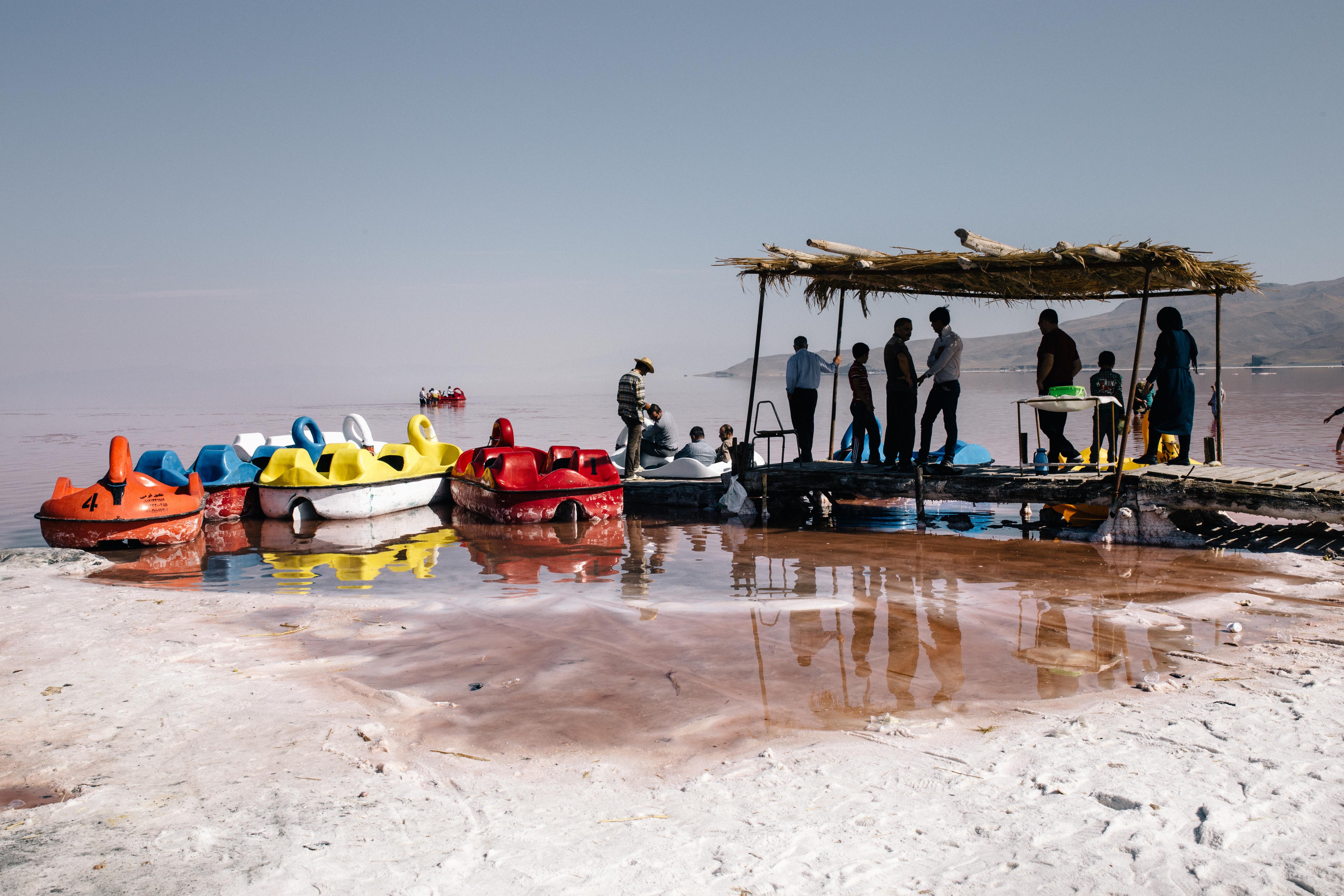
Lake Urmia did not die suddenly. It was killed by degrees. The lake is endorheic -- it has no outlet, depending entirely on thirteen permanent rivers, springs, and rainfall to replace what evaporation takes. When Iran began damming those rivers and pumping groundwater from the surrounding basin to feed expanding agriculture, the equation tipped. By late 2017, the lake had shrunk to ten percent of its former size and one-sixtieth of its 1998 water volume. A 15-kilometer causeway built across the lake -- completed in 2008 with the Urmia Lake Bridge spanning its final 1.3-kilometer gap -- divided the water body in two and choked the natural circulation between its halves. The bridge's steel is already heavily corroded by salt despite anti-corrosion treatment. Salinity surged past 300 grams per liter, four times the concentration of seawater. Fish vanished entirely. The brine shrimp Artemia urmiana, the lake's signature organism and the base of the food chain for migratory flamingos, was reported extinct in 2013, though later surveys found surviving populations.
Billions Spent, Water Still Lost
Iran has not ignored the crisis. In 2014, President Hassan Rouhani approved a 14-trillion-rial recovery program -- over $500 million -- for water management and environmental restoration. The United Nations Development Programme issued a plan calling for $1.3 billion in total spending. Starting in 2016, the FAO and Japan funded an integrated water resources management program for the entire lake basin. In 2015, Rouhani's cabinet approved another $660 million for irrigation improvements and desertification countermeasures. Water was diverted from the Zab River. Armenia agreed to transfer water across the border. Yet none of it proved sufficient. A brief recovery in 2019, when increased rainfall raised water levels, reversed again in the early 2020s. Drought combined with administrative mismanagement to push the lake past the point where any single intervention could reverse the trend.
Salt, Wind, and Protest
The ecological stakes are enormous. Lake Urmia was a UNESCO Biosphere Reserve and a nationally protected park, home to 311 plant species, 226 bird species, and 24 mammal species. Its approximately 102 islands provided isolated habitat for wildlife found nowhere else in the region. As the water retreated, it left behind salt flats that now generate toxic dust storms threatening the health of millions of people in surrounding provinces. The human response has matched the scale of the disaster. In August 2011, when Iran's parliament voted against funding a water transfer from the Aras River, protests erupted in the streets of Tabriz and Urmia. Riot police on motorcycles attacked peaceful demonstrators. At least sixty people were arrested in Urmia alone. Iranian photojournalist Solmaz Daryani has extensively documented the lake's decline and its impact on the communities that depended on it. What was once a natural barrier between two of Iran's most important cities -- Urmia and Tabriz -- is now an environmental wound visible from space.
From the Air
Located at 37.66°N, 45.41°E in northwestern Iran, between the cities of Urmia (west) and Tabriz (east). From altitude, the lake bed is now predominantly visible as white salt flats with diminishing or no remaining water -- one of the most dramatic landscape transformations observable from the air. The Urmia Lake Bridge and causeway bisect the lake bed. Approximately 102 former islands are now mostly connected to the mainland. Urmia Airport (OITR) lies to the west, Tabriz International Airport (OITT) to the east. The Zagros Mountains frame the western horizon. Best viewed at 15,000-25,000 feet for full scale of the environmental transformation. The contrast between salt flats and surrounding agricultural green is stark.