Land Between the Lakes: Where the Government Drowned America
The Tennessee Valley Authority came to western Kentucky and Tennessee with a plan: create two massive lakes, flood the land between them, and transform a 'backward' region into a recreation paradise. They needed the people to leave. Some went willingly, paid for their land; others resisted until condemnation forced them out. By 1969, 2,300 families had been displaced - three towns erased, cemeteries relocated, churches drowned. The moonshine stills that had operated in these hollows for generations went silent. Land Between the Lakes now draws millions of visitors annually to hike, camp, and boat on water that covers what used to be home. The region's descendants remember; the visitors don't know there's anything to remember.
The Plan
TVA envisioned Land Between the Lakes as a national demonstration in outdoor recreation - a government-created playground between Kentucky Lake and Lake Barkley, two reservoirs formed by dams on the Tennessee and Cumberland Rivers. The peninsula between the lakes would become a national recreation area, managed for public enjoyment rather than private ownership. It was a noble vision that required removing everyone who lived there. The residents were mostly subsistence farmers, logging workers, and - unofficially - moonshiners who'd been making whiskey in these hollows since before Prohibition. They weren't consulted about the plan.
The Removal
The forced removal began in the late 1960s. TVA offered to buy properties; those who refused faced condemnation. Compensation was based on assessed value - often pitifully low for land that had been in families for generations. Some residents fought in court; some simply left with what they could carry. Three towns - Golden Pond, Model, and Birmingham - were abandoned and demolished. Churches were torn down or moved. Cemeteries were relocated, the dead dug up and reburied on higher ground. The living scattered to Paducah, Murray, and elsewhere, their community dissolved by government decree.
The Moonshine
Between the Rivers (the peninsula's old name) had produced illegal whiskey for centuries. The terrain was perfect: remote hollows, abundant corn, spring water, and limited law enforcement. During Prohibition, moonshining intensified; after Prohibition, it continued because federal taxes made legal whiskey uncompetitive with untaxed home production. The moonshiners weren't criminals in local eyes - they were neighbors, family, providers of a product that everyone wanted. TVA's project destroyed the stills, the knowledge, and the community that had sustained this tradition. A few recipes survive in legal distilleries; the culture that created them is gone.
The Recreation Area
Land Between the Lakes today covers 170,000 acres and draws 2 million visitors annually. The recreation facilities are excellent: campgrounds, hiking trails, off-road vehicle areas, an elk and bison prairie, a planetarium, a 1850s living history farm. The lakes offer fishing and boating. The forests have recovered from logging and farming; wildlife has returned. By most measures, the project succeeded - the region generates tourism revenue that subsistence farming never could. By other measures, it destroyed a culture to create a playground. The historical interpretation at Homeplace 1850s Farm carefully omits the forced removal that made the recreation area possible.
Visiting Land Between the Lakes
Land Between the Lakes National Recreation Area spans the Kentucky-Tennessee border between Kentucky Lake and Lake Barkley. The main visitor center is at Golden Pond (named for the drowned town). The Elk & Bison Prairie offers wildlife viewing. The Homeplace 1850s Living History Farm interprets pre-displacement life. Camping ranges from developed campgrounds to backcountry sites. The North/South Trail runs 65 miles through the peninsula. Entry is free; some facilities charge fees. Murray, Kentucky and Dover, Tennessee offer lodging and services. Paducah is 50 miles north. The descendants of displaced families sometimes return for cemetery visits and to remember places that exist now only in memory.
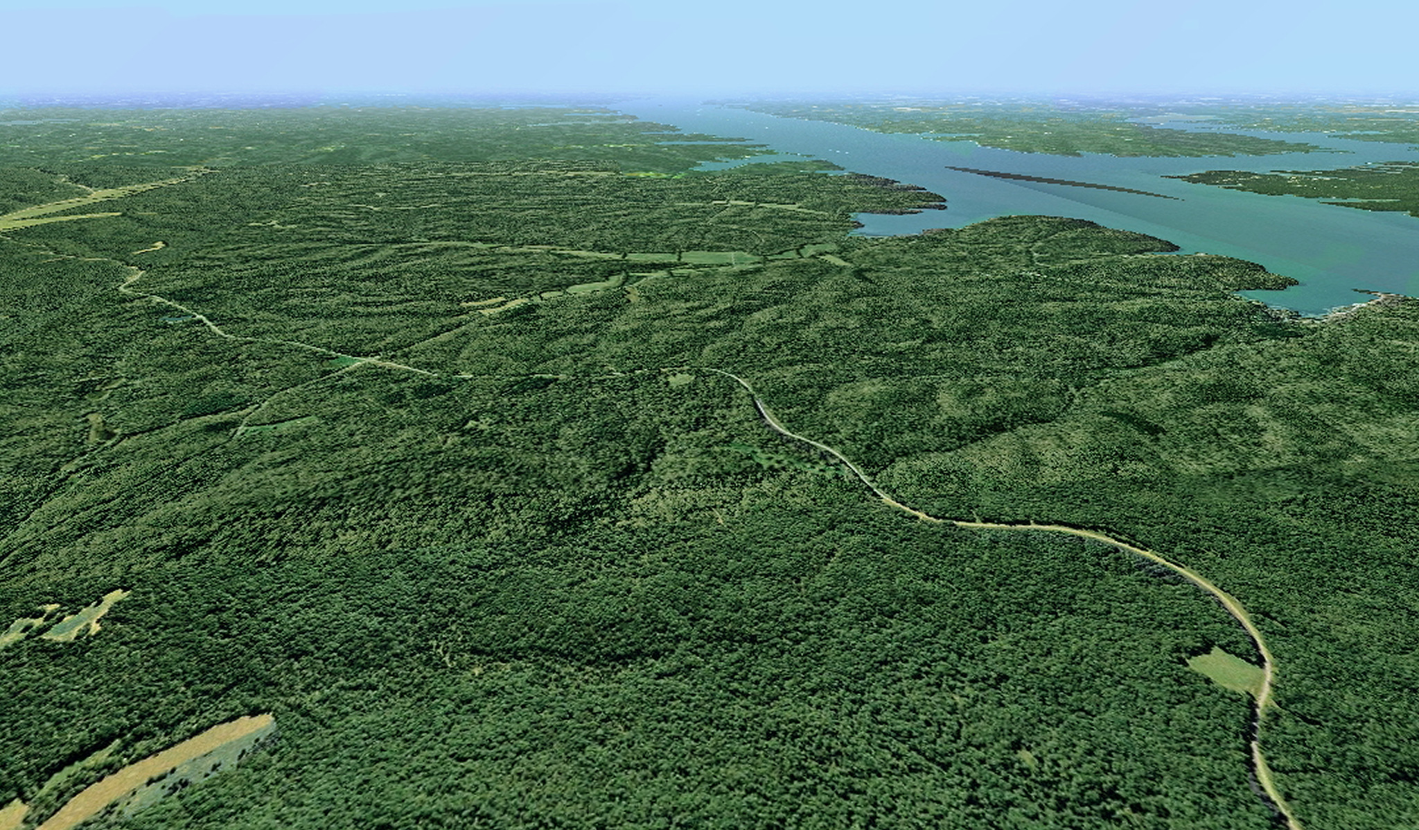
From the Air
Located at 36.83°N, 88.07°W between Kentucky Lake and Lake Barkley in western Kentucky and Tennessee. From altitude, the peninsula is clearly visible as a forested finger of land between two large reservoirs. The terrain is hilly and forested, with no visible towns (they're underwater or demolished). The Barkley Canal connecting the two lakes is visible at the peninsula's northern end. Kentucky Lake stretches west; Lake Barkley east. The landscape looks natural from altitude; nothing indicates that 2,300 families once lived on this land that the government emptied for recreation.