Langeberg
According to local lore, you can tell the time by watching the Langeberg. North of Swellendam, seven summits known as the Clock Peaks cast shadows that shift and rotate through the day, each peak marking a different hour as the sun tracks across the sky. The highest of these, Misty Point, reaches 1,710 meters. Whether the shadow-clock actually works with any precision is beside the point -- the story speaks to an intimate, daily relationship between the people of the Overberg and the mountain wall that defines their horizon. The name itself, Dutch for 'long mountain,' is a piece of descriptive understatement: the Langeberg stretches roughly 250 kilometers from Worcester in the west to the outskirts of George in the east, one of the Western Cape's most commanding landforms.
Folded Stone, Deep Time
The Langeberg is composed primarily of Table Mountain Sandstone, part of the Cape Fold Belt -- a system of mountain ranges created when the rocks of the southern Cape were compressed and folded roughly 250 million years ago during the assembly of the supercontinent Gondwana. A fault line running nearly 300 kilometers along the southern edge of the Swartberg range to the north has contributed to the dramatic uplift of the entire region. The Langeberg runs northwest to southeast in its western portion and shifts to an east-west orientation in its central and eastern sections. To the south lies the Agulhas Plain and the Overberg wheatbelt; to the north, the open, semi-arid plains of the Little Karoo stretch toward the Swartberg. The range acts as a climatic barrier, catching moisture from the south and casting a rain shadow over the Karoo beyond.
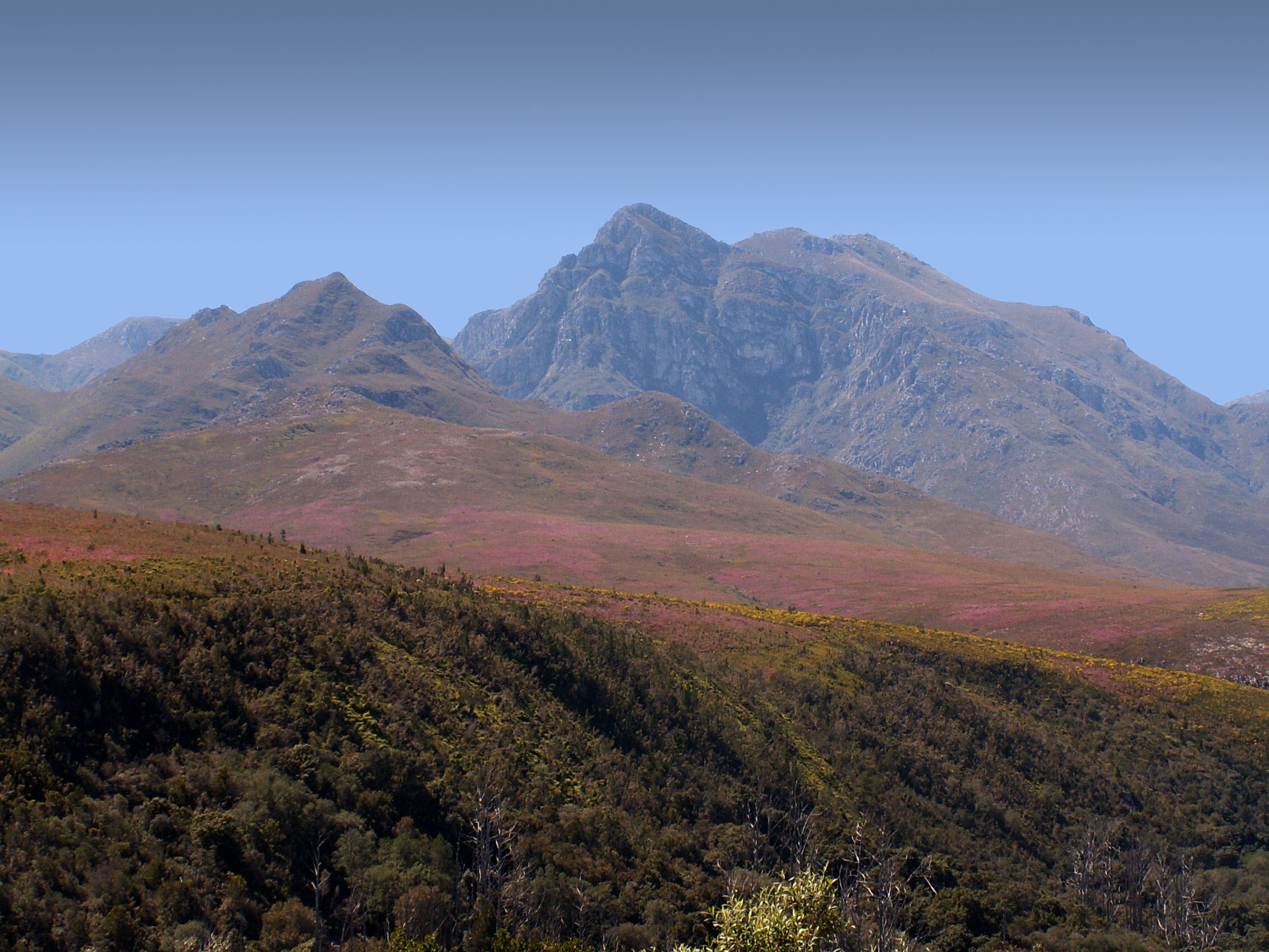
Two Slopes, Two Worlds
Walk the southern slopes of the Langeberg and you move through mountain fynbos -- low, dense, wildly diverse shrubland that belongs to the Cape Floral Kingdom. In the deep gorges where sunlight barely reaches, patches of Afromontane forest survive, ancient pockets of tall trees and ferns that seem to belong to a different continent entirely. Cross to the northern slopes and the landscape dries sharply into karroid scrub, adapted to the rain shadow and the heat that radiates off the Little Karoo floor. The Marloth Nature Reserve protects the area around the highest peaks, while the Boosmansbos Wilderness Area, which includes the Grootvadersbosch Nature Reserve near Barrydale, preserves some of the most intact Afromontane forest in the Western Cape. The Garcia State Forest rounds out the chain of protected areas along the range.
Passages Through the Wall
For centuries, the Langeberg was a barrier to travel between the fertile coastal Overberg and the interior Karoo. Four mountain passes now thread through the range, each engineered to navigate its particular stretch of geology. Cogmanskloof Pass links Montagu with Ashton at the western end, cutting through a dramatic narrow gorge. Tradouws Pass connects Barrydale with Swellendam and Heidelberg. Garcia's Pass links Riversdale with Ladismith. And Cloetes Pass provides the eastern connection between Mossel Bay and Ladismith. Each pass offers its own visual drama -- sharp switchbacks, exposed cliff faces, sudden views of either the green coastal plain or the dry Karoo below. The range's highest peak, Keeromsberg, stands at 2,072 meters, 15 kilometers northeast of Worcester, where the Langeberg begins its long eastward march across the province.
From the Air
Located at 33.82S, 20.15E. The Langeberg is a major terrain feature running roughly 250 km east-west across the Western Cape. Peak elevation 2,072 m (Keeromsberg). Maintain safe altitude -- mountain weather can change rapidly with orographic cloud formation. The four mountain passes (Cogmanskloof, Tradouws, Garcia's, Cloetes) are visible corridors through the range. Nearest airports: George Airport (FAGG, ~100 km E), Cape Town International (FACT, ~180 km W), Robertson Airfield (FARO/ROD, ~50 km W).