Laponia
UNESCO does not often recognize a landscape for being lived in. Most World Heritage sites celebrate buildings, ruins, or pristine nature set apart from human use. Laponia, inscribed in 1996, is different. This 9,400-square-kilometer expanse of Swedish Lapland earned its designation both for its wild scenery and for the Sami culture that has inhabited and shaped it for thousands of years. It is one of the few places on Earth where an indigenous people's continuous relationship with a landscape is the point, not an afterthought.
Four Parks, Two Reserves, One Wilderness
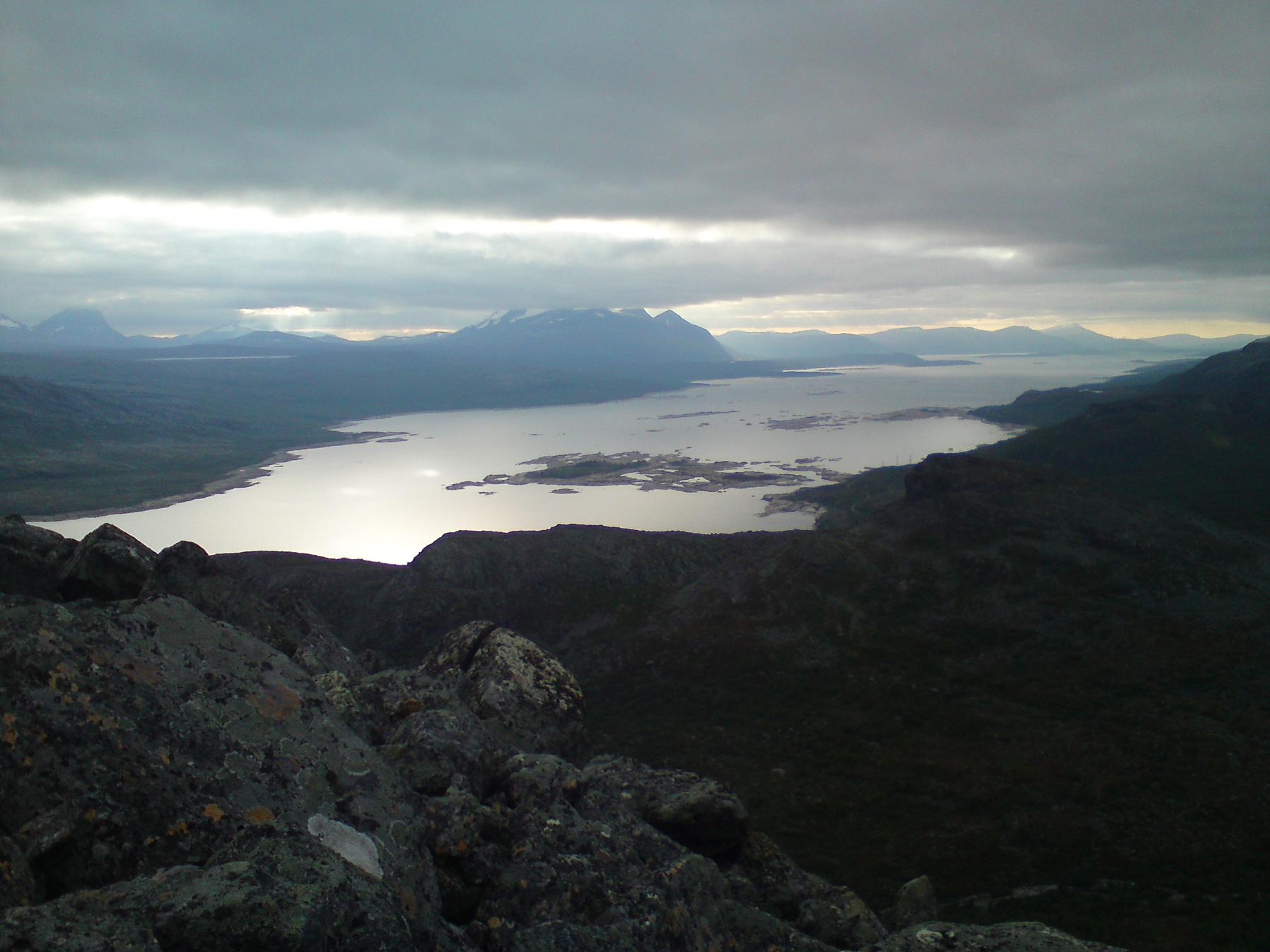
Laponia encompasses four national parks (Sarek, Stora Sjofallet, Muddus, and Padjelanta), the nature reserves of Sjaunja and Stubba, and additional protected areas at Sulitelma, Tjuoltadalen, and Rapadalen. Together they form the largest area of essentially undeveloped land in Western Europe. The landscape is staggeringly varied. Sarek's glaciated peaks, crowned by Sarektjakka at 2,089 meters, contrast sharply with the ancient lowland forests of Muddus, where gnarled pines stand in bogs that have been forming since the last ice age. Sjaunja and Stubba protect Sweden's largest wetland system, a mosaic of mires and lakes that stretches flat to the horizon. Between these extremes lie rounded fells, birch-forested valleys, and the high plateaus of Padjelanta, whose very name in Sami means 'the higher land.'
The People Before the Parks
The Sami arrived in this region as the ice retreated, roughly 8,000 years ago. For millennia they lived as hunter-gatherers before developing the reindeer herding culture that defines Sami identity today. Herds move between winter forests and summer mountain pastures along routes that predate every national boundary in Scandinavia. Within Laponia, reindeer herding is not a quaint tradition preserved for tourists; it is an active livelihood practiced by communities in Gallivare, Jokkmokk, and Arjeplog municipalities. At settlements like Staloluokta, reachable only by boat or on foot, Sami families sell bread and fish to passing hikers. The UNESCO inscription explicitly recognized this living cultural landscape, making Laponia one of relatively few World Heritage sites where indigenous stewardship is central to the designation's meaning.
Trails Through the Heart of It
Several of Scandinavia's most famous long-distance trails pass through Laponia. Kungsleden, the King's Trail, runs 430 kilometers from Abisko to Hemavan through the heart of the heritage site. Nordkalottleden crosses the Norwegian border repeatedly on its 800-kilometer journey from Sulitelma to Kautokeino in Finnmark. Padjelantaleden follows a 140-kilometer route through Padjelanta National Park from Kvikkjokk to Ritsem. For less ambitious walkers, Rallarstigen offers a 44-kilometer path from Gallivare to Porjus through the northern end of Muddus, following a route used since the eighteenth century. Mountain huts operated by the Swedish Tourist Association stand at intervals along the main trails, staffed in season and stocked with basic provisions. In Sarek, by contrast, there are no huts and no marked trails at all.
Vanished Waterfalls and Glacial Time
Not everything in Laponia survives intact. Stora Sjofallet, once considered among the most impressive waterfalls in Europe, was largely silenced when a hydroelectric plant diverted most of its water underground in the early twentieth century. The decision remains controversial, a reminder that even protected landscapes are not immune to industrial priorities. The glaciers tell their own story of change. Over a hundred ice fields persist in Sarek, but they are shrinking, and the pace of retreat has accelerated in recent decades. The old-growth forests of Muddus offer a different temporal scale: some of its pines are hundreds of years old, growing slowly in the cold, damp conditions of the subarctic. The Muddusjokk waterfall still crashes through this ancient forest untouched, a counterpoint to Stora Sjofallet's diminished flow.
At the Edge of the Arctic Circle
Laponia straddles the Arctic Circle, and its climate shapes every aspect of the visitor experience. Summer days are long, lit by a sun that barely sets in June and July, but temperatures can drop near freezing even in midsummer, and rain is frequent. Mosquitoes and black flies are ferocious below the treeline, and experienced hikers consider insect repellent and head nets as essential as food. In winter, deep snow blankets the landscape, and travel is by ski or snowmobile. The remoteness is real. Phone coverage is unreliable or absent across most of the area, and emergency help may require helicopter extraction. Yet this is precisely the appeal. Laponia offers something increasingly rare in twenty-first-century Europe: a place where wildness is not a marketing slogan but a daily condition, and where the people who know it best have been navigating its demands since before anyone thought to call it heritage.
From the Air
Centered approximately at 67.33°N, 17.58°E in Norrbotten County, Swedish Lapland. From cruising altitude, Laponia appears as an enormous expanse of mountain, forest, and wetland stretching along the Norwegian border. Key visual landmarks include the glaciated peaks of Sarek, the Laitaure river delta, and the vast flat wetlands of Sjaunja. The Inlandsbanan railway crosses the eastern edge near Porjus and Jokkmokk. Nearby airports include Kiruna Airport (ESNQ) to the north, Gallivare (served by rail), and Hemavan Tarnaby Airport (ESUT) to the south. The E45 highway passes through the eastern margin of the heritage area.