Lassen Peak
On May 22, 1915, Lassen Peak in northeastern California produced a massive eruption that sent a column of ash and rock 30,000 feet into the atmosphere. A pyroclastic flow raced down the mountain's northeast slope at 100 miles per hour, devastating everything in its path. Mudflows extended 18 miles down Hat Creek Valley. The eruption made Lassen Peak the most recently active volcano in the Cascade Range until Mount St. Helens exploded in 1980. The mountain had been rumbling since May 1914, when steam began venting from a new crater near the summit. Over 300 explosions occurred during the following year. The 1915 climax confirmed that the Cascades remained volcanically active, that the same forces that built Mount Shasta and Mount Hood still simmered beneath northern California. Today, Lassen Volcanic National Park preserves not only the scarred peak but also boiling mudpots, fumaroles, and hot springs that remind visitors the volcano is only sleeping.
The Awakening
Lassen Peak had been quiet for 27,000 years when, on May 30, 1914, a small explosion opened a vent near the summit. Over the following months, the crater grew as more explosions followed - 180 by the end of 1914. Lava began to appear in the crater, and by May 1915, a growing lava dome was visible. The mountain was clearly building toward something larger. On May 14, 1915, lava spilled over the crater rim for the first time, sending mudflows down two drainages. The forest was evacuated. Eight days later, the mountain exploded.
The Eruption
The May 22, 1915, eruption began in the evening. A new, larger outpouring of lava triggered explosions and pyroclastic flows - superheated currents of gas and volcanic debris. The pyroclastic flow raced down the northeast slope, leveling trees for three miles and leaving a zone of devastation that would be named the 'Devastated Area.' Mudflows from melting snow and mixing debris surged down Hat Creek Valley for 18 miles. The vertical eruption column rose over 30,000 feet; ash fell as far away as Elko, Nevada, 200 miles east. The eruption lasted approximately 30 minutes. No one was killed, largely because the area had been evacuated after the May 14 event.
The Science
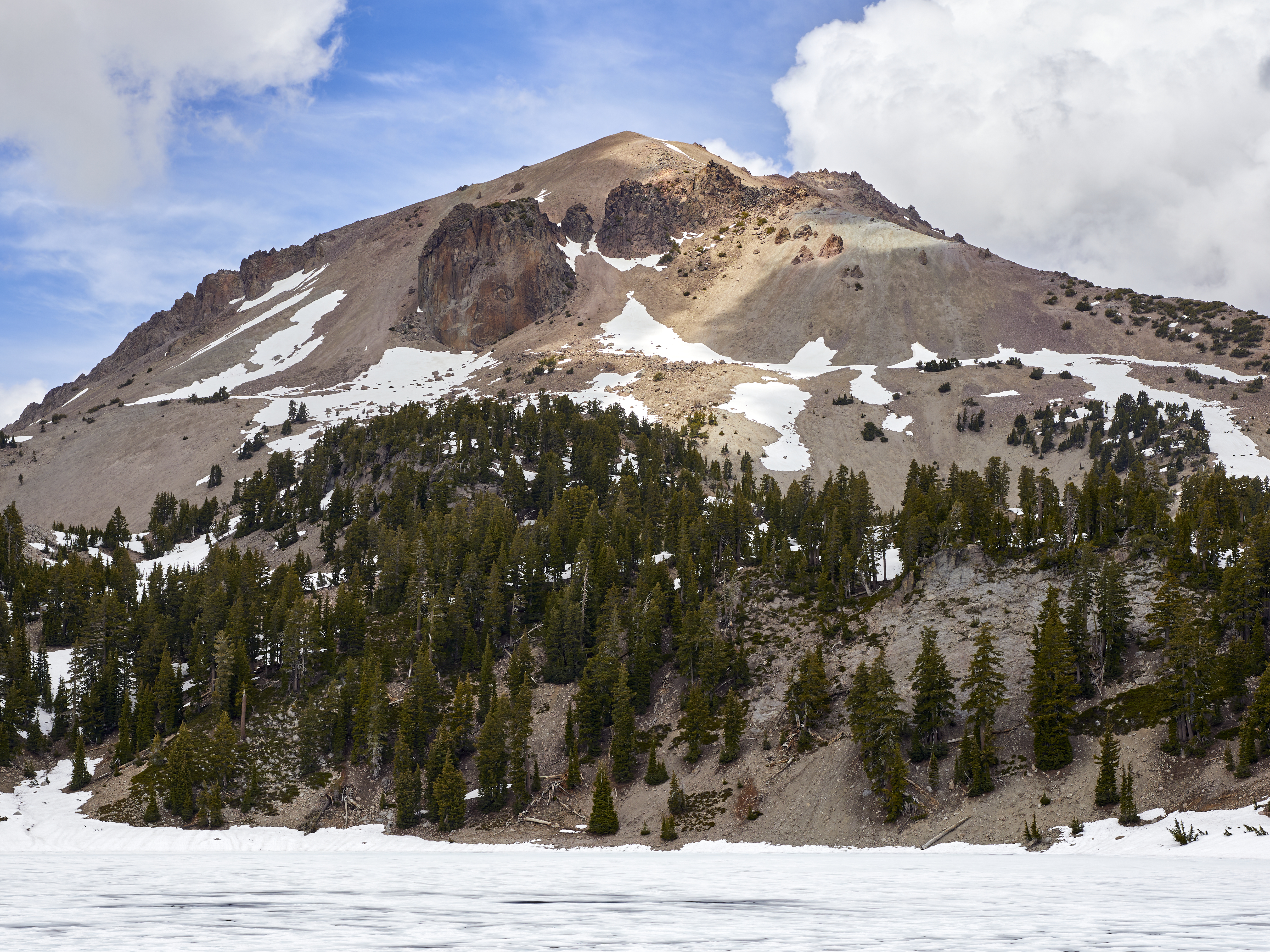
Lassen Peak is the southernmost volcano in the Cascade Range, a chain of volcanoes stretching from Lassen to Mount Garibaldi in British Columbia. The Cascades are fed by the Cascadia Subduction Zone, where the Juan de Fuca Plate dives beneath North America - the same process that will eventually produce a major earthquake in the Pacific Northwest. Lassen is a lava dome volcano, formed by thick, viscous lava that piles up rather than flowing outward. The dome is inherently unstable; its 1915 collapse produced the pyroclastic flows. The mountain's volcanic system remains active: hot springs, mudpots, and fumaroles throughout the park testify to ongoing heat beneath the surface.
The Park
Lassen Volcanic National Park was established in 1916, created in part by the dramatic publicity the eruption generated. The park protects 106,372 acres of volcanic landscape, including Lassen Peak, the Devastated Area, and extensive hydrothermal features. Bumpass Hell, the largest hydrothermal area, offers boardwalks through a landscape of boiling pools, hissing fumaroles, and bubbling mudpots. The Devastated Area, devastated in 1915, has recovered substantially - showing the resilience of ecosystems even after volcanic catastrophe. The summit of Lassen Peak can be climbed via a 2.5-mile trail that gains 2,000 feet; the views encompass other Cascade volcanoes on clear days.
Visiting Lassen
Lassen Volcanic National Park is located in northeastern California, about 50 miles east of Redding. The main park road crosses from the southwest to the northeast entrance, climbing to 8,512 feet at Lake Helen. Key attractions include Bumpass Hell (a 3-mile round-trip hike to the main hydrothermal area), the Devastated Area (interpretive signs explain the 1915 eruption), and the Lassen Peak Trail (5 miles round trip to the summit). The park is typically snow-free from June through October; winter closes the main road. Camping, backcountry hiking, and winter snowshoeing are all possible. Redding Municipal Airport (RDD) has limited service; Sacramento International Airport (SMF) is 160 miles south. The park receives far fewer visitors than Yosemite or other California national parks, offering relative solitude.
From the Air
Located at 40.49°N, 121.50°W in northeastern California, about 50 miles east of Redding. From altitude, Lassen Peak appears as a scarred volcanic dome at the southern end of the Cascade Range. The Devastated Area is visible as a zone of younger forest on the northeast slope. Lake Almanor lies to the southeast; Mount Shasta is visible to the north on clear days. The hydrothermal areas appear as patches of steam and bare ground.